MyTopo
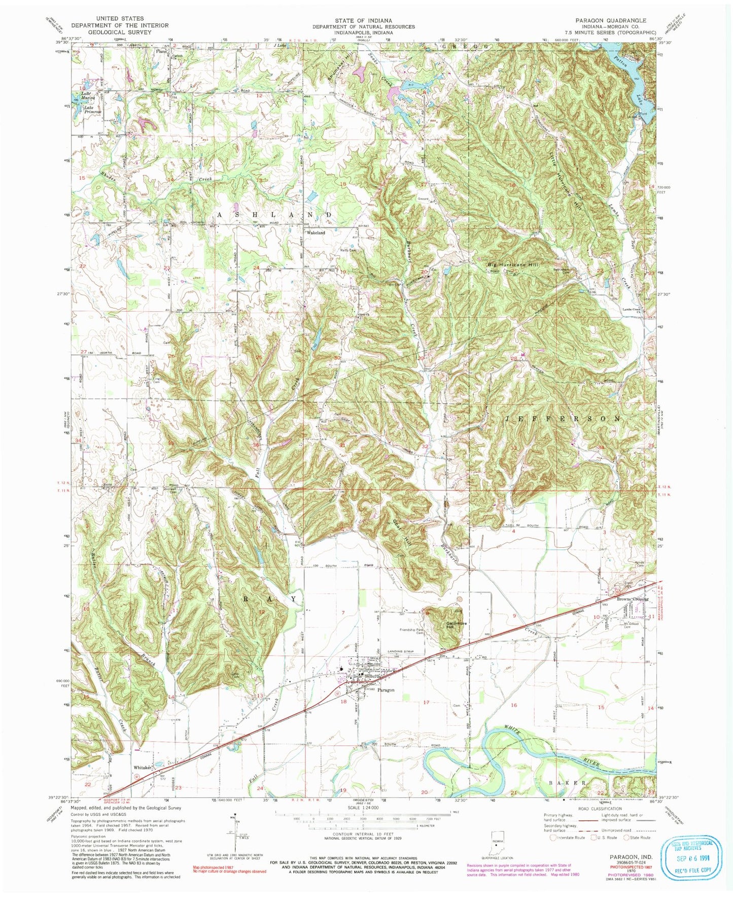
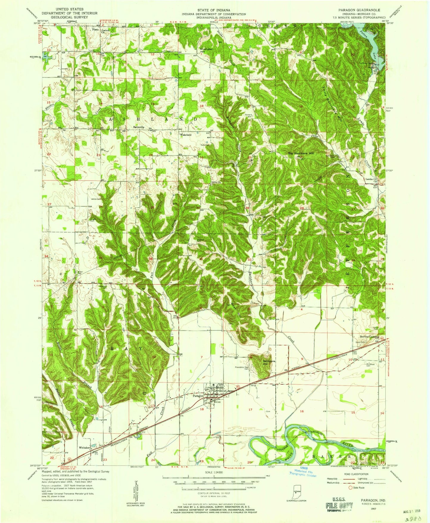
Classic USGS Paragon Indiana 7.5'x7.5' Topo Map
Couldn't load pickup availability
Historical USGS topographic quad map of Paragon in the state of Indiana. Typical map scale is 1:24,000, but may vary for certain years, if available. Print size: 24" x 27"
This quadrangle is in the following counties: Morgan.
The map contains contour lines, roads, rivers, towns, and lakes. Printed on high-quality waterproof paper with UV fade-resistant inks, and shipped rolled.
Contains the following named places: Bethlehem Cemetery, Big Hurricane Hill, Browns Crossing, Burkhart Creek, Butler Branch, Corinth Church, Friendship Park Cemetery, Gallimore Hill, Goat Hill, Goss Cemetery, Hodges Ditch, Hynds Cemetery, Lambs Creek Church, Lingle Cemetery, Little Hurricane Hill, Lake Maxine, Mount Gilead Cemetery, Olive Church, Paragon, Patton Lake, Plano, Lake Primrose, Ratts Cemetery, Shumaker Hill, Stierwalt Cemetery, Stout Cemetery, Wakeland, Whitaker, Paragon Elementary School, Patton Dam, Guthrie Lake Dam, Guthrie Lake, Hren Lake Dam, Hren Lake, Amy Lake Dam, Amy Lake, Potato Mound, Township of Ashland, Township of Ray, Town of Paragon, McClures Mobile Home Park, Paragon Volunteer Fire Department, Bluebird Airport, Paragon Fire Station 17, Paragon Police Department, Paragon Post Office