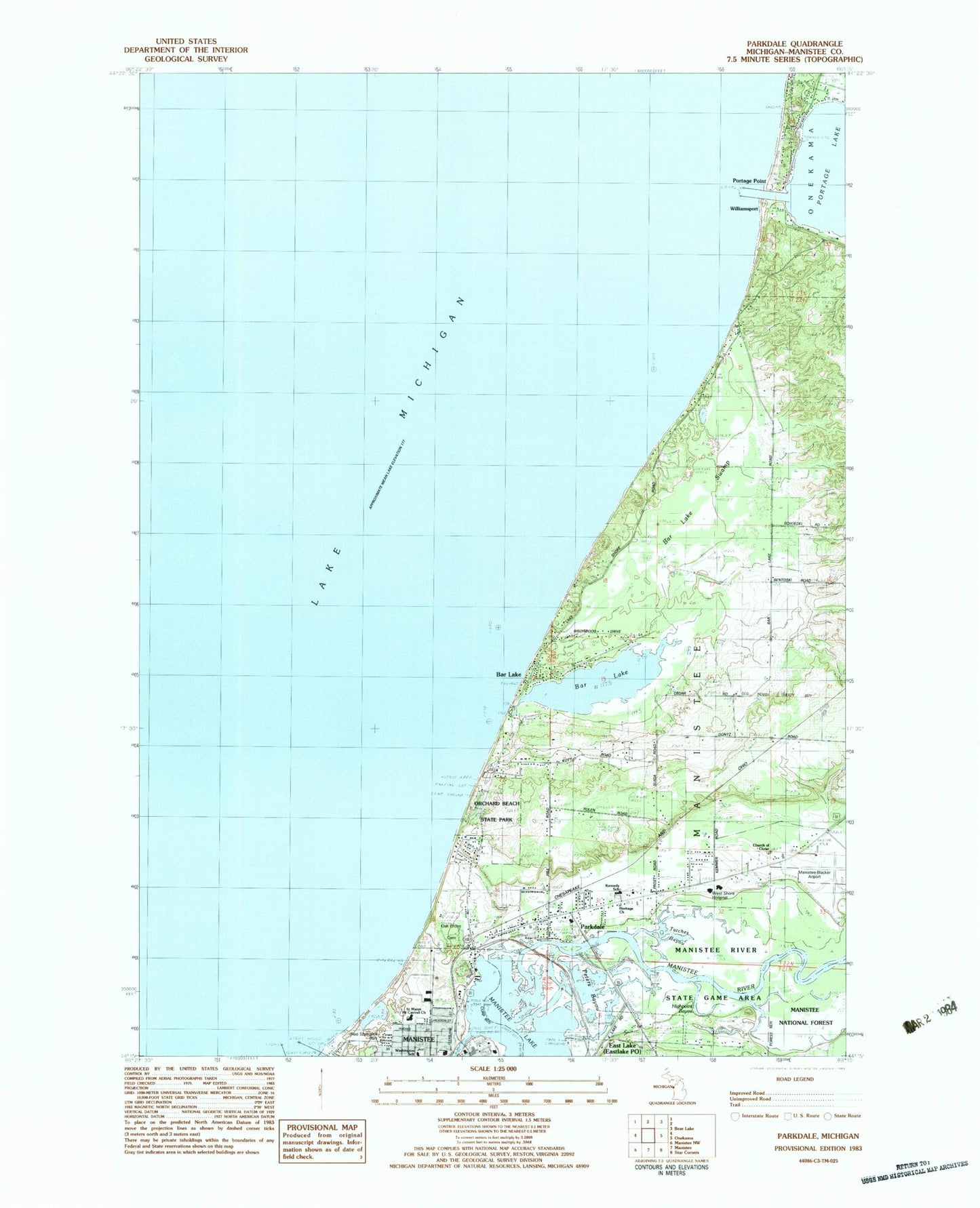
MyTopo
Classic USGS Parkdale Michigan 7.5'x7.5' Topo Map
Couldn't load pickup availability
Historical USGS topographic quad map of Parkdale in the state of Michigan. Map scale may vary for some years, but is generally around 1:24,000. Print size is approximately 24" x 27"
This quadrangle is in the following counties: Manistee.
The map contains contour lines, roads, rivers, towns, and lakes. Printed on high-quality waterproof paper with UV fade-resistant inks, and shipped rolled.
Contains the following named places: Bar Lake, Bar Lake Swamp, Church of Christ, Coast Guard Station Manistee, East Lake Village Park, First Baptist Church, Great Fire of 1871 Historical Marker, Heritage Church, Highpoint Bayou, Indian Springs, Inner Light, Insta Launch Campground, Kennedy School, Manistee Count Blacker Airport Fire Department, Manistee County, Manistee County Care Facility, Manistee County Sheriff's Office, Manistee County-Blacker Airport, Manistee Hospital, Manistee North Pierhead Lighthouse, Manistee River, Manistee Township Fire Department, Newland School, North Pierh Light, Oak Grove Cemetery, Orchard Beach State Park, Orchard Beach State Park Campground, Parkdale, Parkdale Census Designated Place, Parkdale Post Office, Parkdale Station, Peters Bayou, Portage Point, Portage Point Post Office, Red Szymarek Park, River Haven Mobile Home Park, Saint Marys Mount Carmel Church, South Pier Light, Totches Bayou, Washington School, Williamsport