MyTopo
Classic USGS Parker Mountain Oregon 7.5'x7.5' Topo Map
Couldn't load pickup availability
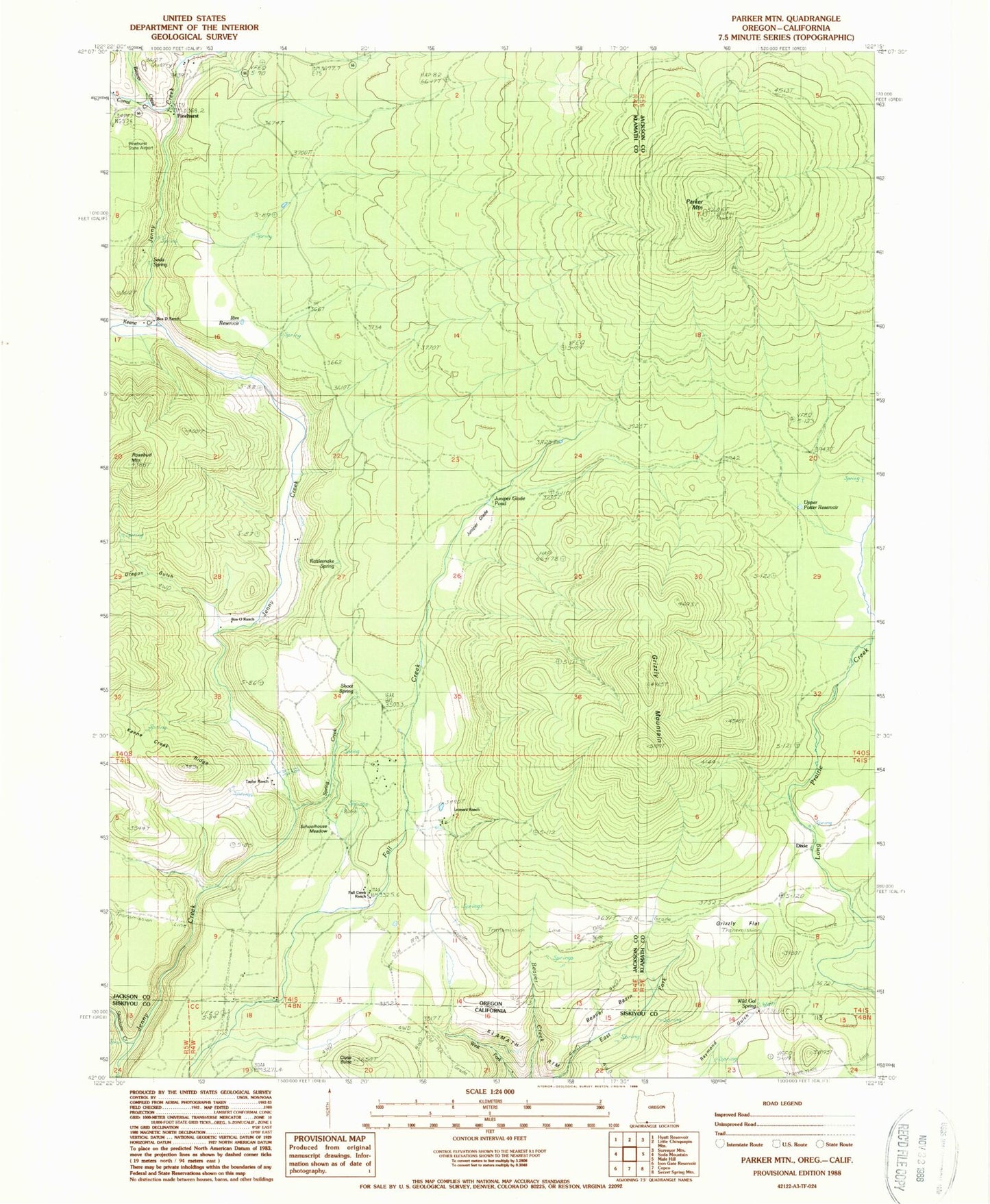
Historical USGS topographic quad map of Parker Mountain in the states of Oregon, California. Typical map scale is 1:24,000, but may vary for certain years, if available. Print size: 24" x 27"
This quadrangle is in the following counties: Jackson, Klamath, Siskiyou.
The map contains contour lines, roads, rivers, towns, and lakes. Printed on high-quality waterproof paper with UV fade-resistant inks, and shipped rolled.
Contains the following named places: Box D Ranch, Corral Creek, Grizzly Flat, Grizzly Mountain, Open Triangle Tee Ranch, Oregon Gulch, Parker Mountain, Pinehurst, Potter Reservoir, Rattlesnake Spring, Rosebud Mountain, Shoat Spring, Skookum Creek, Soda Spring, Upper Potter Reservoir, Wild Gal Spring, Hartwell Draw, Dixie Spring, Cascade Springs, Sloan Springs, Shake (historical), Rim Reservoir, Juniper Glade, Spring Creek, Schoolhouse Meadow, Beaver Creek, Keene Creek, Hamaker Spring, Wallis Spring, Rosebud Reservoir, Oregon Gulch Reservoir Number One, Box O Ranch, Fall Creek Reservoir, Ling Reservoir, Taylor Ranch, Leonard Ranch, Fall Creek Ranch, Dixie (historical), Juniper Glade Pond, Snow Post Office (historical), Pinehurst Post Office (historical), Shake Post Office (historical), Beaver Basin, Close Butte, Sloan Creek