MyTopo
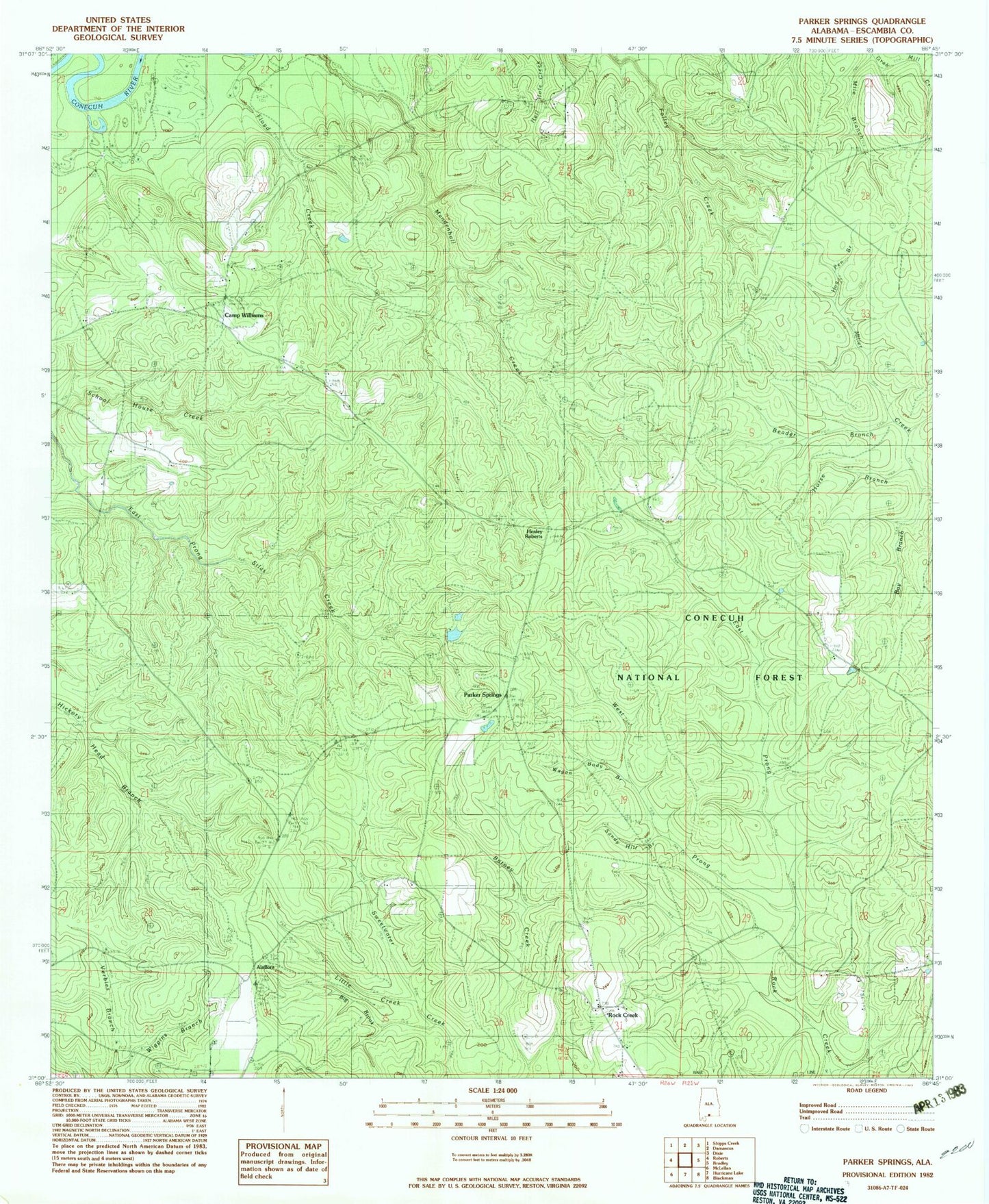
Classic USGS Parker Springs Alabama 7.5'x7.5' Topo Map
Couldn't load pickup availability
Historical USGS topographic quad map of Parker Springs in the state of Alabama. Map scale may vary for some years, but is generally around 1:24,000. Print size is approximately 24" x 27"
This quadrangle is in the following counties: Escambia.
The map contains contour lines, roads, rivers, towns, and lakes. Printed on high-quality waterproof paper with UV fade-resistant inks, and shipped rolled.
Contains the following named places: Alaflora, Bay Branch, Beader Branch, Big Brook, Brackens Ditch, Camp Alex, Camp Williams, East Prong Rock Creek, Elim Cemetery, First Marietta Missionary Baptist Church, Floyd Creek, Henley Roberts, Hog Pen Branch, Horse Branch, Leon Brooks Hines Lake, Little Creek, Mancill Cemetery, Mile Branch, New Bethel Methodist Episcopal Church, Parker Springs, Parker Springs Lookout, Rock Creek, Rock Creek Apostolic Community Church Cemetery, Rock Creek Assembly of God Church, Rock Creek Church, Rock Creek Church Cemetery, Sam McGowin Cemetery, Sandy Hill Branch, Wagon Body Branch, West Prong Rock Creek, Wiggins Branch