MyTopo
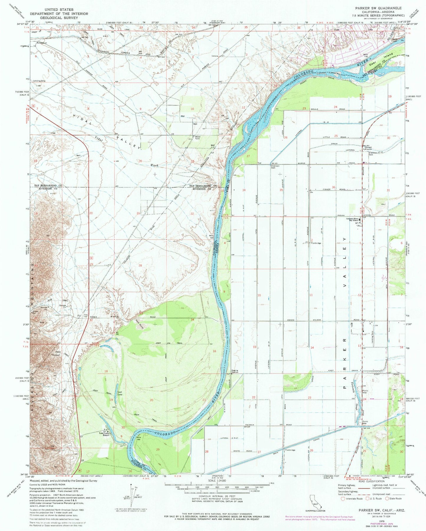
Classic USGS Parker SW California 7.5'x7.5' Topo Map
Couldn't load pickup availability
Historical USGS topographic quad map of Parker SW in the states of California, Arizona. Map scale may vary for some years, but is generally around 1:24,000. Print size is approximately 24" x 27"
This quadrangle is in the following counties: La Paz, Riverside, San Bernardino.
The map contains contour lines, roads, rivers, towns, and lakes. Printed on high-quality waterproof paper with UV fade-resistant inks, and shipped rolled.
Contains the following named places: Alligator Slough, Colorado River Day School, Deer Island, Gravel Hill Bend, Harvest Mission, Lateral Nineteen R, Lateral Nineteen R-37, Lateral Nineteen R-37-24, Lateral Number Seventy-nine, Lateral Twenty-seven R-25, Lost Lake, Lost Lake Resort, Riverside County Fire Department Station 47 - Lost Lake, Twelvemile Slough, Vidal Valley, Vidal Wash