MyTopo
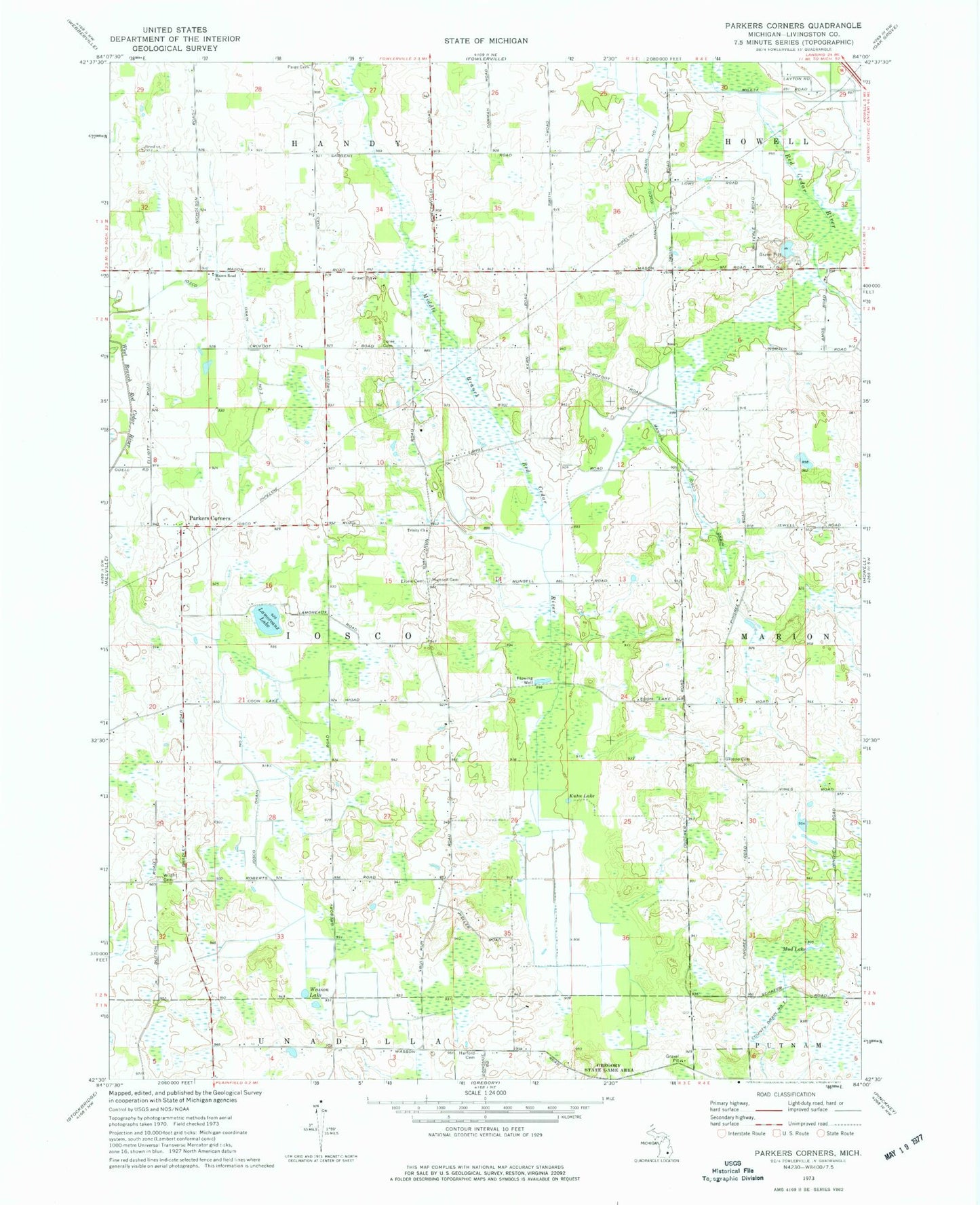
Classic USGS Parkers Corners Michigan 7.5'x7.5' Topo Map
Couldn't load pickup availability
Historical USGS topographic quad map of Parkers Corners in the state of Michigan. Map scale may vary for some years, but is generally around 1:24,000. Print size is approximately 24" x 27"
This quadrangle is in the following counties: Livingston.
The map contains contour lines, roads, rivers, towns, and lakes. Printed on high-quality waterproof paper with UV fade-resistant inks, and shipped rolled.
Contains the following named places: Burkhart Ridge Mobile Home Park, Cloud 9 Airport, Eisele Cemetery, Fowlerville Fire Department Damon Substation, Greene Cemetery, Handy Iosco Drain Number 1, Harford Cemetery, Iosco Drain Number Three, Iosco Drain Number Two, Iosco Post Office, Kuhn Lake, Lamoreaux Lake, Loree Cemetery, Marion Iosco Drain, Marion Post Office, Mason Road Church, Mud Lake, Munsell Cemetery, Paige Cemetery, Parkers Corners, Parkers Corners School, Township of Iosco, Trinity Church, Wasson Lake, Wright Cemetery