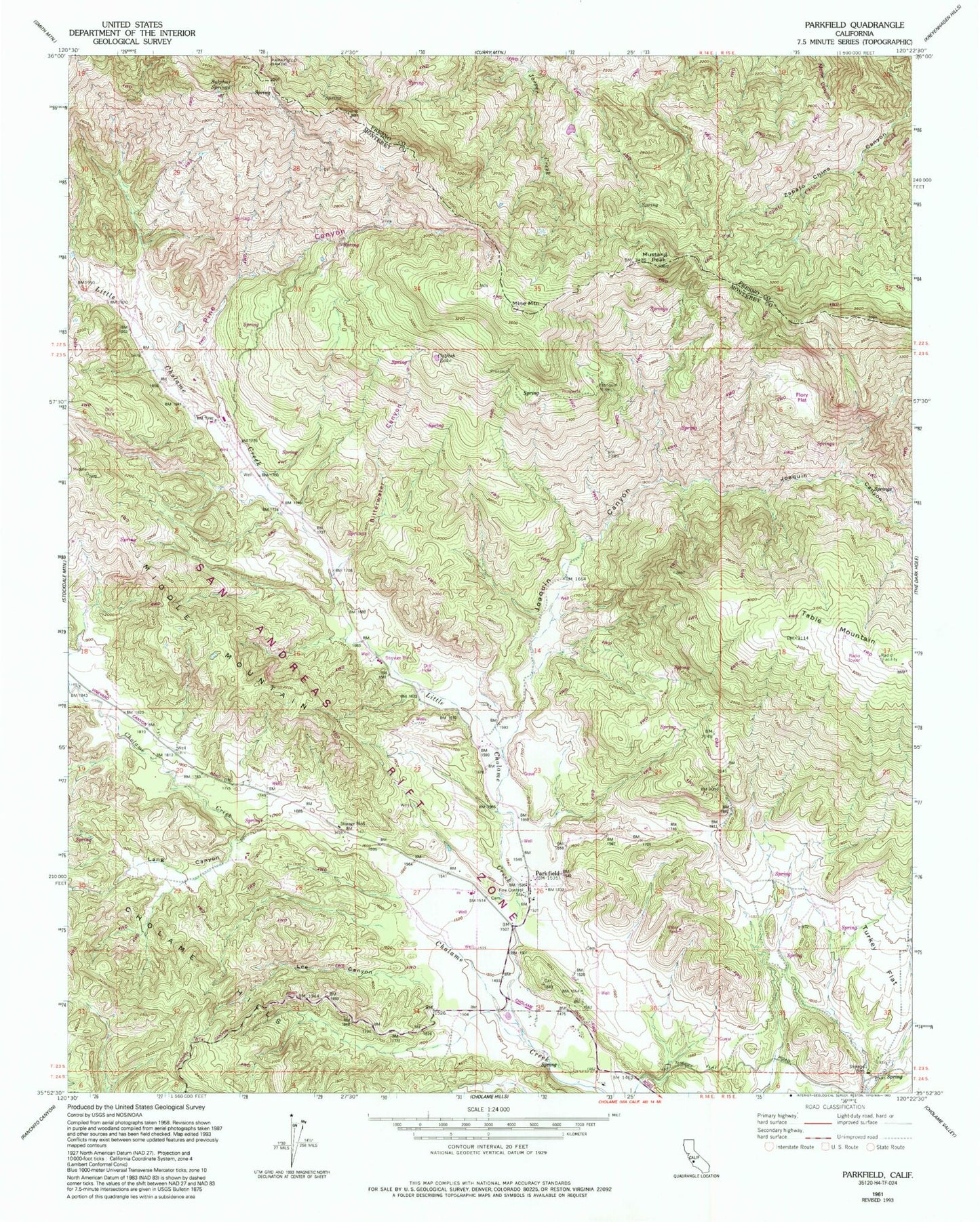
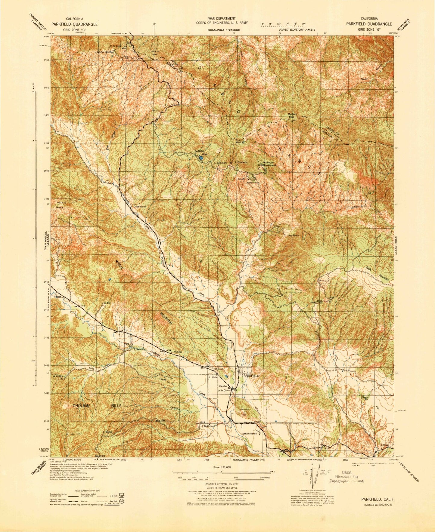
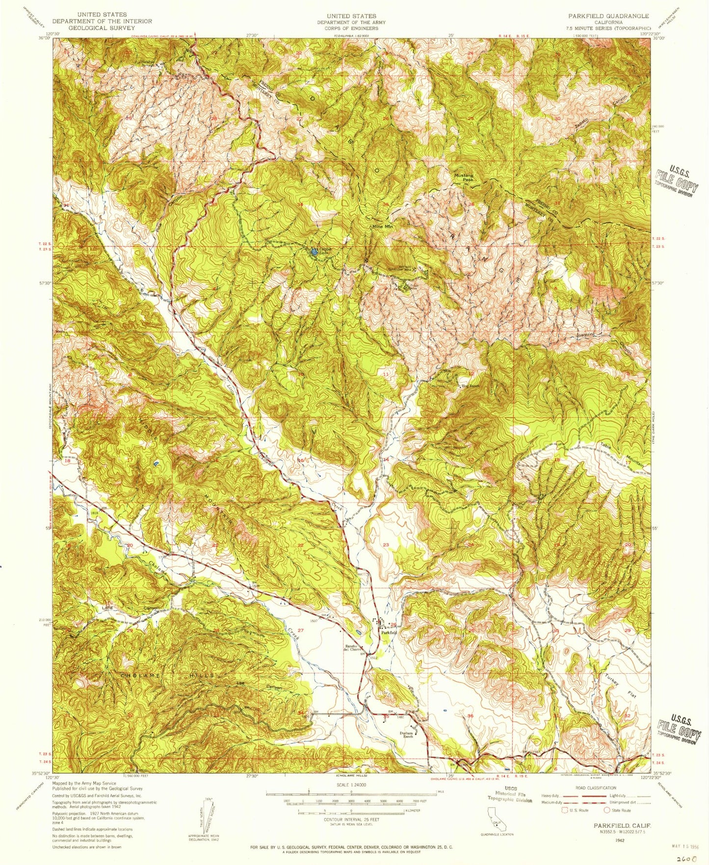
MyTopo
Classic USGS Parkfield California 7.5'x7.5' Topo Map
Couldn't load pickup availability
Historical USGS topographic quad map of Parkfield in the state of California. Map scale may vary for some years, but is generally around 1:24,000. Print size is approximately 24" x 27"
This quadrangle is in the following counties: Fresno, Monterey.
The map contains contour lines, roads, rivers, towns, and lakes. Printed on high-quality waterproof paper with UV fade-resistant inks, and shipped rolled.
Contains the following named places: California Department of Forestry and Fire Protection Parkfield Station 41, Catfish Lake, Durham Ranch, Hog Ranch, Joaquin Canyon, Lang Canyon, Lee Canyon, Little Cholame Creek, Middle Mountain, Mine Mountain, Mustang Peak, Parkfield, Patriquin Mine, Pine Canyon, Rancho De La Charra, Sommers Prospect, Sulphur Springs