MyTopo
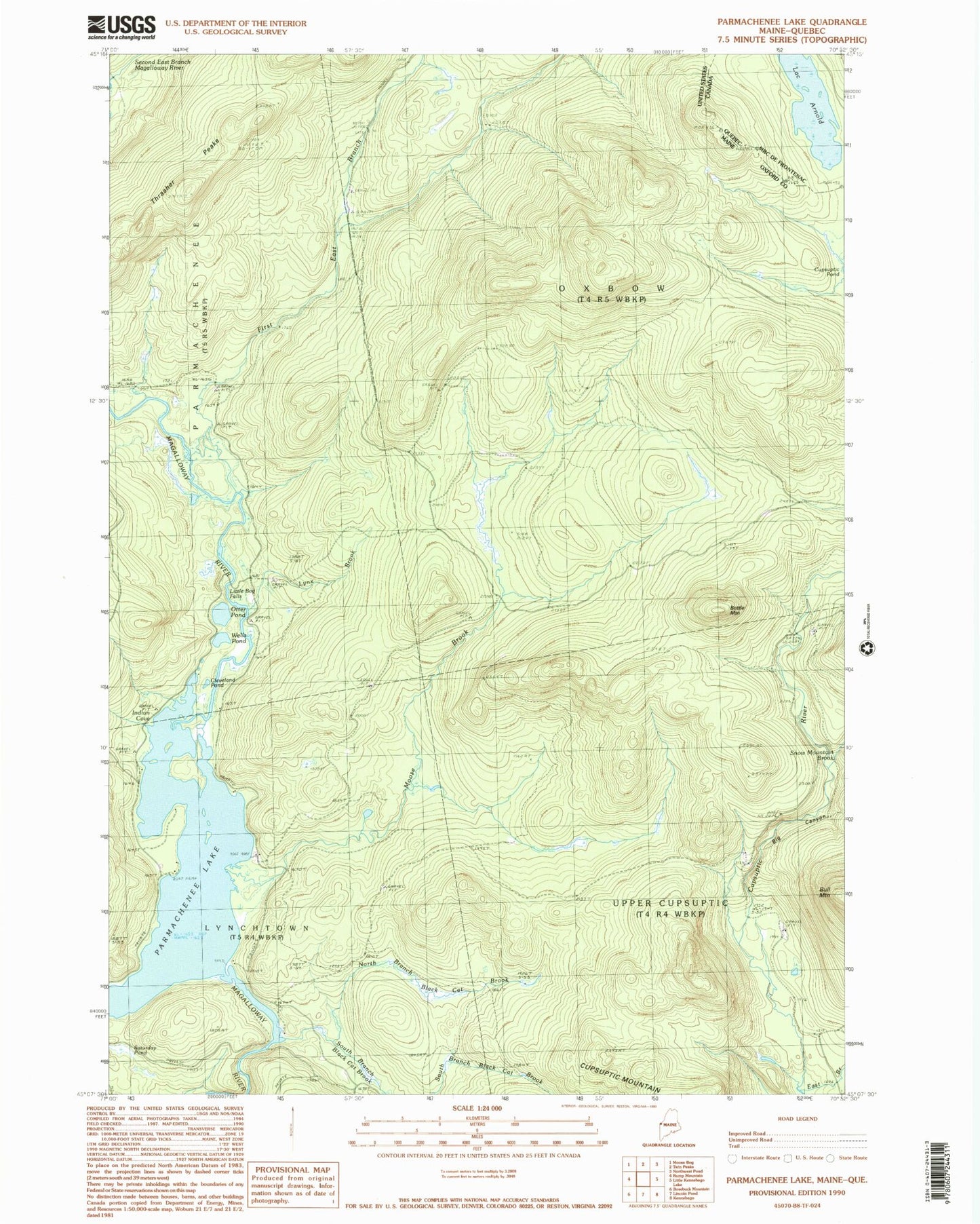
Classic USGS Parmachenee Lake Maine 7.5'x7.5' Topo Map
Couldn't load pickup availability
Historical USGS topographic quad map of Parmachenee Lake in the state of Maine. Typical map scale is 1:24,000, but may vary for certain years, if available. Print size: 24" x 27"
This quadrangle is in the following counties: Oxford.
The map contains contour lines, roads, rivers, towns, and lakes. Printed on high-quality waterproof paper with UV fade-resistant inks, and shipped rolled.
Contains the following named places: Big Canyon, Black Cat Brook, Bottle Mountain, Cleveland Pond, East Branch Cupsuptic River, First East Branch Magalloway River, Indian Cove, Little Boy Falls, Lynx Brook, Moose Brook, Moose Brook Camp (historical), Number Two Camp (historical), North Branch Black Cat Brook, Otter Pond, Parmachenee Club, Parmachenee Lake, Saturday Pond (historical), Snow Mountain Brook, South Branch Black Cat Brook, Thrasher Peaks, Wells Pond, Township of Parmachenee, Oxbow Township