MyTopo
Classic USGS Parsnip Mountain Montana 7.5'x7.5' Topo Map
Regular price
$16.95
Regular price
Sale price
$16.95
Unit price
per
Couldn't load pickup availability
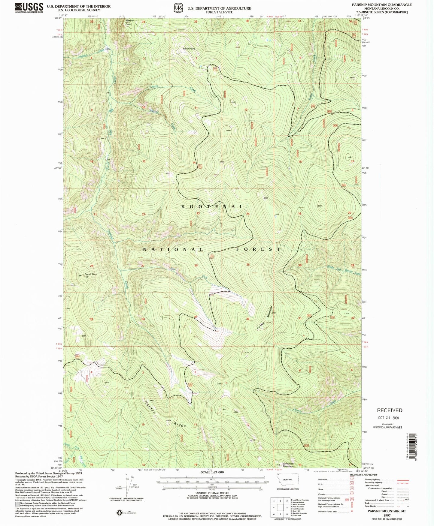
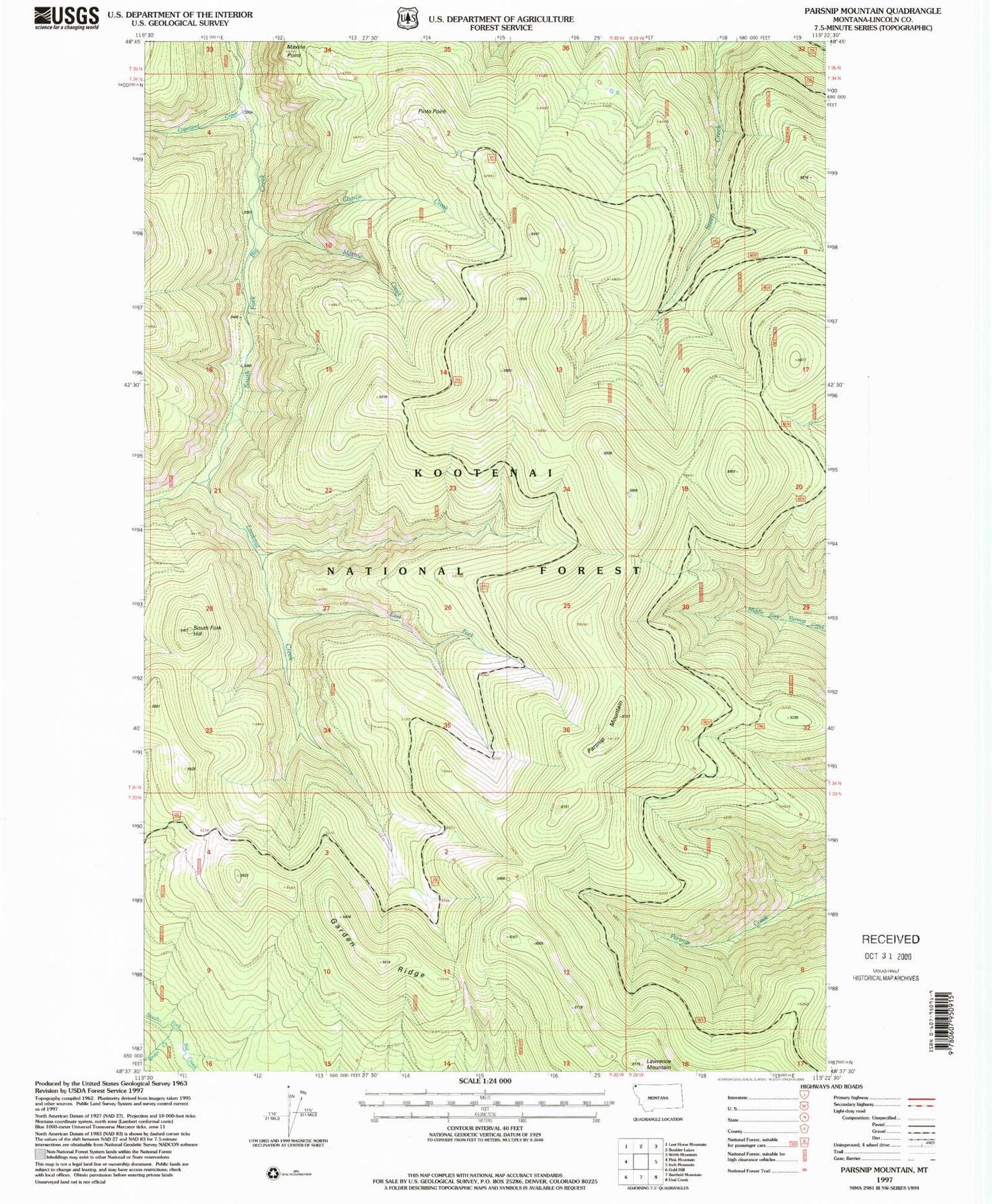
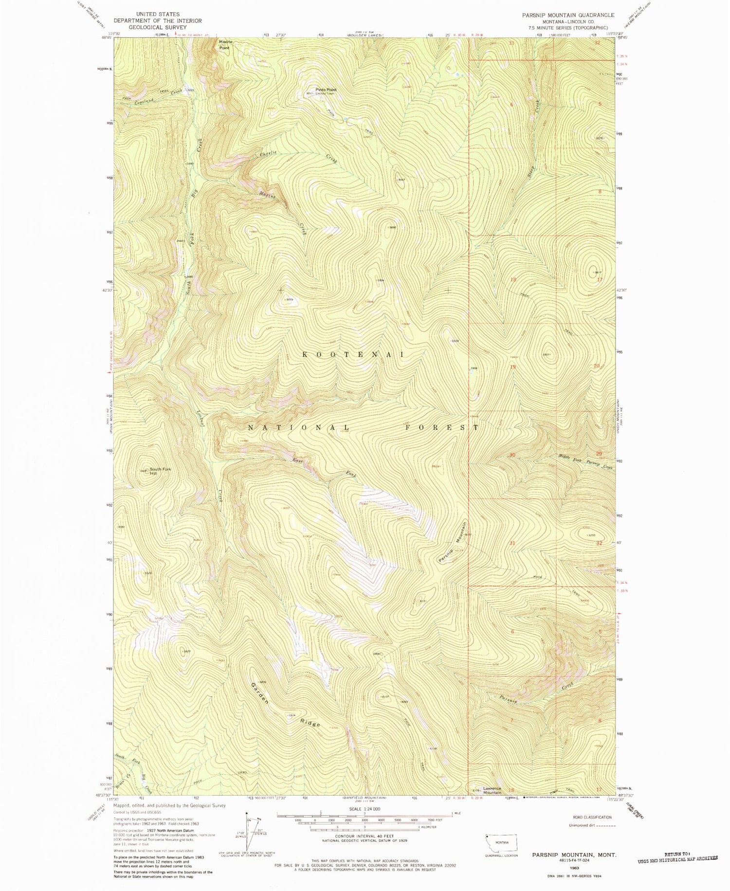
Historical USGS topographic quad map of Parsnip Mountain in the state of Montana. Map scale may vary for some years, but is generally around 1:24,000. Print size is approximately 24" x 27"
This quadrangle is in the following counties: Lincoln.
The map contains contour lines, roads, rivers, towns, and lakes. Printed on high-quality waterproof paper with UV fade-resistant inks, and shipped rolled.
Contains the following named places: Bruin Creek, Charlie Creek, Copeland Creek, East Fork Lookout Creek, Garden Ridge, Lawrence Mountain, Lookout Creek, Maxine Creek, Maxine Point, Parsnip Mountain, Pinto Point, South Fork Hill