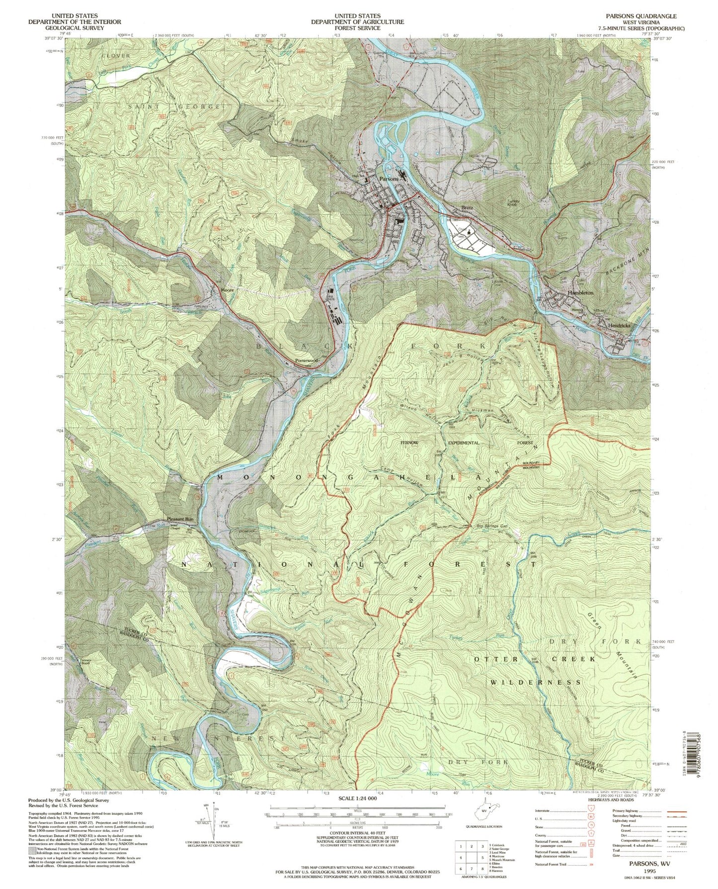
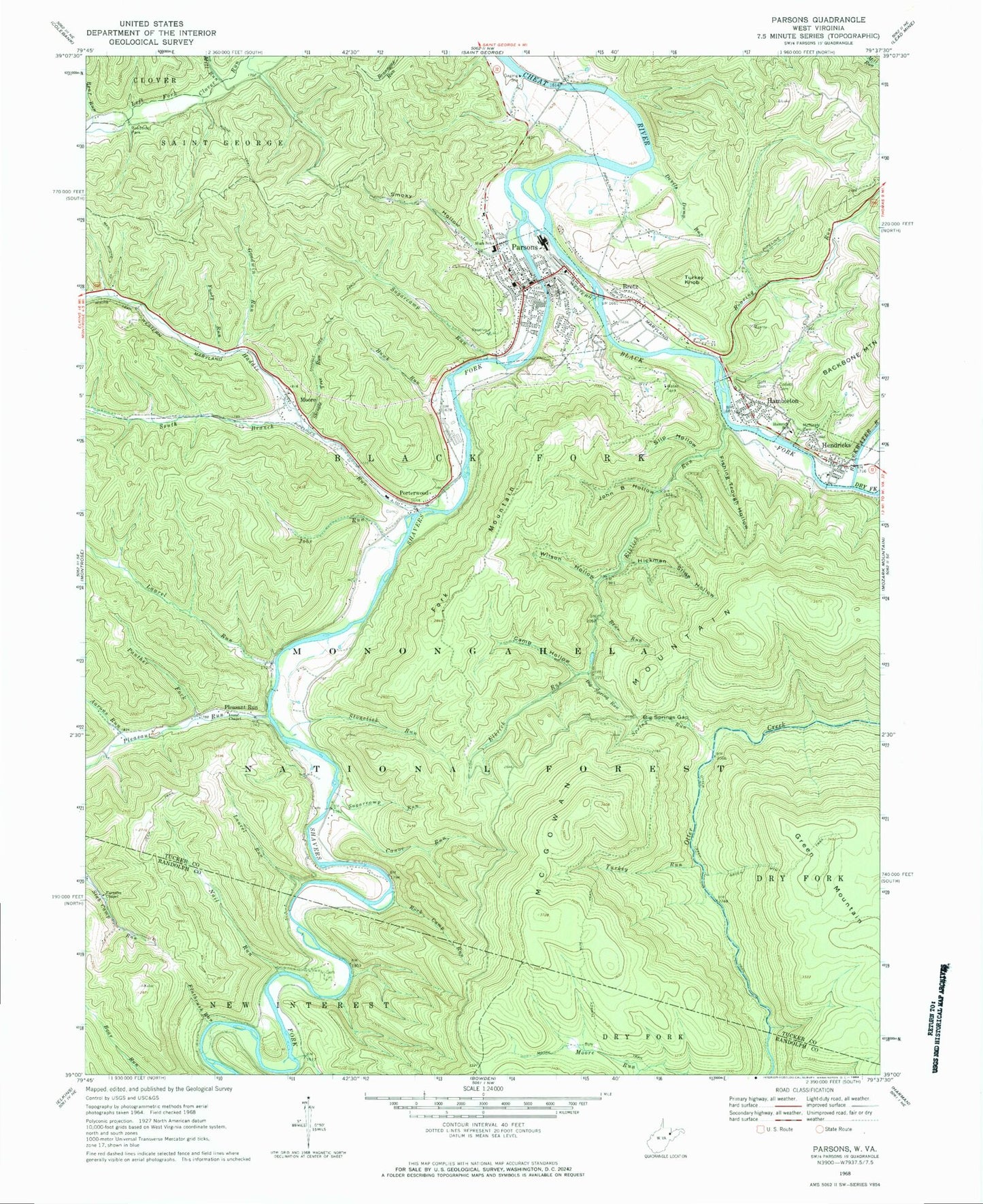
MyTopo
Classic USGS Parsons West Virginia 7.5'x7.5' Topo Map
Couldn't load pickup availability
Historical USGS topographic quad map of Parsons in the state of West Virginia. Typical map scale is 1:24,000, but may vary for certain years, if available. Print size: 24" x 27"
This quadrangle is in the following counties: Randolph, Tucker.
The map contains contour lines, roads, rivers, towns, and lakes. Printed on high-quality waterproof paper with UV fade-resistant inks, and shipped rolled.
Contains the following named places: Aarons Run, Bear Run, Bear Run, Big Spring Run, Big Springs Gap, Black Fork, Blackwater River, Camp Hollow, Canoe Run, Collett Cemetery, Devils Dump Run, Dry Fork, Elklick Run, Farmers Chapel, Fishing Trough Hollow, Flatbrush Run, Fools Run, Fork Mountain, Goff Cemetery, Goodwin Run, Green Mountain Trail, Haddix Run, Hambleton, Hamrick School (historical), Hawk Run, Hickman Slide Hollow, Irons Chapel, Jobs Run, John B Hollow, Laurel Run, Laurel Run, McNeely Cemetery, Mill Run, Moore, Moore Run Trail, Nail Run, Panther Fork, Pleasant Run, Pleasant Run, Porterwood, Shingle Tree Trail, Roaring Run, Rock Camp Run, Shavers Fork, Shingle Tree Run, Shingle Tree Run Trail, Slip Hollow, Smoky Hollow, South Branch Haddix Run, Spring Run, Stonelick Run, Sugarcamp Run, Sugarcamp Run, Turkey Run, Turkey Run Trail, Wilson Hollow, Cheat District Ranger Station, Ferron Experimental Forest, Big Springs Gap Trail, Bretz, Hendricks, Parsons, Turkey Knob, Harlan Irons Spring, Elklick Run Spring, Bretz Church of Christ, Clover Run (historical), Davisville, Fansler Cemetery, First Baptist Church, First Methodist Church, First United Brethren Church, Goff Memorial Methodist Protestant Church, Hambleton Church of the Brethren, Hambleton Post Office, Hendricks Post Office, Jobs Ford, Moss Bridge, Parsons Elementary School (historical), Parsons High School (historical), Parsons Post Office, Parsons Presbyterian Church, Parsons Town Hall, Saint Johns Methodist Church, Tucker County Courthouse, Tucker County Hospital (historical), Tucker County Jail, Nail Run School (historical), Pettit (historical), Pleasant Run School (historical), Coberley School (historical), Fork Mountain School (historical), Holly Meadows School (historical), Black Fork District, Tucker Valley Elementary and Middle School, Tucker Valley Annex School, Town of Hambleton, Town of Hendricks, City of Parsons, Tucker Christian Academy (historical), Parsons Volunteer Fire Department, Tucker County Emergency Medical Services, Lamberts Ambulance Service Parsons, Blackfork Bridge, Holly Meadows Bridge, West Virginia State Police Troop 3 - Parsons Detachment, Tucker County Sheriff's Office, Parsons Police Department