MyTopo
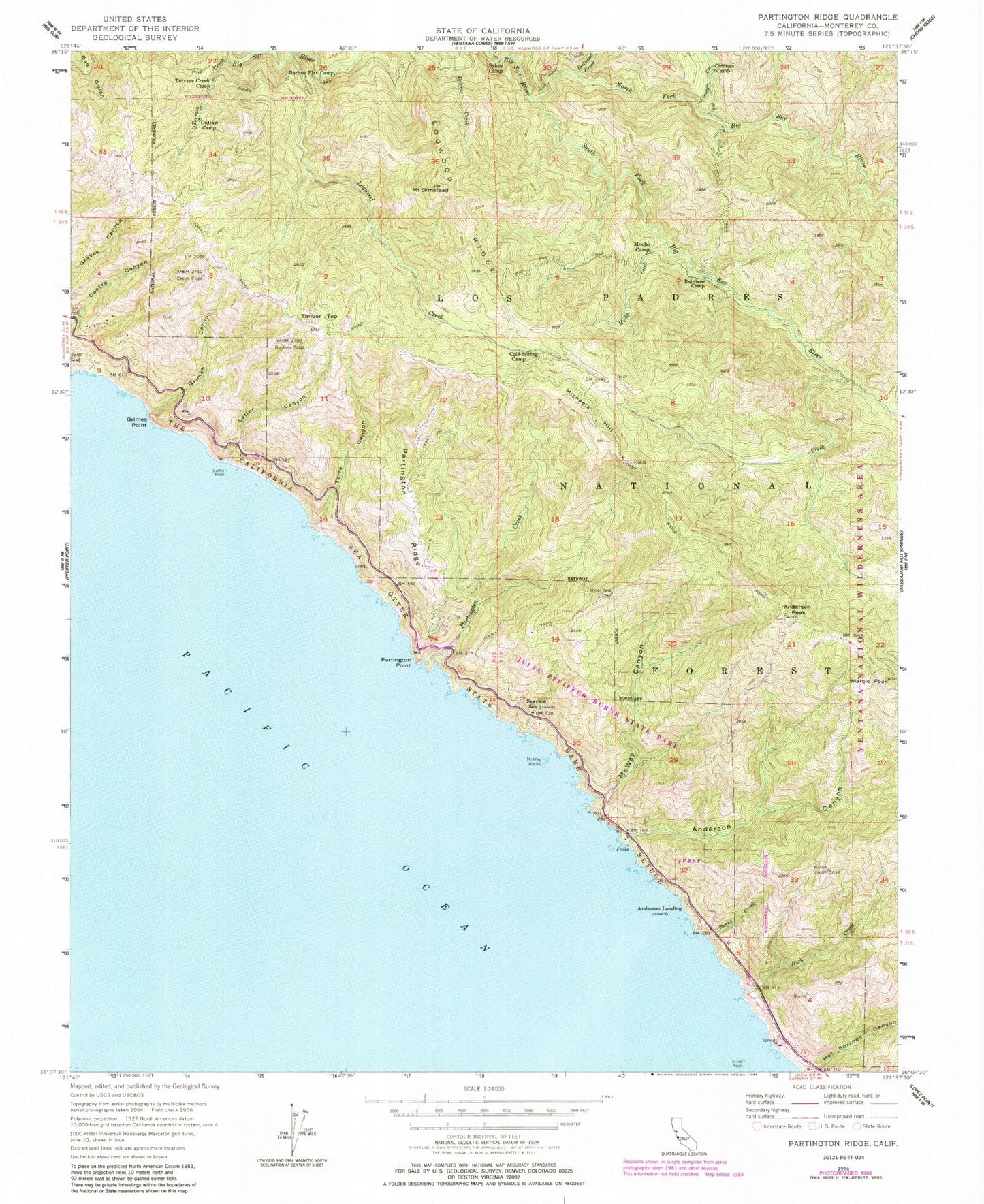
Classic USGS Partington Ridge California 7.5'x7.5' Topo Map
Couldn't load pickup availability
Historical USGS topographic quad map of Partington Ridge in the state of California. Typical map scale is 1:24,000, but may vary for certain years, if available. Print size: 24" x 27"
This quadrangle is in the following counties: Monterey.
The map contains contour lines, roads, rivers, towns, and lakes. Printed on high-quality waterproof paper with UV fade-resistant inks, and shipped rolled.
Contains the following named places: Terrace Creek, Anderson Canyon, Anderson Peak, Barlow Flat Camp, Big Sur Trail, Buck Creek, Burns Creek, Cienega Camp, Cienega Creek, Cold Spring Camp, Grimes Canyon, Grimes Point, Lafler Canyon, Lafler Rock, Logwood Creek, Logwood Ridge, Marble Peak, McWay Canyon, McWay Rocks, Mocho Camp, Mocho Creek, North Fork Big Sur River, Mount Olmstead, Outlaw Camp, Partington Creek, Partington Point, Partington Ridge, Pick Creek, Redwood Creek, Seaview School, South Fork Big Sur River, Terrace Creek Camp, The California Sea Otter State Game Refuge, Torre Canyon, Julia Pfeiffer Burns State Park, Rainbow Camp, Logwood Campground, Partington Cove, Sykes Camp, South Fork Rustic Campsite, Anderson Landing, Michaels Hill, Timber Top, Cold Spring, Julia Pfeiffer Burns Underwater Area, McWay Creek, Partington Canyon, Anderson Creek, Ewoldsen Trail, McWay Cove, McWay Falls, Overlook Trail, Saddle Rock, Tan Bark Trail, Waterfall Trail, Big Sur Division, Big Sur Volunteer Fire Brigade Station 2, Big Sur Wild and Scenic River