MyTopo
Classic USGS Pastoria Creek California 7.5'x7.5' Topo Map
Regular price
$16.95
Regular price
Sale price
$16.95
Unit price
per
Couldn't load pickup availability
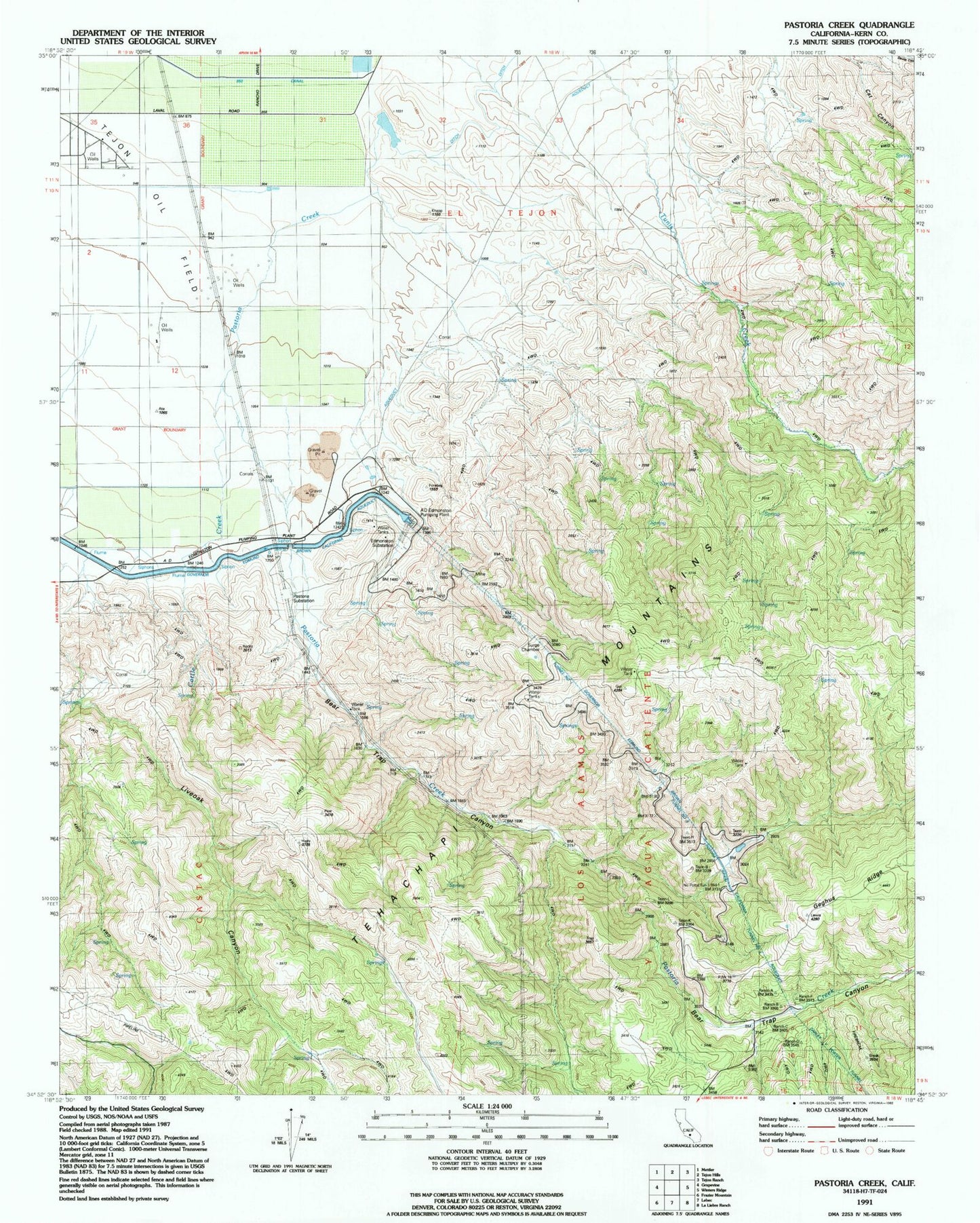
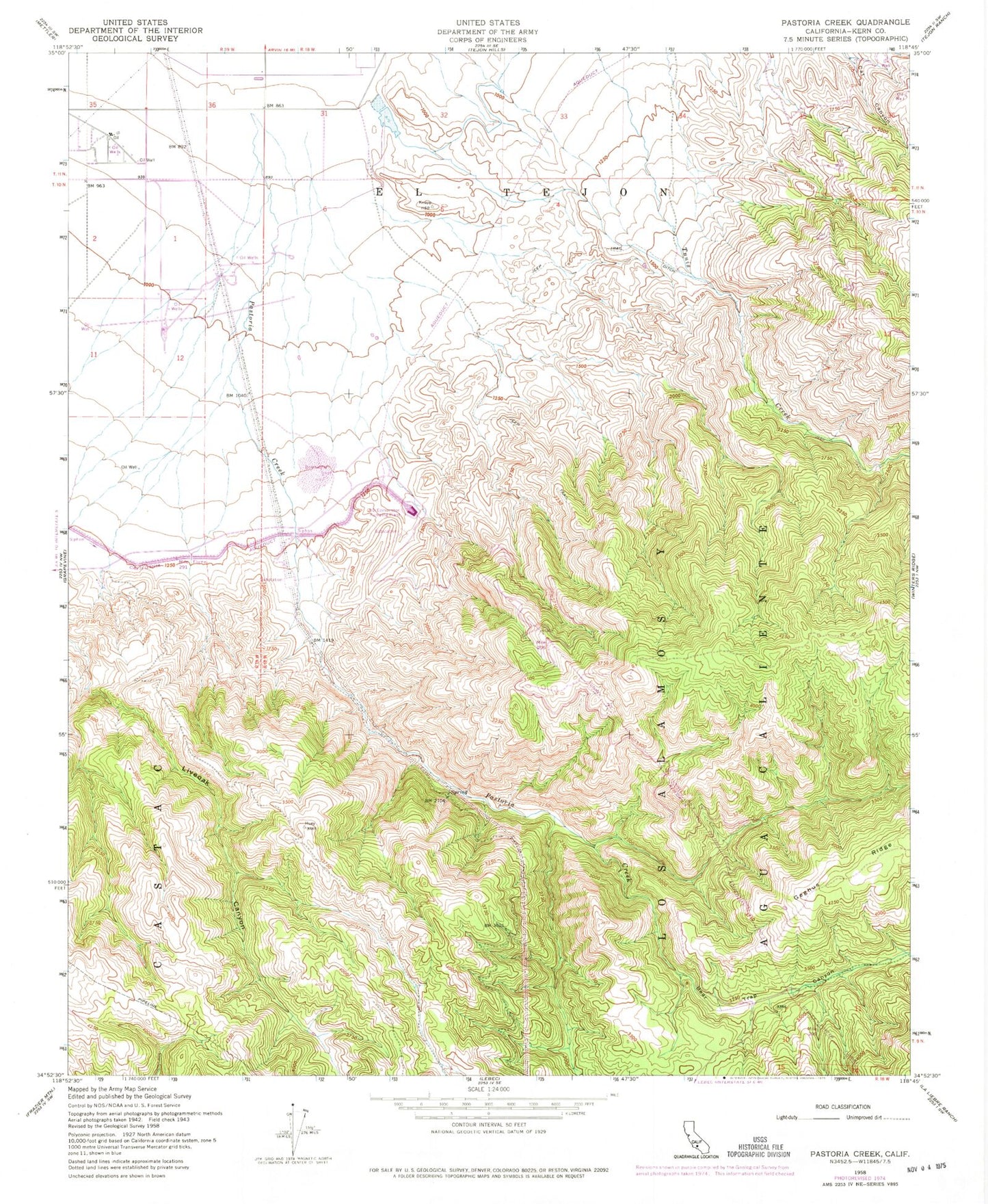
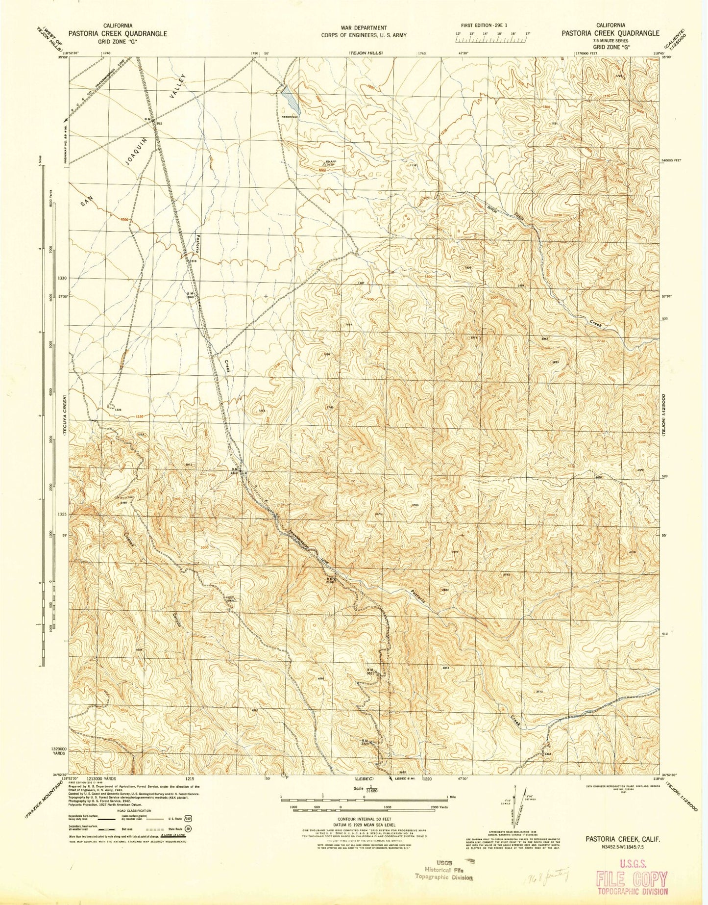
Historical USGS topographic quad map of Pastoria Creek in the state of California. Map scale may vary for some years, but is generally around 1:24,000. Print size is approximately 24" x 27"
This quadrangle is in the following counties: Kern.
The map contains contour lines, roads, rivers, towns, and lakes. Printed on high-quality waterproof paper with UV fade-resistant inks, and shipped rolled.
Contains the following named places: 850 Canal, A D Edmonston Pumping Plant, Bear Trap Canyon, Castac, Cattle Creek, Edmonston Substation, Los Alamos Y Agua Caliente, Pastoria Creek, Pastoria Siphon, Pastoria Substation, Tunnel Number One, Tunnel Number Three, Tunnel Number Two