MyTopo
Classic USGS Pat Keyes Canyon California 7.5'x7.5' Topo Map
Regular price
$16.95
Regular price
Sale price
$16.95
Unit price
per
Couldn't load pickup availability
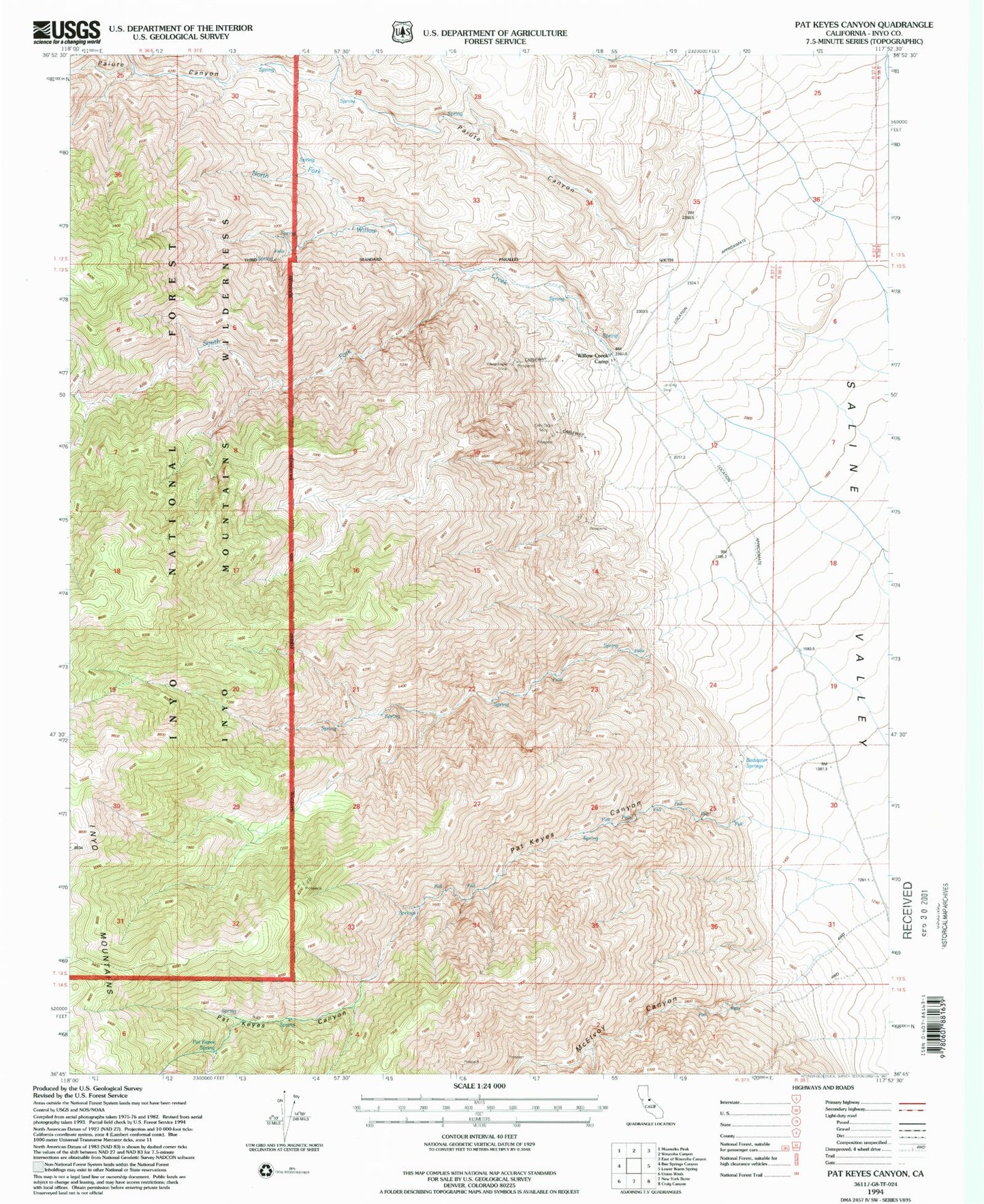
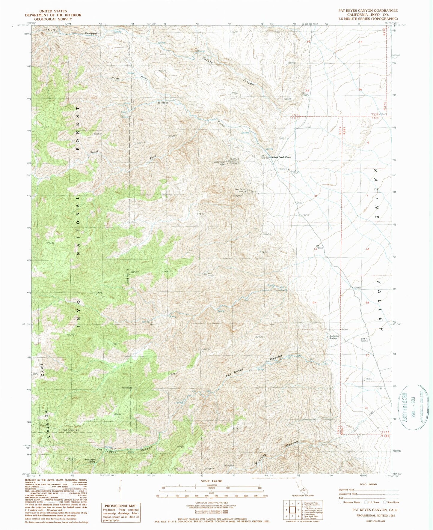
Historical USGS topographic quad map of Pat Keyes Canyon in the state of California. Map scale may vary for some years, but is generally around 1:24,000. Print size is approximately 24" x 27"
This quadrangle is in the following counties: Inyo.
The map contains contour lines, roads, rivers, towns, and lakes. Printed on high-quality waterproof paper with UV fade-resistant inks, and shipped rolled.
Contains the following named places: Badwater Springs, Grey Eagle Talc Mine, Inyo Mountains Wilderness, McElvoy Canyon, North Fork Willow Creek, Paiute Canyon, Pat Keyes Canyon, Pat Keyes Spring, South Fork Willow Creek, White Eagle Talc Mine, Willow Creek, Willow Creek Camp