MyTopo
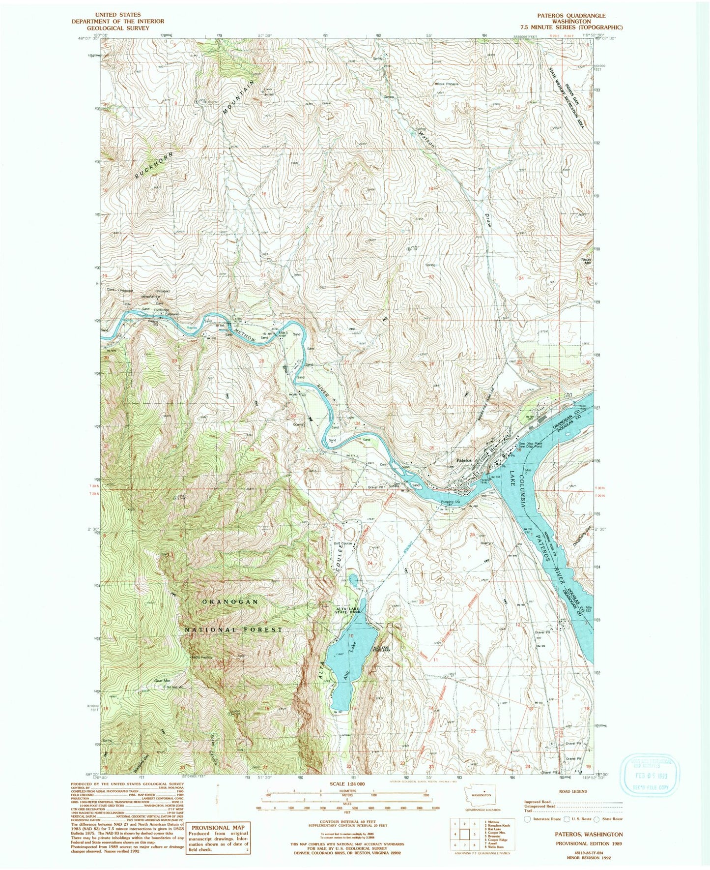
Classic USGS Pateros Washington 7.5'x7.5' Topo Map
Couldn't load pickup availability
Historical USGS topographic quad map of Pateros in the state of Washington. Map scale may vary for some years, but is generally around 1:24,000. Print size is approximately 24" x 27"
This quadrangle is in the following counties: Douglas, Okanogan.
The map contains contour lines, roads, rivers, towns, and lakes. Printed on high-quality waterproof paper with UV fade-resistant inks, and shipped rolled.
Contains the following named places: Alta Coulee, Alta Lake, Alta Lake Golf Course, Alta Lake State Park, City of Pateros, Dougherty Canyon, Douglas - Okanogan County Fire District 15 Pateros Station 10, Goat Mountain, Methow Rapids, Methow River, Okanogan County Sheriff Pateros, Pateros, Pateros Elementary School, Pateros High School, Pateros Post Office, Pateros United Methodist Church, Pateros Volunteer Fire Department, Watson Draw, ZIP Code: 98846