MyTopo
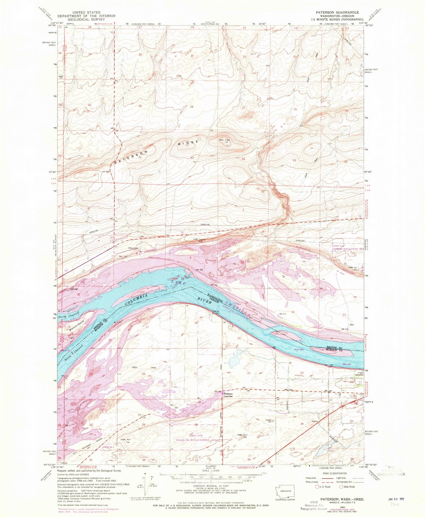
Classic USGS Paterson Washington 7.5'x7.5' Topo Map
Couldn't load pickup availability
Historical USGS topographic quad map of Paterson in the states of Washington, Oregon. Map scale may vary for some years, but is generally around 1:24,000. Print size is approximately 24" x 27"
This quadrangle is in the following counties: Benton, Morrow.
The map contains contour lines, roads, rivers, towns, and lakes. Printed on high-quality waterproof paper with UV fade-resistant inks, and shipped rolled.
Contains the following named places: Benton County Fire District 6, Big Blalock Island, Blalock Island, Columbia Crest Winery Airport, Cooks Island, Irrigon Cemetery, Irrigon Fish Hatchery, Irrigon Lower Range, Island Number 17, Island Number 18, John Day Wildlife Management Area, Judson, Long Walk Island, McCormack Slough, Monument Island, Number 18 Island, Paterson, Paterson Elementary School, Paterson Junction, Paterson Post Office, Paterson Ridge, Patterson Ferry Boat Ramp, Umatilla National Wildlife Refuge, ZIP Code: 97844