MyTopo
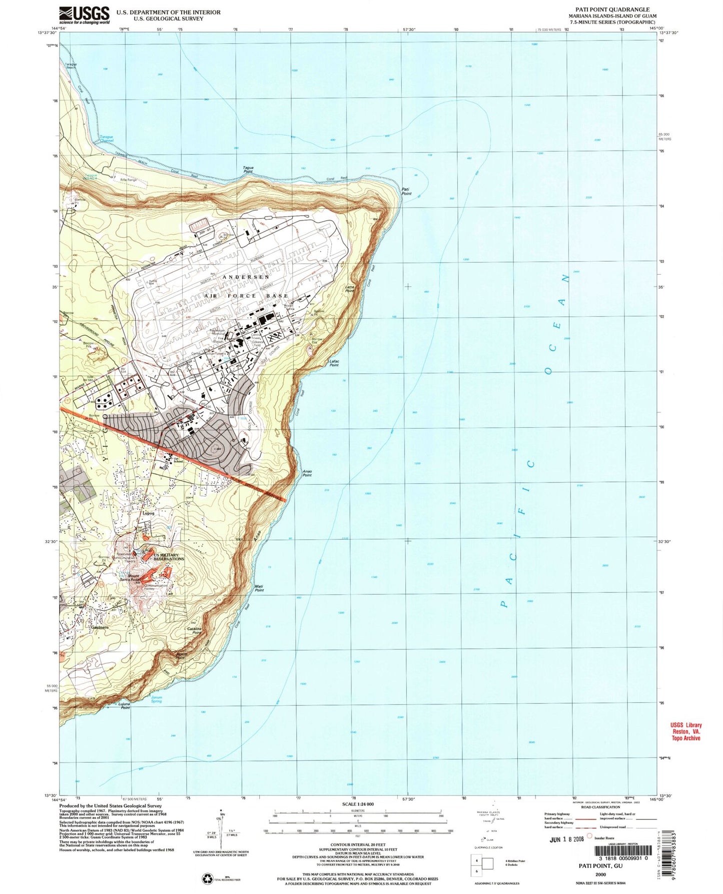
Classic USGS Pati Point Guam 7.5'x7.5' Topo Map
Couldn't load pickup availability
Historical USGS topographic quad map of Pati Point in the state of Guam. Map scale may vary for some years, but is generally around 1:24,000. Print size is approximately 24" x 27"
This quadrangle is in the following counties: Guam.
The map contains contour lines, roads, rivers, towns, and lakes. Printed on high-quality waterproof paper with UV fade-resistant inks, and shipped rolled.
Contains the following named places: Anao, Anao Census Designated Place, Anao Conservation Reserve, Anao Point, Andersen Air Force Base, Andersen Air Force Base Census Designated Place, Astobias, Base Chapel Number 1, Base Chapel Number 2, Catalina Point, Central Tower, Chunge Well, Gayinero, Gilkeson Field, Janum Point, Janum Spring, Kimball Field, Lafac Point, Latte Point, Lujuna Point, Lupog, Mati Point, Mount Santa Rosa, North Gayinero Census Designated Place, Pati Point, Santa Rosa Well, Scout Beach, Tagua Point, Tarague, Tarague Beach, Tarague Channel, Tarague Point, Taraque Well Number 4, Upi, Upi Elementary School, Well Number 5, Yigo Election District