
MyTopo
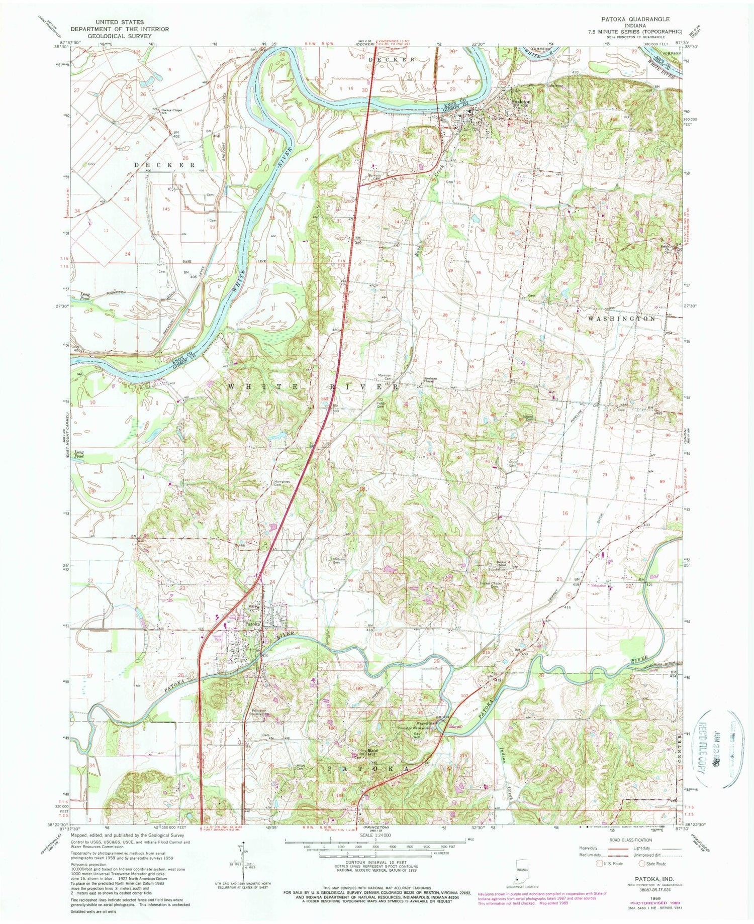
Classic USGS Patoka Indiana 7.5'x7.5' Topo Map
Couldn't load pickup availability
Historical USGS topographic quad map of Patoka in the state of Indiana. Map scale may vary for some years, but is generally around 1:24,000. Print size is approximately 24" x 27"
This quadrangle is in the following counties: Gibson, Knox.
The map contains contour lines, roads, rivers, towns, and lakes. Printed on high-quality waterproof paper with UV fade-resistant inks, and shipped rolled.
Contains the following named places: Bald Hill, Barnett Cemetery, Decker Cemetery, Decker Chapel, Decker Elementary School, Field Cemetery, Fields Station, Hazleton, Hitch Cemetery, Hull Airport, Humphrey Cemetery, Indian Creek, Johnson - Decker Township Volunteer Fire Department, Luke Decker Claim, Milburn Cemetery, Millers Station, Morrison Cemetery, Patoka, Patoka - White River Township Fire Department, Patoka Police Department, Patoka Post Office, Princeton Country Club, Princeton Waterworks, Robb Cemetery, Robb Creek, Shiloh Church, Snider Field, Steelman Chapel, Thompson Ditch, Town of Hazleton, Town of Patoka, Township of White River, Trippet Cemetery, Trippet Ditch, White River - Hazleton Volunteer Fire Department, ZIP Codes: 47524, 47666


