MyTopo
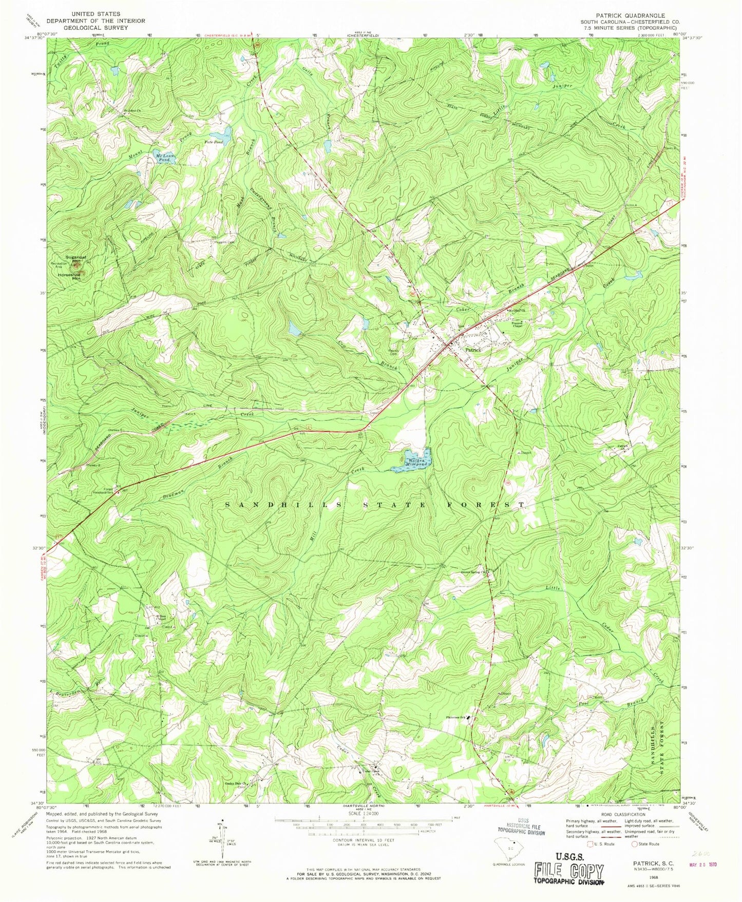
Classic USGS Patrick South Carolina 7.5'x7.5' Topo Map
Couldn't load pickup availability
Historical USGS topographic quad map of Patrick in the state of South Carolina. Typical map scale is 1:24,000, but may vary for certain years, if available. Print size: 24" x 27"
This quadrangle is in the following counties: Chesterfield.
The map contains contour lines, roads, rivers, towns, and lakes. Printed on high-quality waterproof paper with UV fade-resistant inks, and shipped rolled.
Contains the following named places: Coker Branch, Cow Branch, Deadman Branch, Frances Chapel, Gully Branch, Huggins Cemetery, Mash Branch, McLean Pond, Mill Creek, Mount Olive Church, Pate Pond, Patrick Cemetery, Pool Branch, Underground Branch, Wilkes Millpond, Horseshoe Mountain, Bear Creek Church (historical), Bear Creek School (historical), Cat Pond School (historical), Church of God, Evans Mill (historical), Juniper School (historical), Middle Prong Juniper Creek, Mount Olive Church, Ousleydale School (historical), Palmetto School (historical), Patrick Baptist Church, Spring Hill School (historical), South Carolina Noname 13059 D-3228 Dam, Flory Pond, Scott Pond Dam D-3213, Wilkes Millpond Dam D-3211, Brown Springs Pond Dam D-3212, Hunter Pond Dam D-3210, Lee Pond Dam D-3209, McLean Pond Dam D-3208, Brown Springs Baptist Church, Cedar Creek Baptist Church, Saint Johns Cemetery, Ousley Dale Church, Patrick, Patrick Church, Plainview School, Saint Johns Free Will Baptist Church, Sand Hills State Forest, Sugarloaf Mountain, Wilkes Chapel, Ousley Dale School (historical), Patrick Division, Town of Patrick, Patrick Fire Department, Alligator Fire Department Cedar Creek, Patrick Rescue Squad, Ousley Dale Church Cemetery