MyTopo
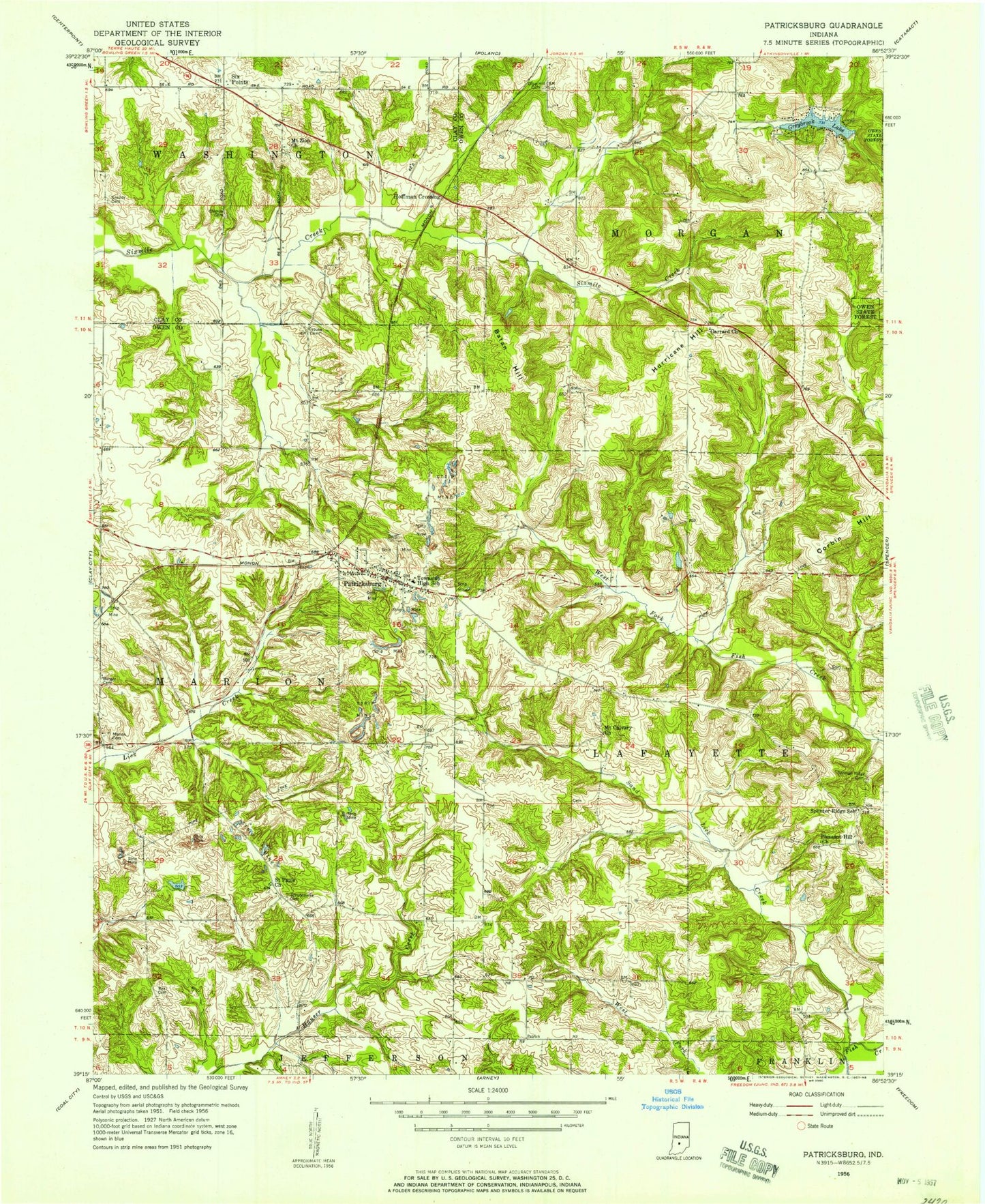
Classic USGS Patricksburg Indiana 7.5'x7.5' Topo Map
Couldn't load pickup availability
Historical USGS topographic quad map of Patricksburg in the state of Indiana. Map scale may vary for some years, but is generally around 1:24,000. Print size is approximately 24" x 27"
This quadrangle is in the following counties: Clay, Owen.
The map contains contour lines, roads, rivers, towns, and lakes. Printed on high-quality waterproof paper with UV fade-resistant inks, and shipped rolled.
Contains the following named places: Beamer, Burger Cemetery, Corbin Hill, Crouse Cemetery, Garrard Church, Greybrook Lake, Greybrook Lake Dam, Hoffman Crossing, Hurricane Hill, Marion Cemetery, Marion Mills, Mount Calvary Church, Mount Zion Church, Olive Hill Cemetery, Patricksburg, Patricksburg Community Volunteer Fire Department, Patricksburg Elementary School, Patricksburg Post Office, Pleasant Hill Church, Rea Cemetery, Saint Pauls Church, Sand Lick Creek, Satan Hill, Six Points, Sixmile Cemetery, Snoddy Cemetery, Splinter Ridge Cemetery, Splinter Ridge School, Steubenville Cemetery, Township of Lafayette, Township of Marion, Township of Morgan, ZIP Codes: 47455, 47833