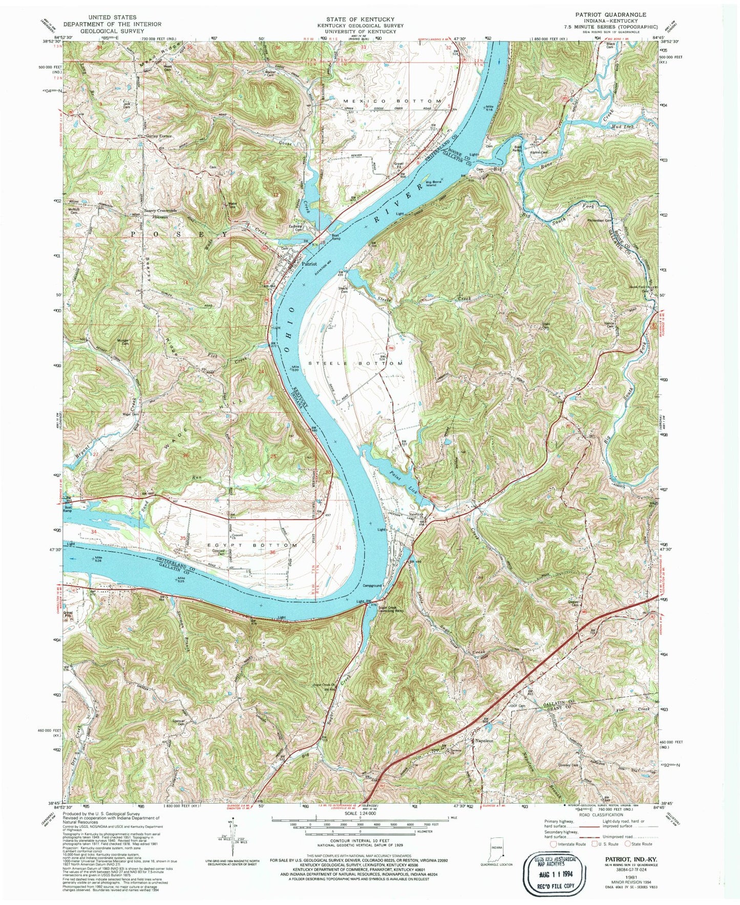
MyTopo
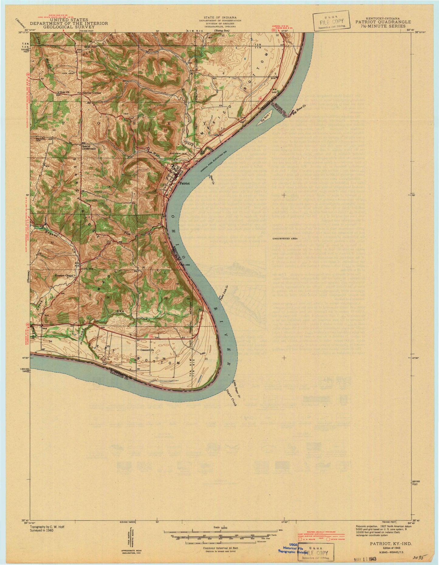
Classic USGS Patriot Indiana 7.5'x7.5' Topo Map
Couldn't load pickup availability
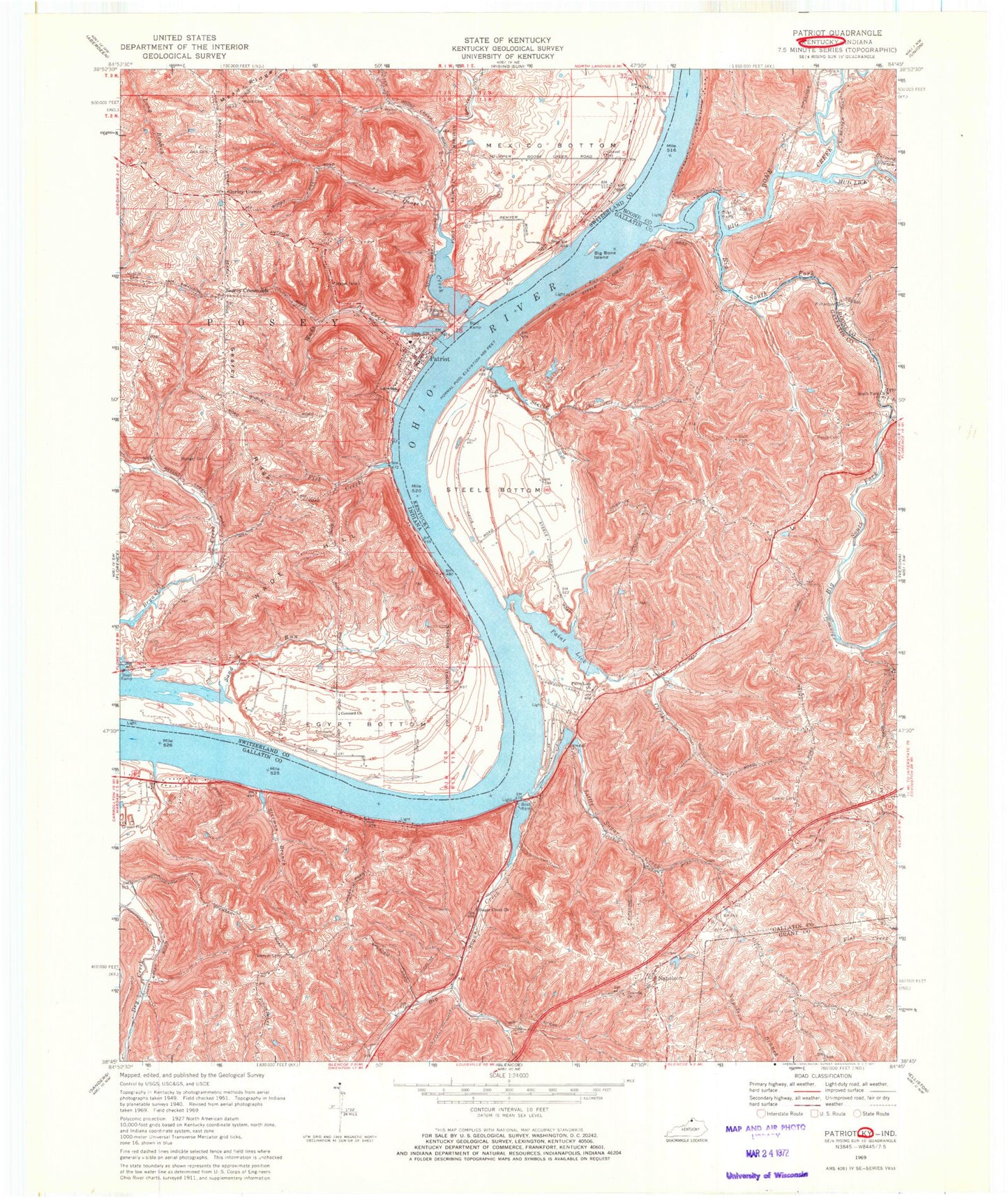
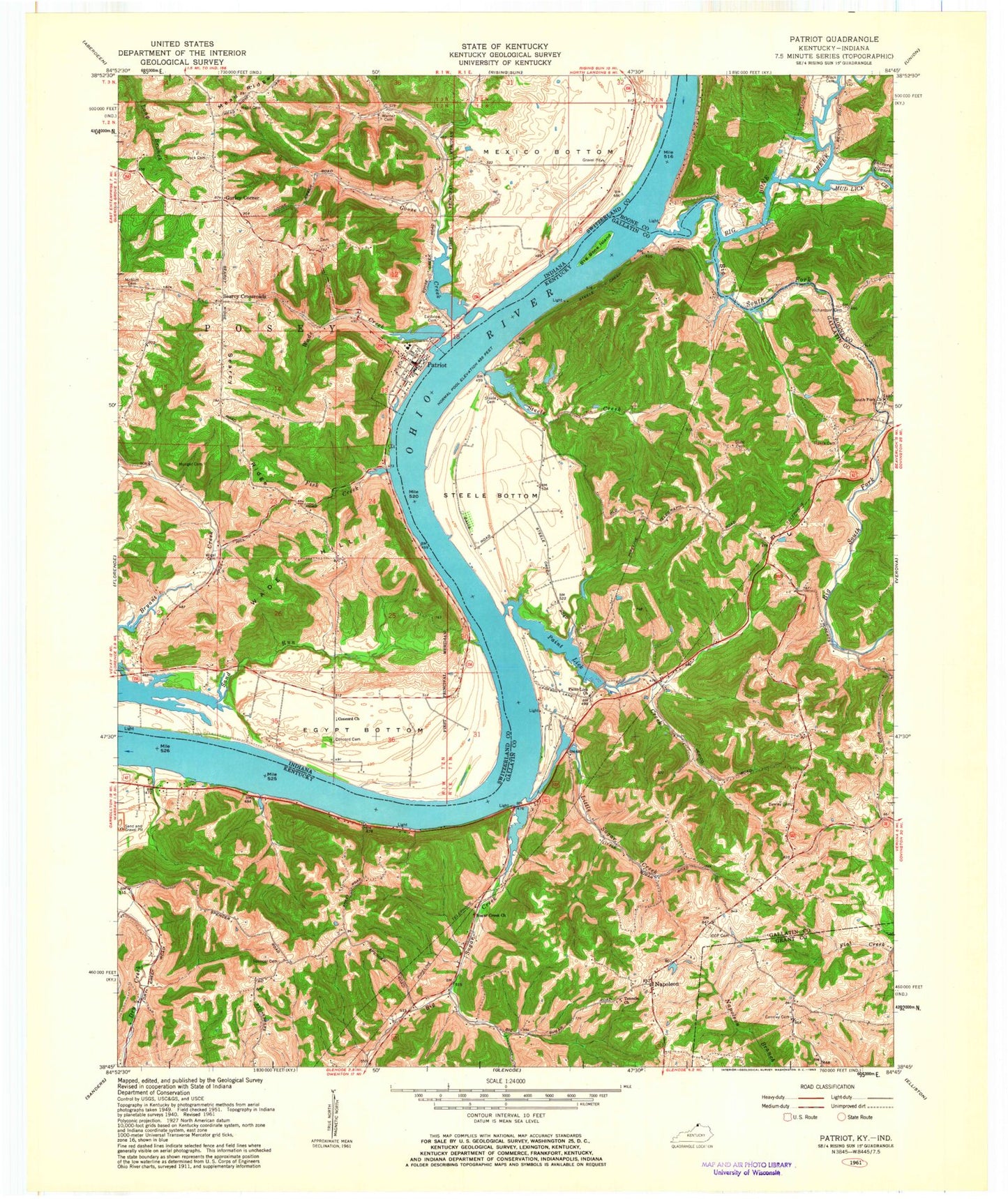
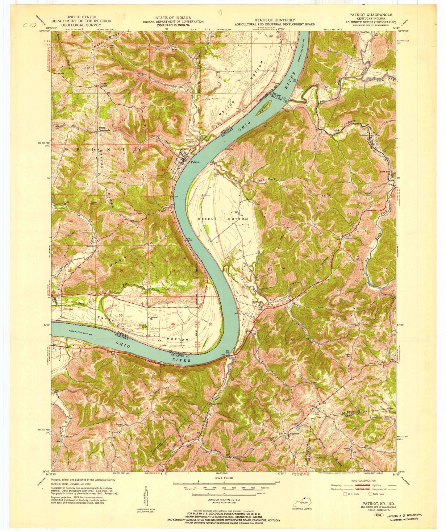
Historical USGS topographic quad map of Patriot in the states of Indiana, Kentucky. Map scale may vary for some years, but is generally around 1:24,000. Print size is approximately 24" x 27"
This quadrangle is in the following counties: Boone, Gallatin, Grant, Switzerland.
The map contains contour lines, roads, rivers, towns, and lakes. Printed on high-quality waterproof paper with UV fade-resistant inks, and shipped rolled.
Contains the following named places: Alphin Cemetery, Berkshire Post Office, Big Bone Creek, Big Bone Island, Big South Fork, Big Sugar Creek, Buzzard Branch, Concord Cemetery, Concord Church, Connley Cemetery, Dawley Cemetery, Eastview Cemetery, Egypt Bottom, Fisk Creek, Gallatin County, Goose Creek, Gurley Corner, Hance Cemetery, Jack Cemetery, Jackson Landing, Little South Fork, Little Sugar Creek, McNutt Cemetery, Mead Cemetery, Mead Ridge, Mud Lick Creek, Munger Cemetery, Napoleon, Paint Lick Church, Paint Lick Creek, Patriot, Patriot Post Office, Patriot Volunteer Fire Department, Posey Township Fire Department, Richardson Cemetery, Rock Landing, Sand Run, Searcy Crossroads, Searcy Ridge, South Fork Cemetery, South Fork Church, Spencer Cemetery, Stahl Cemetery, Steele Bottom, Steele Cemetery, Steele Creek, Steele's Bottom Airport, Steeles Creek, Sterman Branch, Sugar Creek Church, Tenmile Baptist Church, Town of Patriot, Township of Posey, Wade Creek, Wade Hill, Warsaw Division, Wigal Cemetery, ZIP Code: 47038