MyTopo
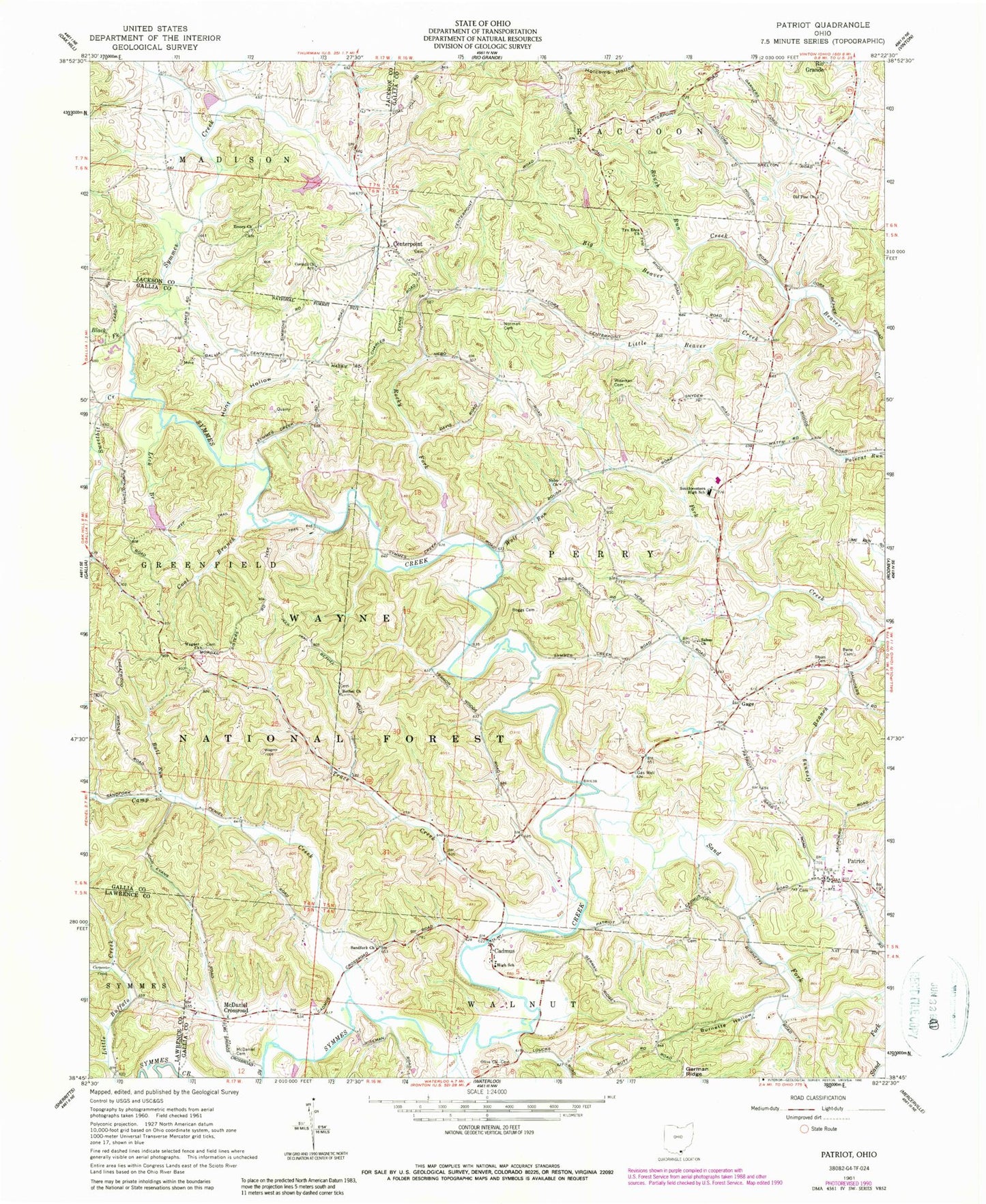
Classic USGS Patriot Ohio 7.5'x7.5' Topo Map
Couldn't load pickup availability
Historical USGS topographic quad map of Patriot in the state of Ohio. Typical map scale is 1:24,000, but may vary for certain years, if available. Print size: 24" x 27"
This quadrangle is in the following counties: Gallia, Jackson, Lawrence.
The map contains contour lines, roads, rivers, towns, and lakes. Printed on high-quality waterproof paper with UV fade-resistant inks, and shipped rolled.
Contains the following named places: Carpenter Hollow, Tynrhos (historical), Cadmus Covered Bridge, Cadmus High School (historical), Centerpoint Cemetery, Old Pine Cemetery, Patriot Cemetery, Salem Cemetery, Tyn Rhos Cemetery, Centerpoint United Baptist Church, Corinth Cemetery, Patriot, Bane Cemetery, Bethel Church, Big Beaver Creek, Black Fork, Boggs Cemetery, Bull Run, Burnette Hollow, Cadmus, Camp Creek, Carpenter Creek, Centerpoint, Coal Branch, Corinth Missionary Baptist Church, Emory Church, Gage, Granny Branch, Hunt Hollow, Lick Branch, Little Beaver Creek, McDaniel Cemetery, McDaniel Crossroad, Nebo Church, Norman Cemetery, Old Pine Church, Olive Church, Rocky Fork, Roush Run, Salem Baptist Church, Sand Fork, Sandfork Church, Siloam Cemetery, Southwestern High School, Sweetbit Creek, Trace Creek, Tyn Rhos Church, Wagner Church, Wiseman Cemetery, Wolf Run, Camp Francis Asbury Pond Dam, Camp Francis Asbury Pond, Wayne National Forest Pond 8623-002 Dam, Wayne National Forest Pond 8623-, Donta Pond Dam, Donta Pond, Kenton Lake, Township of Perry, Bethel Cemetery, Jones Cemetery, Nebo Cemetery, Olive Cemetery, Sandfork Cemetery, Wagner Cemetery, Gage Post Office (historical), Patriot Post Office, Cadmus Post Office (historical)