MyTopo
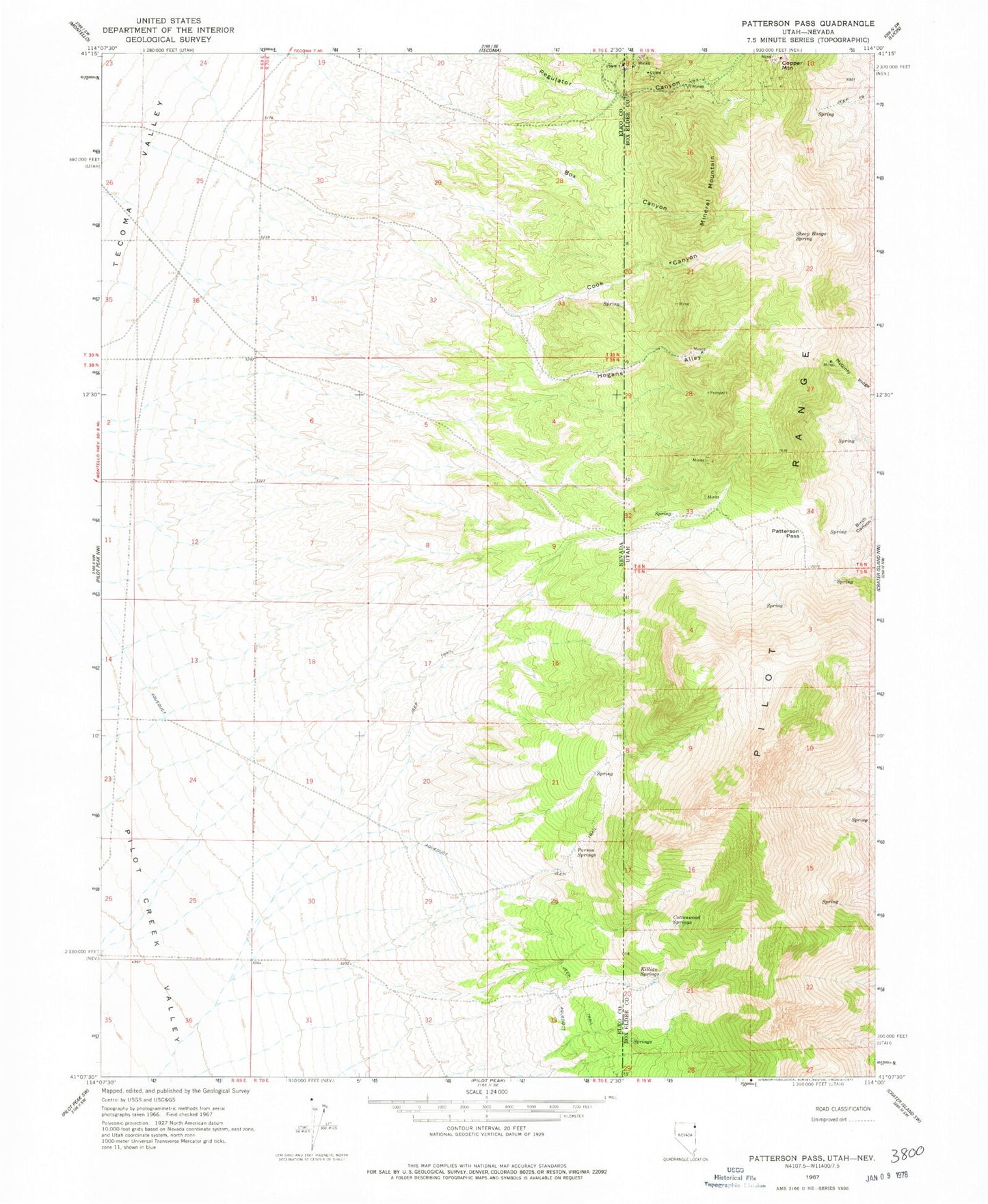
Classic USGS Patterson Pass Utah 7.5'x7.5' Topo Map
Regular price
$16.95
Regular price
Sale price
$16.95
Unit price
per
Couldn't load pickup availability
Historical USGS topographic quad map of Patterson Pass in the states of Utah, Nevada. Map scale may vary for some years, but is generally around 1:24,000. Print size is approximately 24" x 27"
This quadrangle is in the following counties: Box Elder, Elko.
The map contains contour lines, roads, rivers, towns, and lakes. Printed on high-quality waterproof paper with UV fade-resistant inks, and shipped rolled.
Contains the following named places: Box Canyon, Cook Canyon, Copper Mountain, Cottonwood Springs, Hogans Alley, Killian Springs, McGinty Ridge, Mineral Mountain, Parson Springs, Patterson Gulch, Patterson Pass, Sheep Range Spring