MyTopo
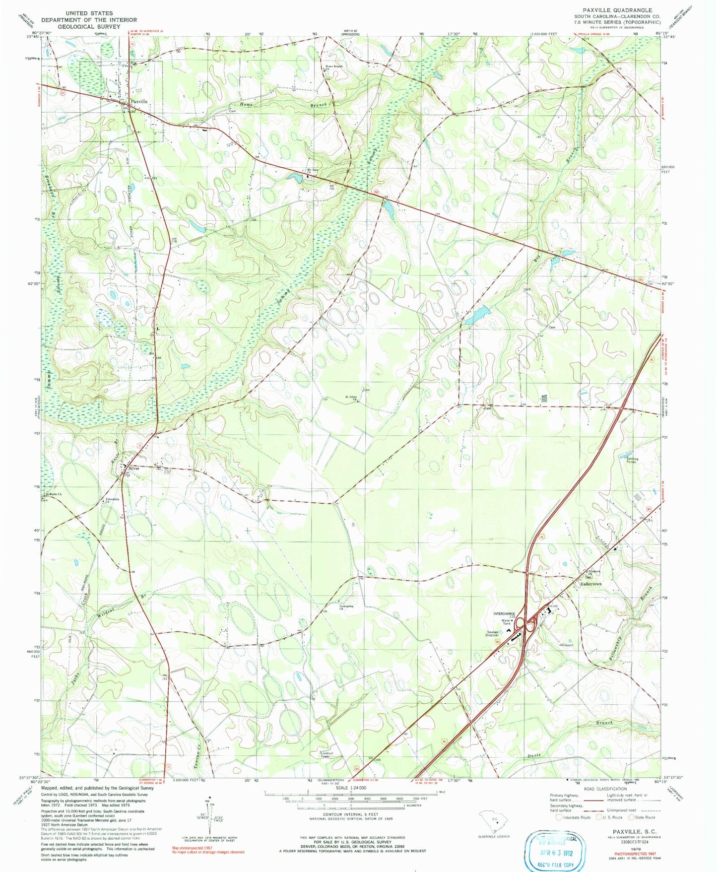
Classic USGS Paxville South Carolina 7.5'x7.5' Topo Map
Couldn't load pickup availability
Historical USGS topographic quad map of Paxville in the state of South Carolina. Map scale may vary for some years, but is generally around 1:24,000. Print size is approximately 24" x 27"
This quadrangle is in the following counties: Clarendon.
The map contains contour lines, roads, rivers, towns, and lakes. Printed on high-quality waterproof paper with UV fade-resistant inks, and shipped rolled.
Contains the following named places: Barrett church, Berry Pond, Berry Pond Dam D-3491, Broadway Branch, Chapel Hill Church, Clarendon County Rural Fire Department Paxville, Delain Chapel, Eden Street School, Edna Ward Pond, Edna Ward Pond Dam D-3492, Elizabeth Church, Friendship Church, Gumspring Church, Halleytown, Halleytown Church, Halleytown School, Home Branch, Home Branch Cemetery, Home Branch Church, Hungary Hall Branch, Knife Branch, Lakewood Lake, Mount Zero Church, New Covenant Presbyterian Church, New Road School, Oak Grove School, Paxville, Paxville Post Office, Paxville School, Rambay Church, Rambay School, Rosehen Bay, Rosehen Branch, Saint John School, Saint Johns Church, Saint Mark Missionary Baptist Church, Saint Marys School, Silver, Silver School, South Carolina Highway Patrol, South Carolina Noname 14012 D-3499 Dam, Summerton Lookout Tower, Town of Paxville, W J Jackson Pond, W J Jackson Pond Dam D-3488, Wildcat Branch, WYMB-AM (Manning), Zoar Hill School