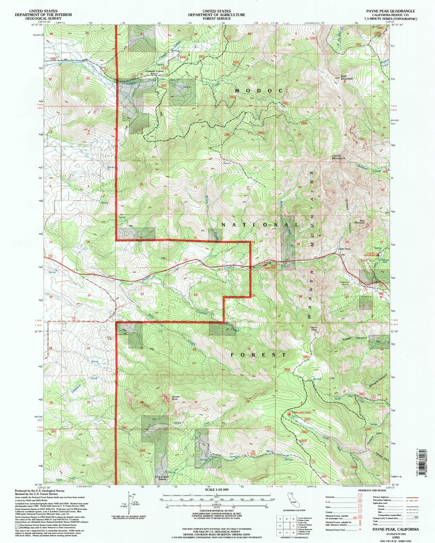
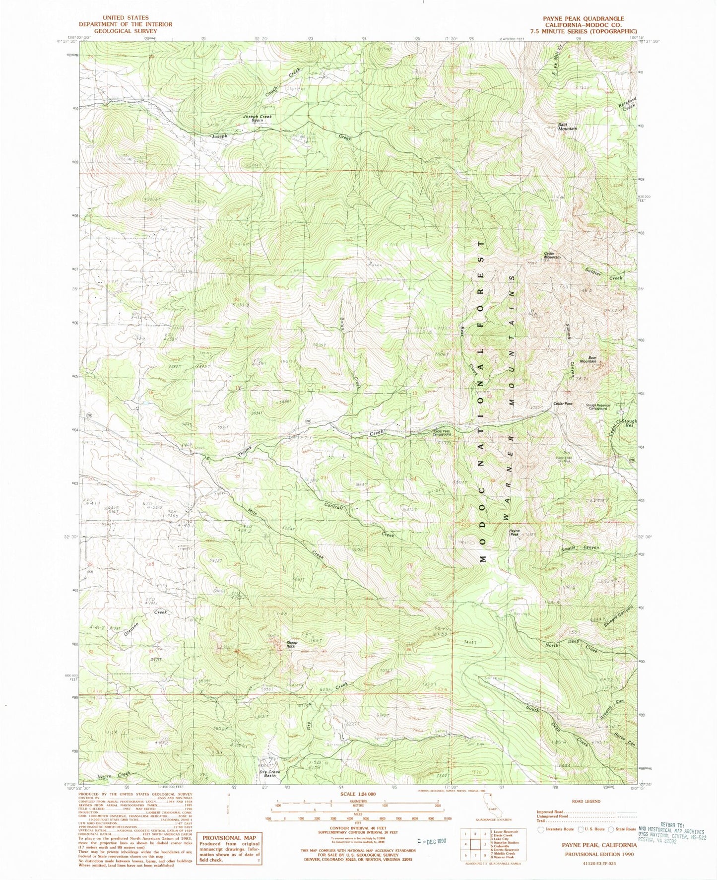
MyTopo
Classic USGS Payne Peak California 7.5'x7.5' Topo Map
Regular price
$16.95
Regular price
Sale price
$16.95
Unit price
per
Couldn't load pickup availability
Historical USGS topographic quad map of Payne Peak in the state of California. Typical map scale is 1:24,000, but may vary for certain years, if available. Print size: 24" x 27"
This quadrangle is in the following counties: Modoc.
The map contains contour lines, roads, rivers, towns, and lakes. Printed on high-quality waterproof paper with UV fade-resistant inks, and shipped rolled.
Contains the following named places: Bald Mountain, Bear Creek, Bear Mountain, Bolan Creek, Cantrall Creek, Cedar Mountain, Cedar Pass, Joseph Creek Basin, Payne Peak, Sheep Rock, Summit Canyon, Mile Creek, Cedar Pass Ski Area, Stough Reservoir, Couch Creek, Stough Campground, Cidar Pass Ski Course, Cedar Pass Campground