MyTopo
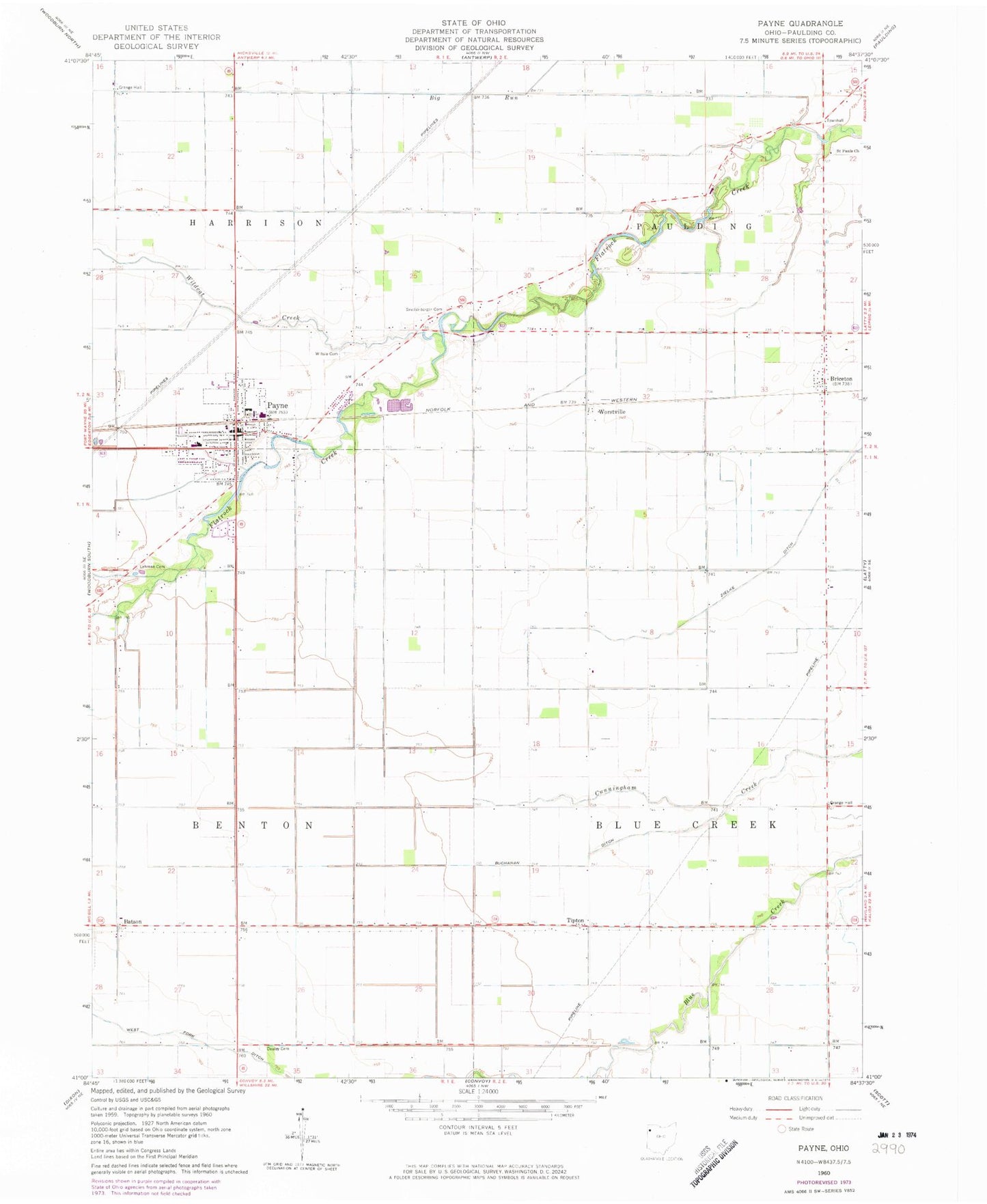
Classic USGS Payne Ohio 7.5'x7.5' Topo Map
Couldn't load pickup availability
Historical USGS topographic quad map of Payne in the state of Ohio. Map scale may vary for some years, but is generally around 1:24,000. Print size is approximately 24" x 27"
This quadrangle is in the following counties: Paulding.
The map contains contour lines, roads, rivers, towns, and lakes. Printed on high-quality waterproof paper with UV fade-resistant inks, and shipped rolled.
Contains the following named places: Batson, Batson Post Office, Blue Creek Township Hall, Briceton, Briceton Post Office, Briceton School, Buchanan Ditch, Center School, Church of God, Coil School, Dealey Cemetery, Dill School, Fisher School, Happy Corner School, Hardesty School, Harrison Township Hall, Horneys Mobile Home Park, Jackson School, Lehman Cemetery, Lehman School, Logtown, Logtown School, Mount Carmel Church, Paulding Township Hall, Payne, Payne Church of Christ, Payne Community Park, Payne Elementary School, Payne Grange Hall, Payne High School, Payne Post Office, Payne Volunteer Fire and Emergency Medical Services Department, Pio School, Rarick School, Rodenbaugh School, Saint Jacobs Evangelical and Reformed Church, Saint James Lutheran Church, Saint John the Baptist Roman Catholic Church, Saint John the Baptist School, Saint Johns Catholic Cemetery, Saint Johns Elementary School, Saint Paul United Methodist Church, Saint Pauls Cemetery, Saint Pauls Church, School Number 1, School Number 2, School Number 4, School Number 6, School Park, Snellenbarger Cemetery, Sophia, Sophia Post Office, South Fork, Swamp College, Tipton, Tipton Post Office, Township of Benton, Township of Blue Creek, Township of Harrison, Township of Paulding, Van Erk Dairy, Village of Payne, Wildcat Creek, Wiltsie Cemetery, Wiltsie School, Worm School, Worstville, WorstvillePost Office, ZIP Code: 45880