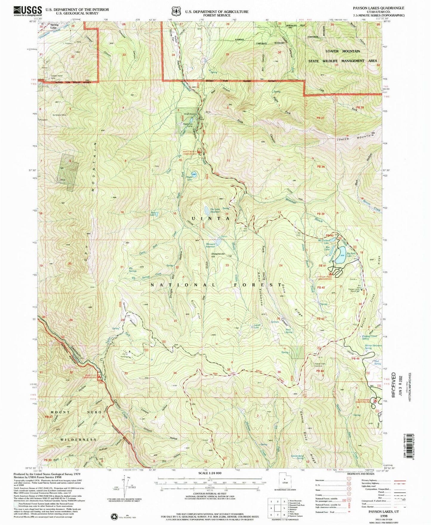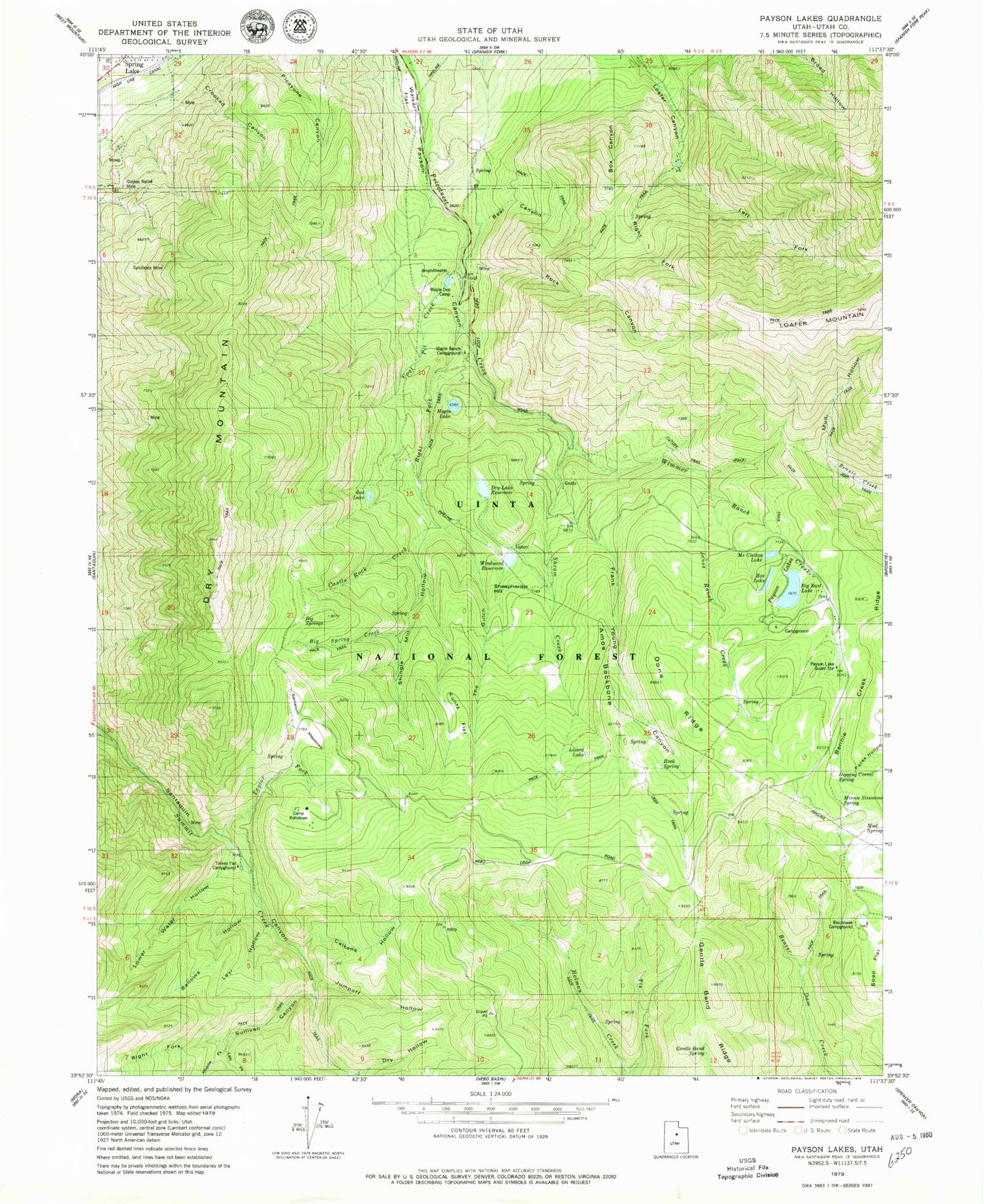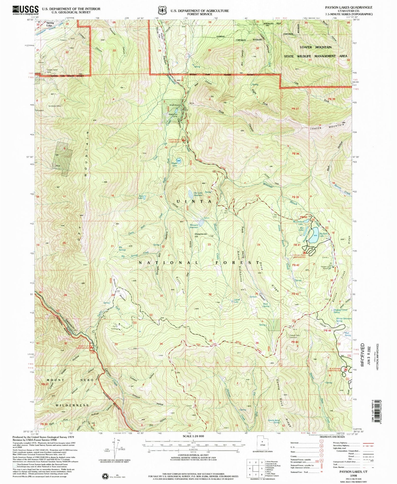
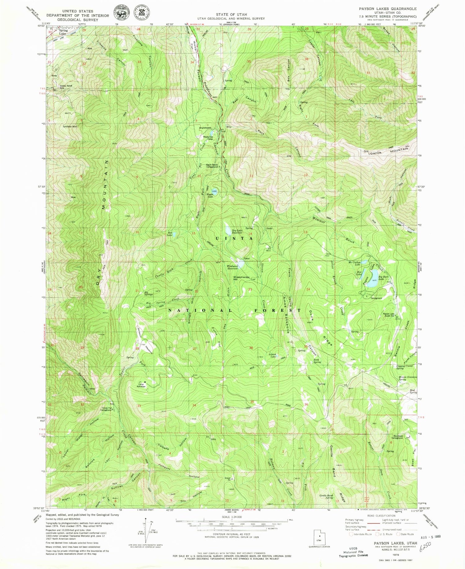
MyTopo
Classic USGS Payson Lakes Utah 7.5'x7.5' Topo Map
Couldn't load pickup availability
Historical USGS topographic quad map of Payson Lakes in the state of Utah. Typical map scale is 1:24,000, but may vary for certain years, if available. Print size: 24" x 27"
This quadrangle is in the following counties: Utah.
The map contains contour lines, roads, rivers, towns, and lakes. Printed on high-quality waterproof paper with UV fade-resistant inks, and shipped rolled.
Contains the following named places: Amos Backbone, Bear Canyon, Bellows Hollow, Bennie Creek Ridge, Big Spring Creek, Big Springs, Blackhawk Campground, Box Canyon, Box Lake, Calkens Hollow, Camp Koholowo, Castle Rock Creek, Coal Pit Creek, Crooked Canyon, Dipping Corral Spring, Done Ridge, Dry Hollow, Dry Lake Reservoir, Dry Mountain, Frank Young Canyon, Gentle Band Ridge, Gentle Band Spring, Golden Relief Mine, Jones Ranch Creek, Jumpoff Hollow, Kuntz Flat, Left Fork Loafer Canyon, Left Fork Sullivan Canyon, Levi Hollow, Lizard Lake, Lower Water Hollow, Maple Bench Campground, Maple Dell Camp, Middle Fork Sullivan Canyon, Minnie Simmons Spring, Mud Hollow, Mud Spring, Payson Lake Guard Station, Payson Lakes, Red Lake, Right Fork Loafer Canyon, Right Fork Peteeneet Creek, Right Fork Sullivan Canyon, Rock Canyon, Rock Spring, Santaquin Meadows, Sheepherder Hill, Shingle Mill Hollow, Shram Creek, Soap Flat, Sullivan Canyon, Syndicate Mine, Taylor Fork, The Gulch, Tie Fork, Tinney Flat Campground, Walker Flat, Wimmer Ranch Creek, Big East Reservoir, Big East Dam, Pete Winward Reservoir, Pete Winward Dam, McClellan Lake, McClellan Lake Dam, Dry Lake Dam, Maple Lake, Maple Lake Dam, Beaver Dam Overlook, Payson Lakes Campground, Tinney Flat