MyTopo
Classic USGS Pe Ell Washington 7.5'x7.5' Topo Map
Couldn't load pickup availability
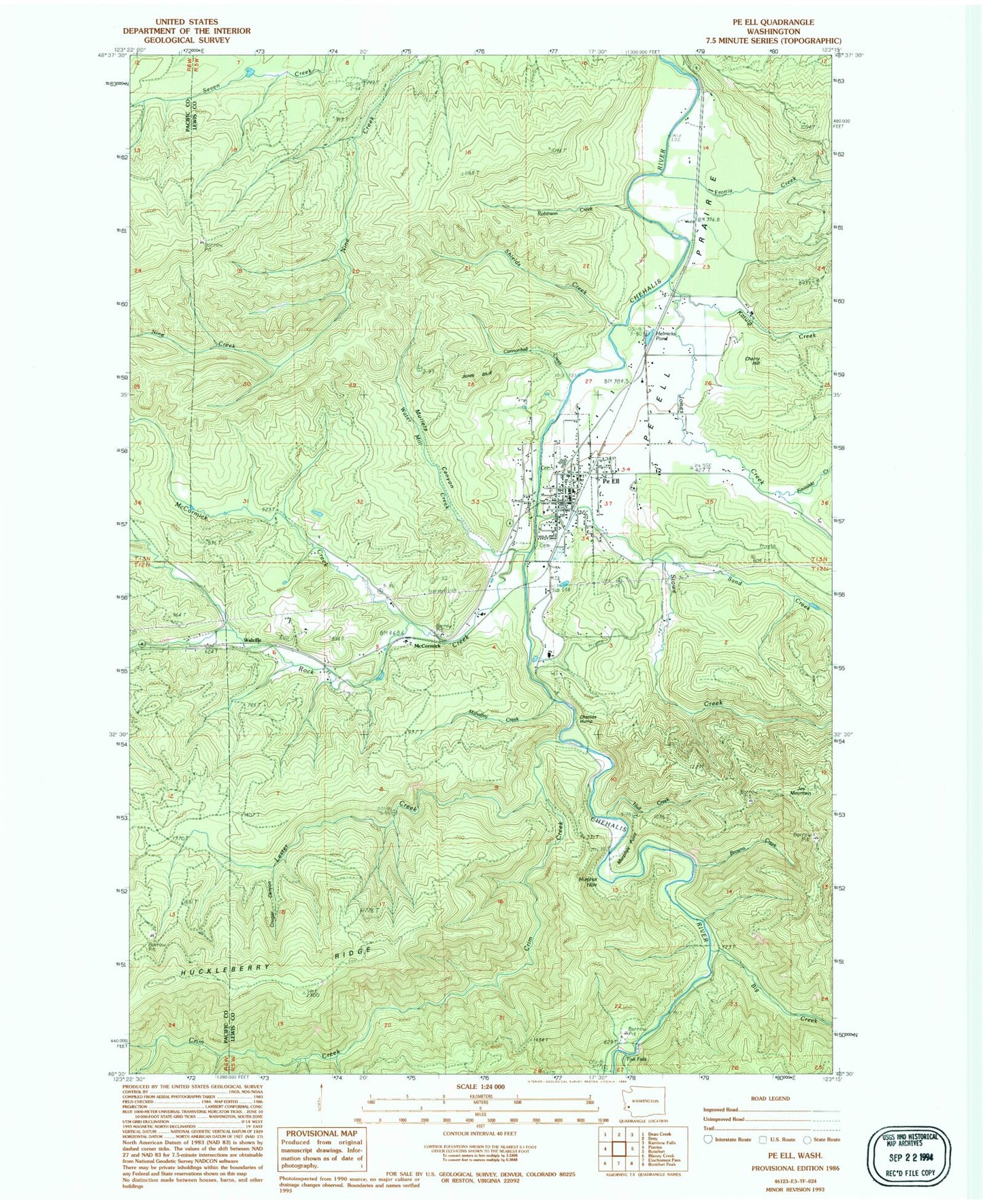
Historical USGS topographic quad map of Pe Ell in the state of Washington. Map scale may vary for some years, but is generally around 1:24,000. Print size is approximately 24" x 27"
This quadrangle is in the following counties: Lewis, Pacific.
The map contains contour lines, roads, rivers, towns, and lakes. Printed on high-quality waterproof paper with UV fade-resistant inks, and shipped rolled.
Contains the following named places: Big Creek, Browns Creek, Cannonball Creek, Charlies Hump, Cherry Hill, Cougar Canyon, Crim Creek, Fisk Falls, Forest Lawn Cemetery, Fronia Creek, Helmicks Pond, Huckleberry Ridge, Hull Creek, Jones Bluff, Jones Creek, Joy Mountain, Katula Creek, Kowalski Creek, Lester Creek, Lester Creek Reservoir, Lester Creek Reservoir Dam, Lewis County Fire District 11 Station 1, Lewis County Fire District 11 Station 2, Mahaffey Creek, McCormick, McCormick Creek, Mullers Canyon, Murphys Hole, Murphys Point, Pe Ell, Pe Ell Ambulance, Pe Ell Post Office, Pe Ell Prairie, Pe Ell School, Reynolds, Robinson Creek, Rock Creek, Roger Creek, Sand Creek, Shields Creek, Stowe Creek, Town of Pe Ell, Walville, Water Mill Creek, ZIP Code: 98572