MyTopo
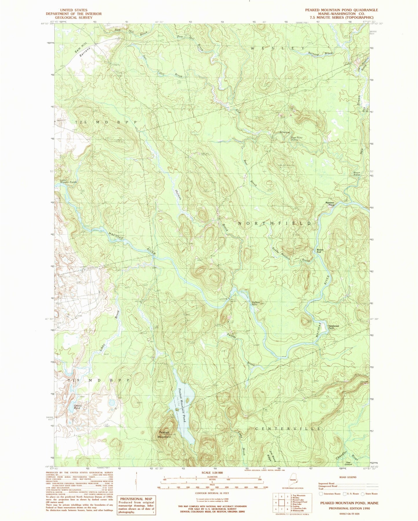
Classic USGS Peaked Mountain Pond Maine 7.5'x7.5' Topo Map
Couldn't load pickup availability
Historical USGS topographic quad map of Peaked Mountain Pond in the state of Maine. Map scale may vary for some years, but is generally around 1:24,000. Print size is approximately 24" x 27"
This quadrangle is in the following counties: Washington.
The map contains contour lines, roads, rivers, towns, and lakes. Printed on high-quality waterproof paper with UV fade-resistant inks, and shipped rolled.
Contains the following named places: Barnard Brook, Bear Brook, Bog Stream, Brown Riffles, Dan Hill Brook, Dyer Point Riffles, Grassy Pond, Hardwood Point, Holmes Brook, Holmes Falls, Joe Meadow Brook, Libby Brook, Lower Wigwam Rapids, Mattimo Place, New Stream, Old Stream, Palmer Brook, Peaked Mountain, Peaked Mountain Pond, Pineo Brook, Rivers End, Sam Hill Brook, Soddy Meadow Brook, The Oxbow