MyTopo
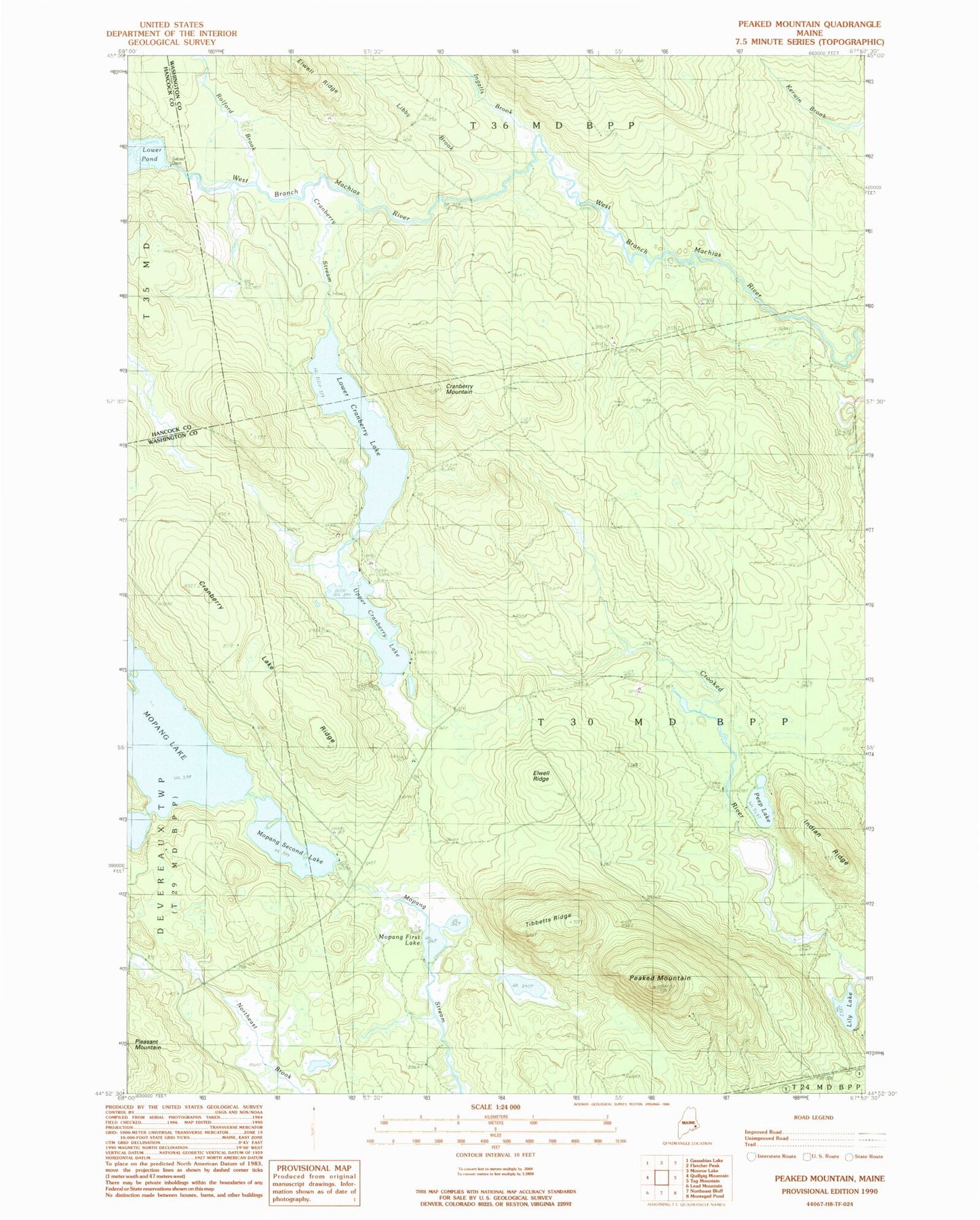
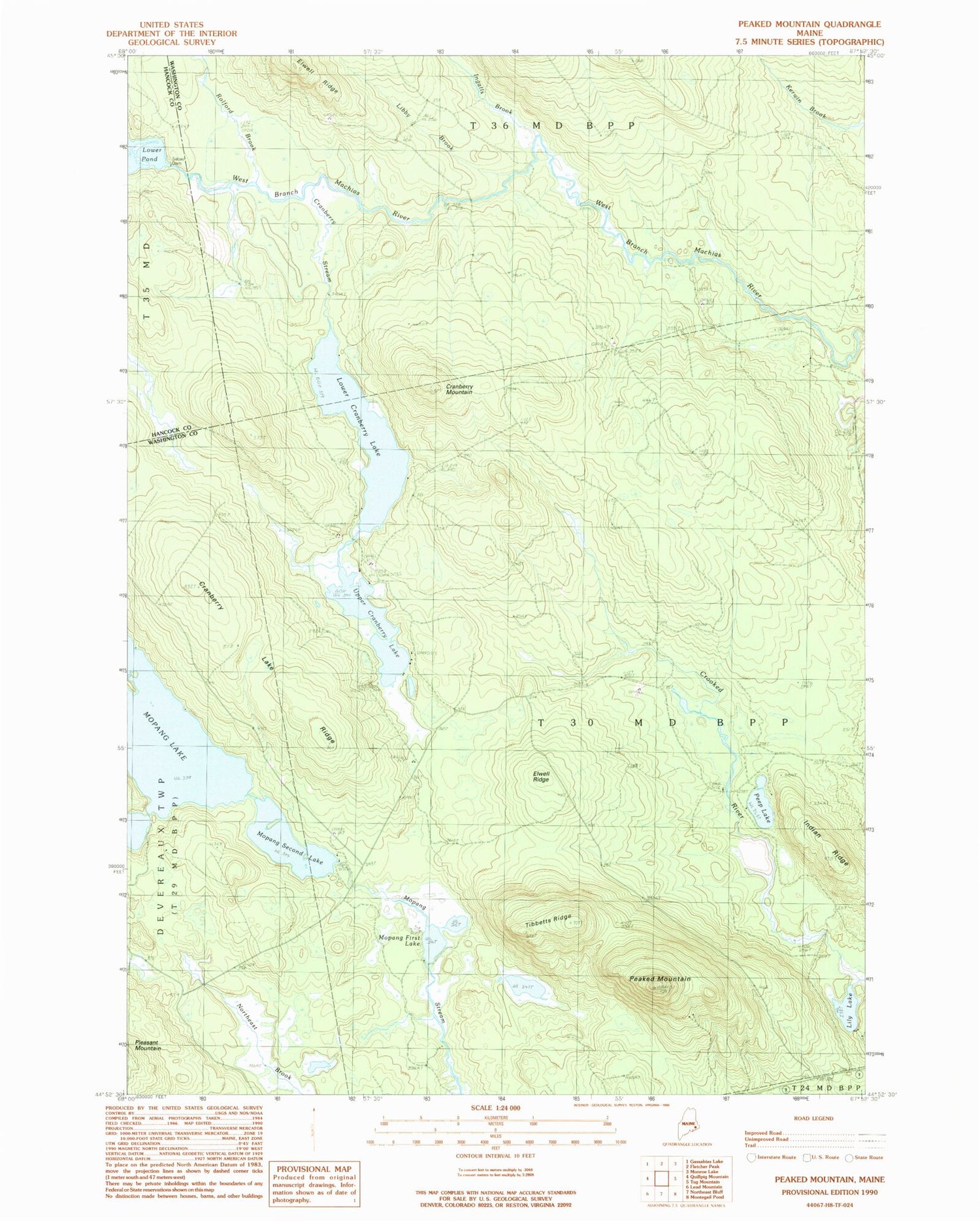
Classic USGS Peaked Mountain Maine 7.5'x7.5' Topo Map
Couldn't load pickup availability
Historical USGS topographic quad map of Peaked Mountain in the state of Maine. Map scale may vary for some years, but is generally around 1:24,000. Print size is approximately 24" x 27"
This quadrangle is in the following counties: Hancock, Washington.
The map contains contour lines, roads, rivers, towns, and lakes. Printed on high-quality waterproof paper with UV fade-resistant inks, and shipped rolled.
Contains the following named places: Cranberry Lake Ridge, Cranberry Mountain, Cranberry Stream, Elwell Dam, Elwell Ridge, Indian Ridge, Ingalls Brook, Libby Brook, Lily Lake, Lower Cranberry Lake, Lower Pond, Lower Sabao Lake Dam, Mopang First Lake, Mopang Second Lake, Mopang Second Lake Dam, Peaked Mountain, Peep Lake, Rolford Brook, Rolford Dam, T30 MD BPP, Tibbets Ridge, Upper Cranberry Lake