MyTopo
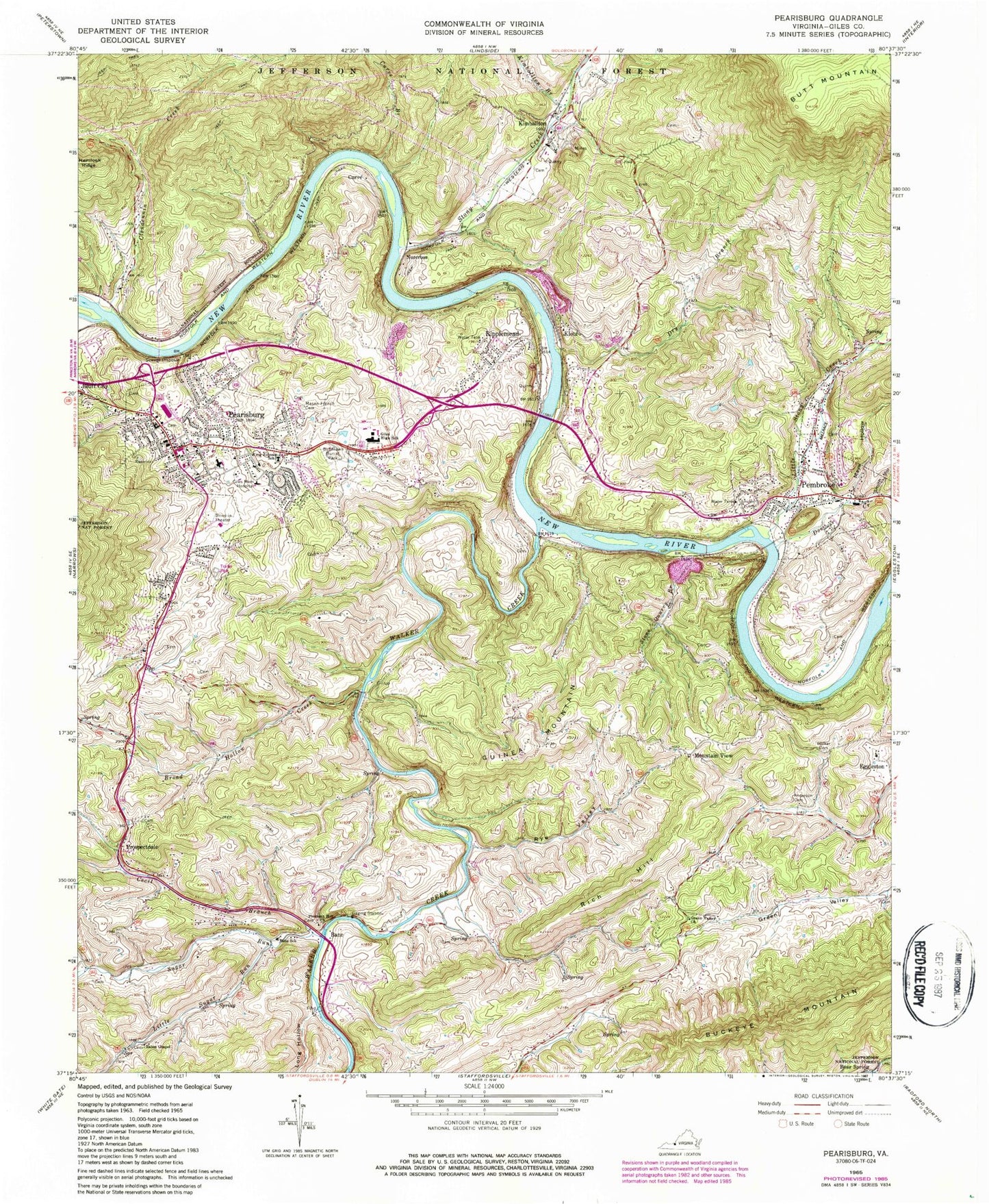
Classic USGS Pearisburg Virginia 7.5'x7.5' Topo Map
Couldn't load pickup availability
Historical USGS topographic quad map of Pearisburg in the state of Virginia. Typical map scale is 1:24,000, but may vary for certain years, if available. Print size: 24" x 27"
This quadrangle is in the following counties: Giles.
The map contains contour lines, roads, rivers, towns, and lakes. Printed on high-quality waterproof paper with UV fade-resistant inks, and shipped rolled.
Contains the following named places: Anderson Cemetery, Bane Elementary School, Birchlawn Burial Park, Broad Hollow Creek, Buckeye Mountain, Cecil Branch, Clendennin Creek, Curve, Curve Branch, Doe Creek, Dry Branch, Eaton Chapel, Giles High School, Carilion Giles Memorial Hospital (historical), Green Valley Church, Kimballton Branch, King Johnson School, Little Stony Creek, Little Sugar Run, Long Hollow, Mason French Cemetery, Mays Hollow, Pleasant Hill Church, Rich Hill, Rye Valley, Smith Hollow, Snidow Cemetery, Stony Creek, Sugar Run, Burton Walker Family Cemetery, Walker Creek, Stone Quarry Branch, Broad Hollow School (historical), Church of God of Prophecy, Pembroke Elementary School (historical), Eatons Chapel Cemetery, Giles County, Giles County Courthouse, Green Valley Lutheran Church (historical), Macy McClaugherty Elementary - Middle School, McClardy School (historical), Mountain View Methodist Church, Painter School (historical), Pearisburg Baptist Church, Pearisburg Post Office, Pearisburg Presbyterian Church, Pembroke Baptist Church, Pembroke First Baptist Church, Pleasant Hill Cemetery, Bane, Guinea Mountain, Kimballton, Klotz, Mountain View, Norcross, Pembroke, Prospectdale, Ripplemead, Pearisburg, Giles Memorial Hospital Heliport, Big Spring Branch, Snidows Ferry (historical), Wenonah (historical), Big Stoney United Methodist Church, Curve Road United Methodist Church, Eggleston Elementary School (historical), Holy Family Roman Catholic Church, Maxway Shopping Center, Pembroke Lutheran Memorial Church, Redeemer Evangelical Lutheran Church, Riverview Baptist Church, Snidow Cemetery, Snidow Cemetery, Giles Lifesaving and Rescue Squad, Pearisburg Volunteer Fire Department, Pembroke Volunteer Fire Department, Town of Pearisburg, Town of Pembroke, Giles County Technology Center, Jefferson Christian Academy, Carilion Giles Community Hospital, Giles County Ambulance Service, Eggleston Volunteer Fire Department, Ripplemead Post Office, Pembroke Post Office, Pembroke Police Department, Giles County Sheriff, Pearisburg Police Department, Ripplemead Census Designated Place