MyTopo
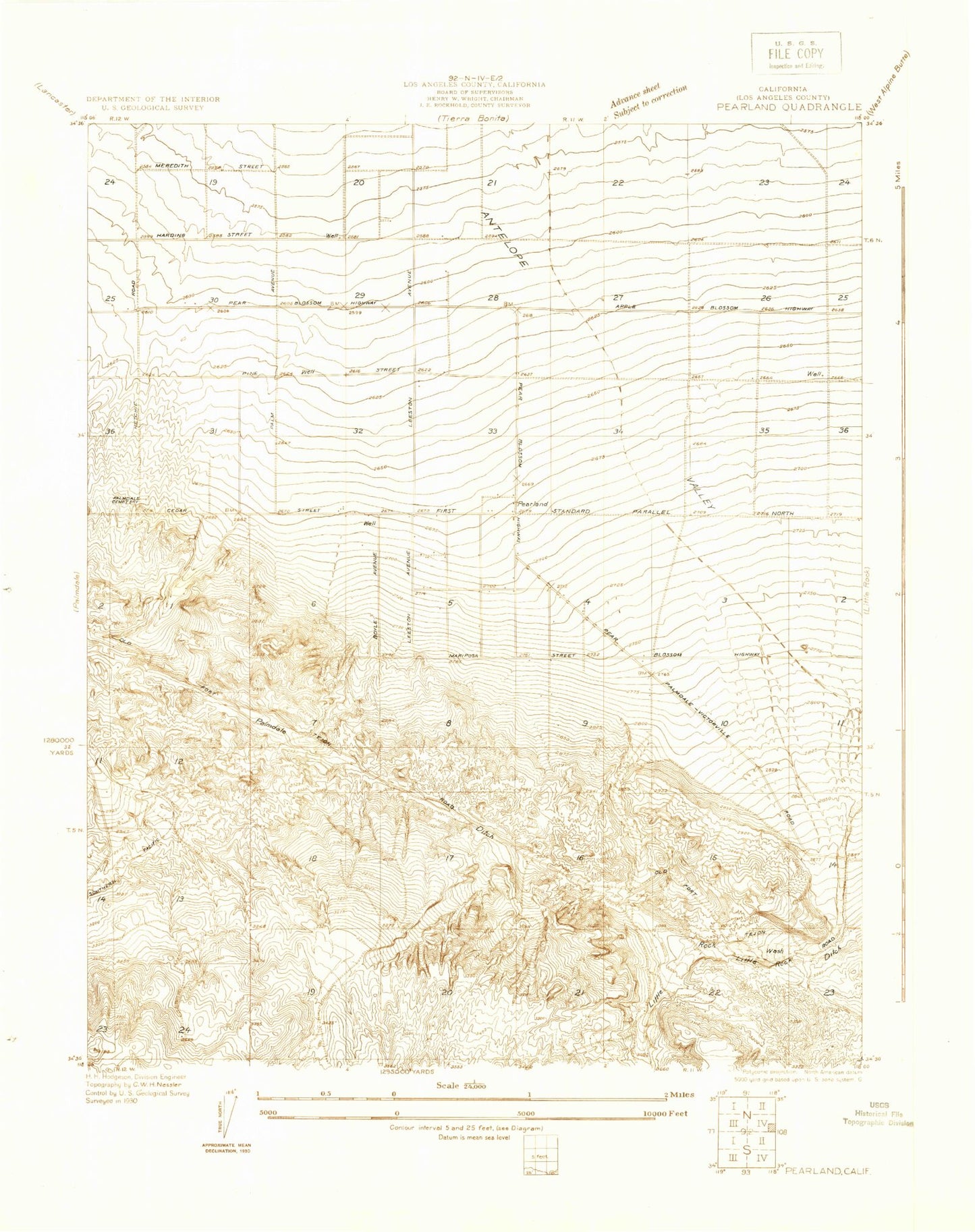
Classic USGS Pearland California 7.5'x7.5' Topo Map
Couldn't load pickup availability
Historical USGS topographic quad map of Pearland in the state of California. Map scale may vary for some years, but is generally around 1:24,000. Print size is approximately 24" x 27"
This quadrangle is in the following counties: Los Angeles.
The map contains contour lines, roads, rivers, towns, and lakes. Printed on high-quality waterproof paper with UV fade-resistant inks, and shipped rolled.
Contains the following named places: Avenue S Park, Barrel Springs, Cactus Elementary School, Carr Canyon, Chaparral Elementary School, Cheseboro Siphon, Christ The King Episcopal Church, Christ's Church of the Valley, Church of Christ, Church of Jesus Christ of Latter Day Saints, Desert Lawn Memorial Park, Desert Rose Elementary School, Four Points, Horizon Community Church, Hunt Canyon, Joshua Hills Elementary School, Little Rock Siphon, Living Faith Foursquare Church, Los Angeles County Fire Department Station 131, Manzanita Elementary School, McAdam Park, Palmdale Cemetery, Palmdale Ditch, Palmdale High School, Palmdale Park, Palmdale Post Office, Palmdale Seventh Day Adventist Church, Palmdale Water Reclamation Plant, Palms Park, Pearland, Pentecostal Holiness Church, Sage Intermediate School, Saint Mary's Catholic School, Saint Stephen's Lutheran Church, Sierra Paloma High School, Tamarisk Elementary School, ZIP Code: 93552