MyTopo
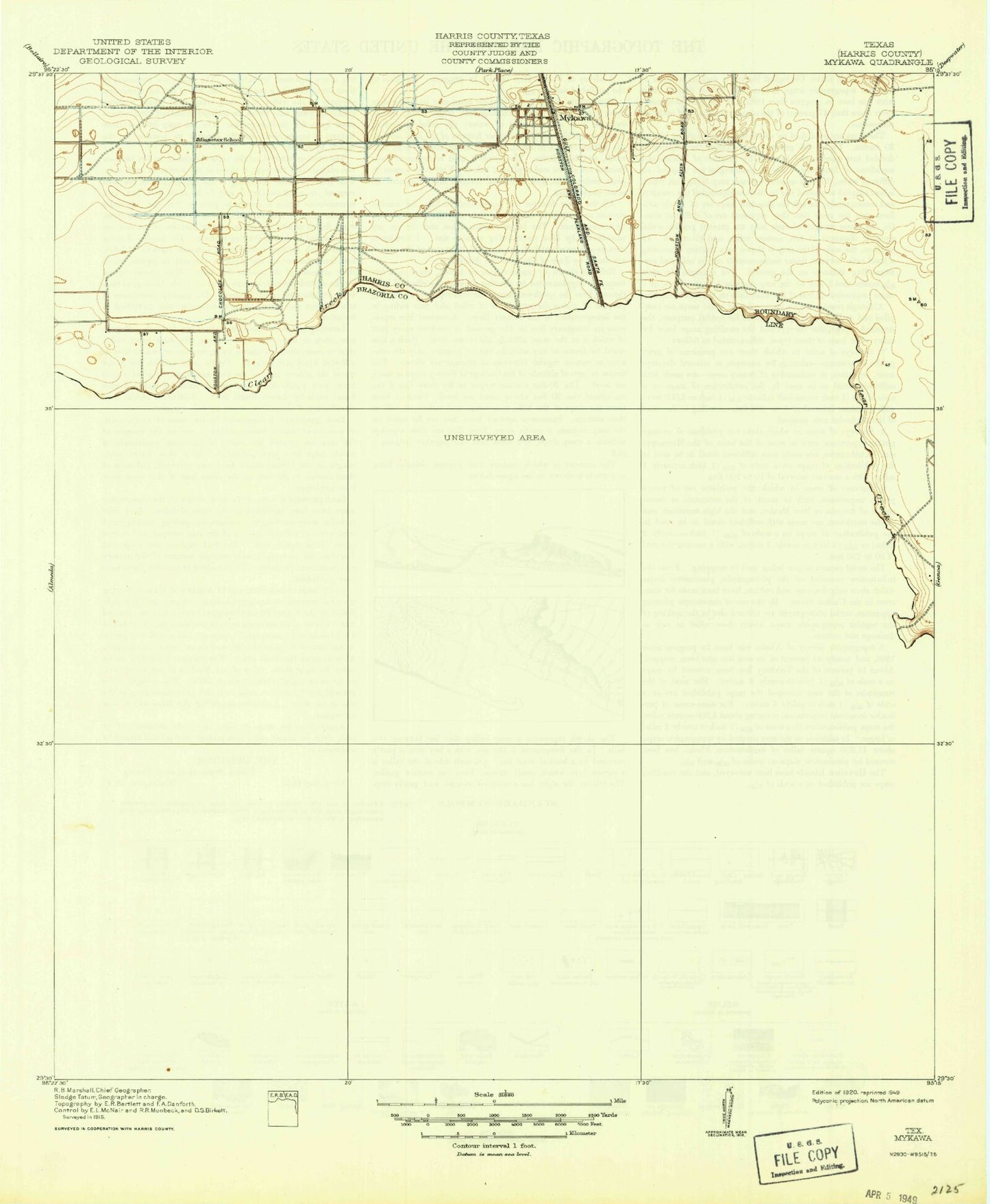
Classic USGS Pearland Texas 7.5'x7.5' Topo Map
Couldn't load pickup availability
Historical USGS topographic quad map of Pearland in the state of Texas. Map scale may vary for some years, but is generally around 1:24,000. Print size is approximately 24" x 27"
This quadrangle is in the following counties: Brazoria, Harris.
The map contains contour lines, roads, rivers, towns, and lakes. Printed on high-quality waterproof paper with UV fade-resistant inks, and shipped rolled.
Contains the following named places: A&A Flying Service Airport, Airway Baptist Church South, Alexander Landing, Allison Memorial Clubhouse, Almeda Genoa, Banbury Cross, Bradair Heliport, Brazoria County Constable's Office Precinct 3, Brookside Police Department, Brookside Village, Brookside Village Volunteer Fire Department, Bunch School, C J Harris Elementary School, Calvary Hill Baptist Church, Carden Jackson School, Center Fire Station, Challenger Elementary School, Christia Adair County Park, City of Brookside Village, City of Pearland, Cobblestone, Country Place, Covenant United Methodist Church, Cullen Baptist Church, Dads Club Community Park, Dagg Cemetery, Day Star Residential School, Dobie High School, E A Lawhon Elementary School, Eagle Heights Christian Academy, Epiphany Lutheran Church, Fairway Village, Faith Community Church, First Baptist Church of Brookside, First United Methodist Church, Freeway Baptist Church, Garden Acres, Garden Road Baptist Church, Gulfcoast Heliport, H C Carleston Elementary School, Harris Elementary School, Hastings, Hastings Siding, Heritage Green, Heritage Plaza Shopping Center, Hickory Creek Place, Hickory Slough, Holloway Heights, Houston Airpark, Houston Police Department - Telephone Road, Independence Park, Jacksonville Public Library, Joe Rye Heliport, Jones Park, Lakepointe, Lakes of Country Place, Langston Place, Leon H Sablatura Middle School, Linwood, M D K Field Heliport, Magnolia Place, Manvel Oil Field, McLean Road Park, Meadowview, Metro Heli-Pad, Minnetex, Mitchell Elementary School, Mount Pilgrim Baptist Church, Mykawa, Mykawa Oil Field, Nelson Levee, Nelson Reservoir, New Jerusalem Baptist Church, New Life Baptist Fellowship Church, North Fork Marys Creek, Oakbrook Estates, Old Pearland Cemetery, Parkview, Pearland, Pearland Chamber of Commerce, Pearland City Hall, Pearland East Junior High School, Pearland Emergency Medical Services, Pearland Heliport, Pearland High School, Pearland Junior High School, Pearland Junior High School West, Pearland Library, Pearland Police Department, Pearland Post Office, Pearland Public Safety Building, Pearland Shopping Center, Pearland South Industrial Park, Pearland Stadium, Pearland Volunteer Fire Department Station 1, Pearland Volunteer Fire Department Station 2, Pearland Volunteer Fire Department Station 4, Presner Stadium, Pro - Stat Ambulance Service, Ravenwood Estates, Regency Park, Ryan Acres, Saint Andrews Episcopal Church, Saint Helens Catholic Church, Saint Stephen Lutheran Church, Sam Jamison Middle School, Second Baptist Church of Pearland, Sedgewood, Shadycrest, Shadycrest Elementary School, Shamrock Manor, Sherwood, Silver Lake Post Office, Silverlake Elementary School, Skyscraper Shadows, Skyway Manor Airport, South Fork Marys Creek, Southdown, Southwyck, The Believers Covenant Church, Turner, Val Verde East, West Lea, West Oaks, West Oaks Village, Westchester Estates, Westminster, Westwood Village, ZIP Codes: 77048, 77075, 77581, 77584