MyTopo
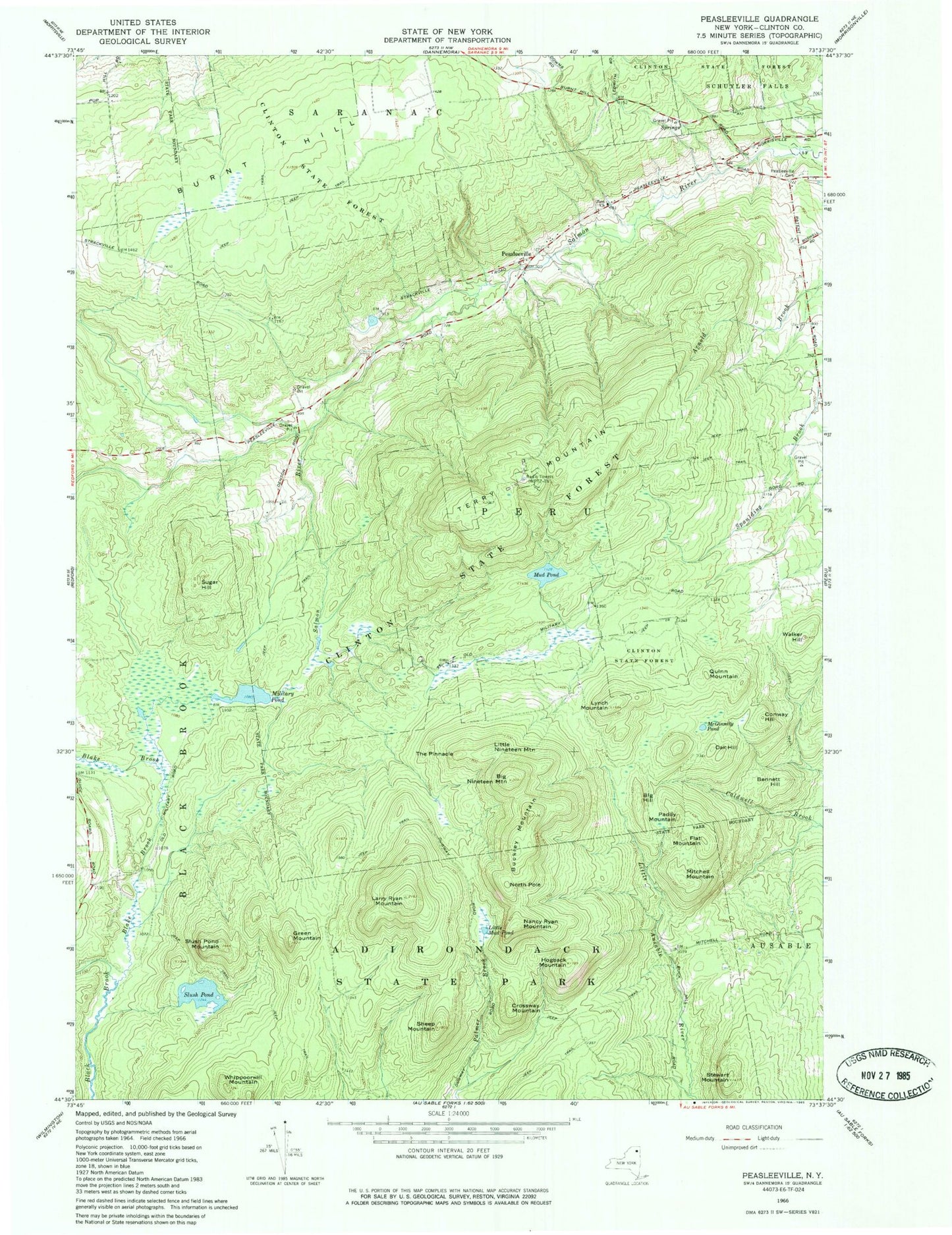
Classic USGS Peasleeville New York 7.5'x7.5' Topo Map
Couldn't load pickup availability
Historical USGS topographic quad map of Peasleeville in the state of New York. Map scale may vary for some years, but is generally around 1:24,000. Print size is approximately 24" x 27"
This quadrangle is in the following counties: Clinton.
The map contains contour lines, roads, rivers, towns, and lakes. Printed on high-quality waterproof paper with UV fade-resistant inks, and shipped rolled.
Contains the following named places: Bennett Hill, Big Hill, Big Nineteen Mountain, Blake Brook, Buckley Mountain, Burnt Hill, Conway Hill, Crossway Mountain, Flat Mountain, Green Mountain, Hogback Mountain, Larry Ryan Mountain, Little Mud Pond, Little Nineteen Mountain, Lynch Mountain, McGinnity Pond, Military Pond, Mitchell Mountain, Mud Pond, Nancy Ryan Mountain, North Pole, Oak Hill, Paddy Mountain, Peasleeville, Peasleeville Cemetery, Quinn Mountain, Sheep Mountain, Slush Pond, Slush Pond Mountain, Stewart Mountain, Sugar Hill, Terry Mountain, The Pinnacle, Walker Hill, Whippoorwill Mountain, WPTZ-TV (North Pole), Zion Church, ZIP Code: 12985