MyTopo
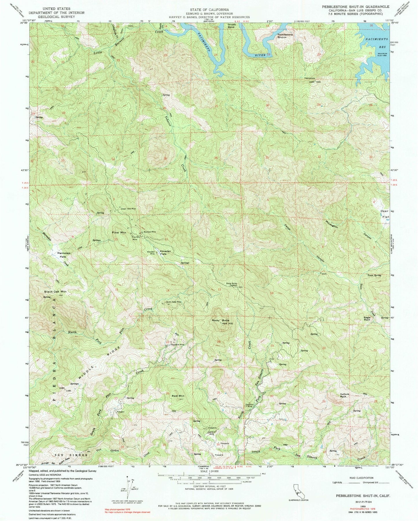
Classic USGS Pebblestone Shut-in California 7.5'x7.5' Topo Map
Couldn't load pickup availability
Historical USGS topographic quad map of Pebblestone Shut-in in the state of California. Typical map scale is 1:24,000, but may vary for certain years, if available. Print size: 24" x 27"
This quadrangle is in the following counties: San Luis Obispo.
The map contains contour lines, roads, rivers, towns, and lakes. Printed on high-quality waterproof paper with UV fade-resistant inks, and shipped rolled.
Contains the following named places: Almaden Flats, Almaden Mine, Black Oak Mountain, Buckeye Mine, Caballada Creek, Eucalyptus Lateral Ten, Carrol Canyon, Deer Flat, Grizzly Bend, Hamilton Mine, Kavanaugh Creek, Keystone Mine, Marmo-lejo Flats, McLaughlin Canyon, Middle Ridge, North Fork San Simeon Creek, North Grizzly Bend Creek, Ocean View Mine, Pine Mountain, Pine Mountain Mine, Quien Sabe Mine, Red Mountain, Rocky Butte, Rocky Butte Lookout, Tobacco Creek, Town Spring, Vulture Rock, Gould Creek, Little Burnett Creek, Eagle Rock, Pebblestone Shut-in, Goat Camp (historical)