MyTopo
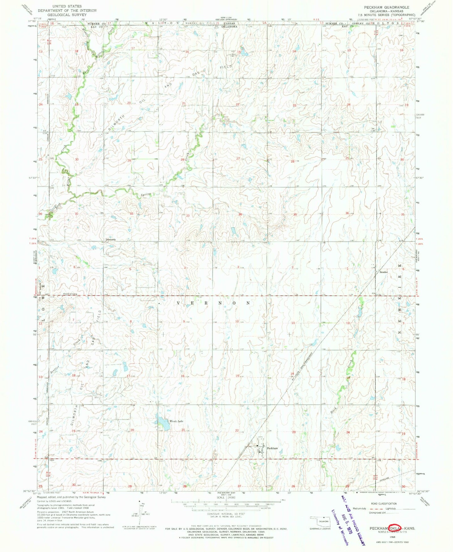
Classic USGS Peckham Oklahoma 7.5'x7.5' Topo Map
Couldn't load pickup availability
Historical USGS topographic quad map of Peckham in the state of Oklahoma. Map scale may vary for some years, but is generally around 1:24,000. Print size is approximately 24" x 27"
This quadrangle is in the following counties: Cowley, Kay, Sumner.
The map contains contour lines, roads, rivers, towns, and lakes. Printed on high-quality waterproof paper with UV fade-resistant inks, and shipped rolled.
Contains the following named places: Bender, Church of God, Dilworth, Dilworth Oil and Gas Field, Lost Duck Creeks Site D-6 Dam, Lost Duck Creeks Site D-6 Reservoir, Middle Bitter Creek, Murphy Oil Field, Peckham, Peckham Census Designated Place, Peckham Elementary School, Peckham Volunteer Fire Department, Plainview Cemetery, Spring Creek, Township of Vernon, Wentz Lake, Wentz Lake Dam