MyTopo
USGS Classic Pecos Falls New Mexico 7.5'x7.5' Topo Map
Couldn't load pickup availability
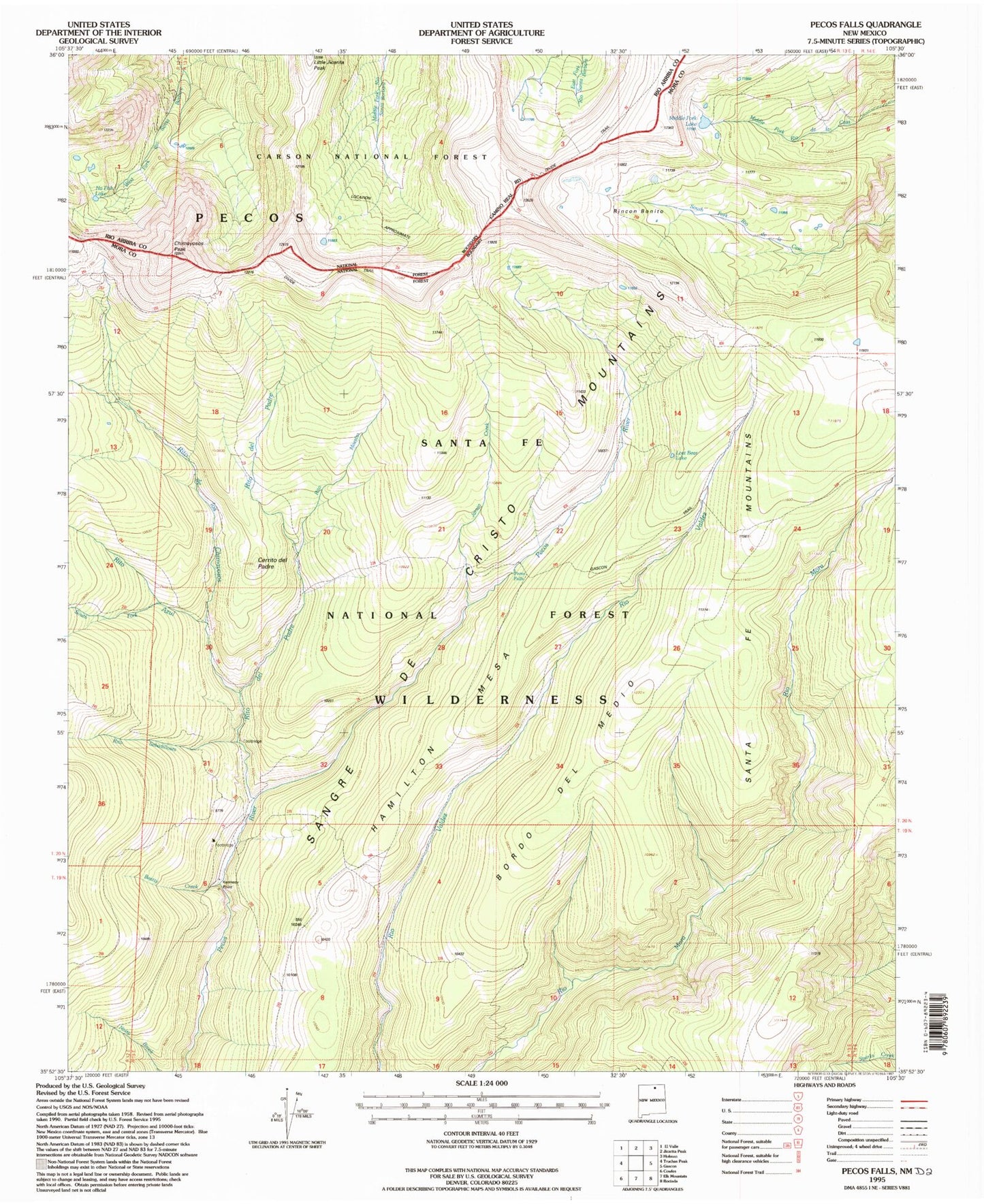
Historical USGS topographic quad map of Pecos Falls in the state of New Mexico. Scale: 1:24000. Print size: 24" x 27"
This quadrangle is in the following counties: Mora, Rio Arriba.
The map contains contour lines, roads, rivers, towns, lakes, and grids including latitude / longitude and UTM / MGRS. Printed on high-quality waterproof paper with UV fade-resistant inks.
Contains the following named places: Beatty Creek, Bordo Del Medio, Cerrito del Padre, Hamilton Mesa, Jarosa Canyon, Little Jicarita Peak, Lost Bear Lake, Middle Fork Lake, Pecos Falls, Rincon Bonito, Rito de los Chimayosos, Rito Azul, Smith Cabin, South Fork Rito Azul, Beatty Cabin, Rito del Padre, Rito Maestas, Rito Sebadilloses, Santa Fe Mountains, Chimayosos Peak, Kennedy Point