MyTopo
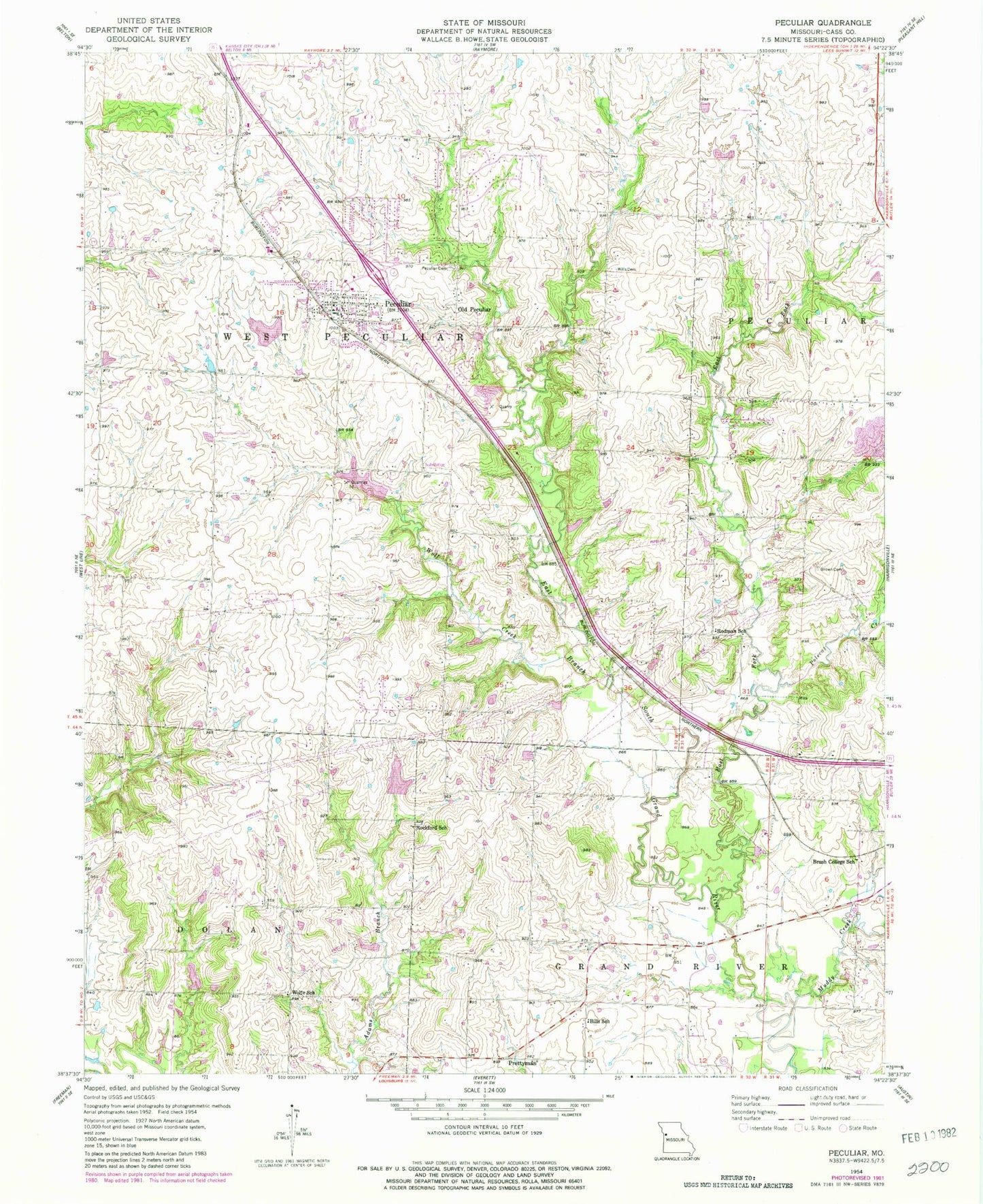
Classic USGS Peculiar Missouri 7.5'x7.5' Topo Map
Couldn't load pickup availability
Historical USGS topographic quad map of Peculiar in the state of Missouri. Map scale may vary for some years, but is generally around 1:24,000. Print size is approximately 24" x 27"
This quadrangle is in the following counties: Cass.
The map contains contour lines, roads, rivers, towns, and lakes. Printed on high-quality waterproof paper with UV fade-resistant inks, and shipped rolled.
Contains the following named places: Baiers Den Lake, Baiers Den Lake Dam, Barton, Bills School, Brown Family Cemetery, Brush College School, Cass Regional Medical Center, City of Peculiar, East Fork East Branch South Grand River, Harper Lake, Harper Lake Dam, Muddy Creek, Old Peculiar, Peculiar, Peculiar Cemetery, Peculiar City Reservoir, Peculiar City Reservoir Dam, Peculiar Elementary School, Peculiar Police Department, Peculiar Post Office, Pleasant Ridge School, Polecat Creek, Prettyman, Raymore - Peculiar Freshman Center, Raymore - Peculiar High School, Raymore - Peculiar Middle School, Ridgeview Ranch Airport, Rockford School, Rodman School, Shull Elementary School, South Harper Peaking Facility, Township of West Peculiar, West Aero Ranch Airport, West Peculiar Fire Protection District Station 1, Wills Cemetery, Wolf Creek, Wolfe School, ZIP Code: 64078