MyTopo
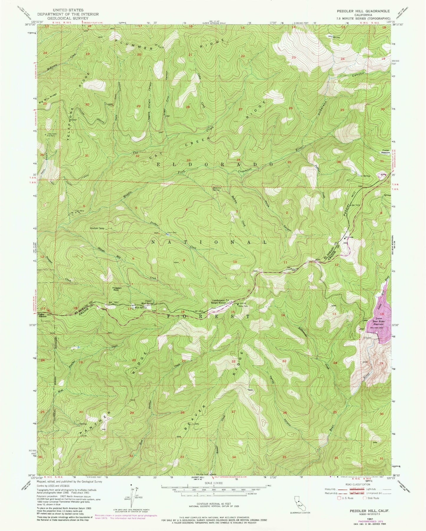
Classic USGS Peddler Hill California 7.5'x7.5' Topo Map
Couldn't load pickup availability
Historical USGS topographic quad map of Peddler Hill in the state of California. Typical map scale is 1:24,000, but may vary for certain years, if available. Print size: 24" x 27"
This quadrangle is in the following counties: Amador, El Dorado.
The map contains contour lines, roads, rivers, towns, and lakes. Printed on high-quality waterproof paper with UV fade-resistant inks, and shipped rolled.
Contains the following named places: Lumberyard Ranger Station, Beaver Ridge, Big Mountain Ridge, Cabin Creek, Cat Creek, Cat Creek Ridge, Dark Canyon, Ellis Fire Tank, Foster Meadow, Greilich Camp, Henley Canyon, Horse Canyon, Loggers Delight Canyon, Lynch Dam, Mehrten Creek, Mehrten Spring, Mud Spring, Panther Ridge, Peddler Creek, Prospect Rock, Prothro Creek, Rattlesnake Creek, Shingle Mill Creek, Sugar Pine Canyon, Telephone Ridge, Tiger Mine, Twin Gulch Fire Tank, Upper Mud Spring, Anderson Canyon, Little Bear River, Bear River Resort, Lumberyard Campground, Peddler Hill Scenic Viewpoint, Peddler Hill, Lower Bear River 97-115 Dam, Lower Bear River Campground, Bear River Resort Ski Area, Pine Grove-Silver Lake Division