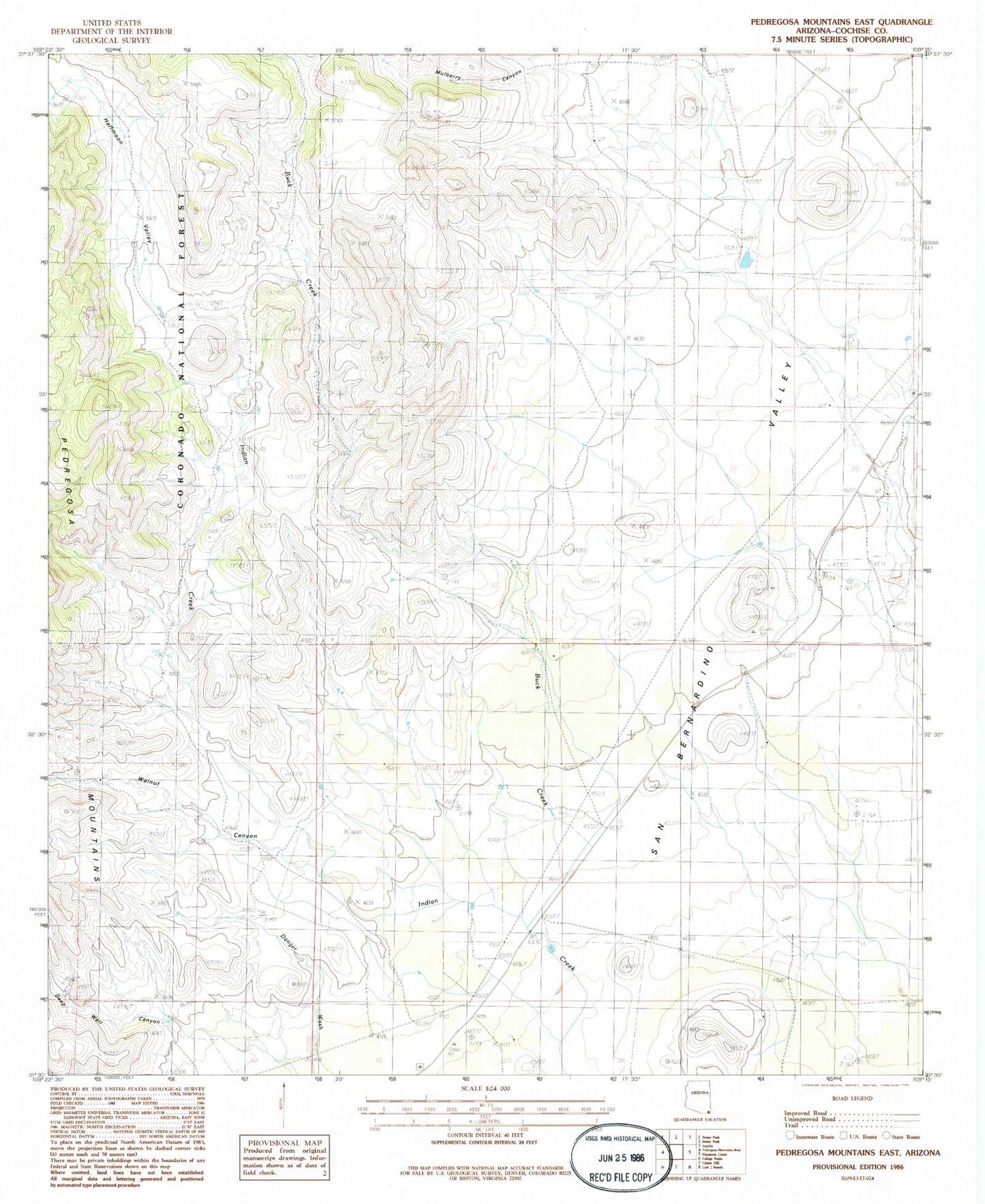
MyTopo
Classic USGS Pedregosa Mountains East Arizona 7.5'x7.5' Topo Map
Regular price
$16.95
Regular price
Sale price
$16.95
Unit price
per
Couldn't load pickup availability
Historical USGS topographic quad map of Pedregosa Mountains East in the state of Arizona. Map scale may vary for some years, but is generally around 1:24,000. Print size is approximately 24" x 27"
This quadrangle is in the following counties: Cochise.
The map contains contour lines, roads, rivers, towns, and lakes. Printed on high-quality waterproof paper with UV fade-resistant inks, and shipped rolled.
Contains the following named places: Bernardino, Boss Ranch, Buck Creek, Deep Well, Deep Well Canyon, Devil Tank, Half Moon Tanks, Halfmoon Valley, Joe Glenn Ranch, Mulberry Canyon, Riddle Tank, Upper Tank, Walnut Canyon