MyTopo
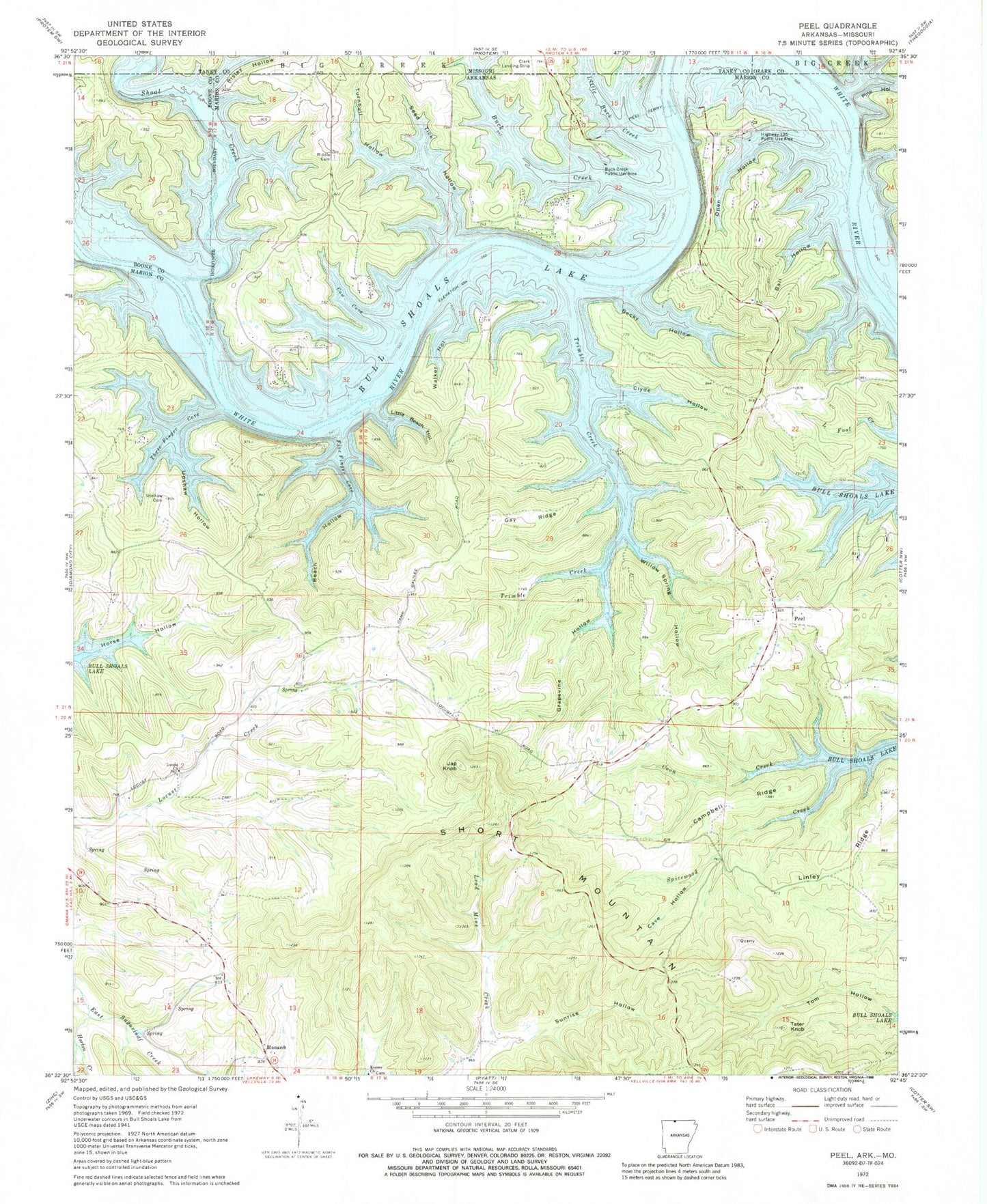
Classic USGS Peel Arkansas 7.5'x7.5' Topo Map
Couldn't load pickup availability
Historical USGS topographic quad map of Peel in the states of Arkansas, Missouri. Map scale may vary for some years, but is generally around 1:24,000. Print size is approximately 24" x 27"
This quadrangle is in the following counties: Boone, Marion, Ozark, Taney.
The map contains contour lines, roads, rivers, towns, and lakes. Printed on high-quality waterproof paper with UV fade-resistant inks, and shipped rolled.
Contains the following named places: Ball Hollow, Beach Hollow, Becky Hollow, Black Bear Hollow, Buck Creek, Buck Creek Public Use Area, Buck Shoals Ford, Campbell Ridge, Cave Hollow, Clyde Hollow, Cow Cove, Fishtrap Shoals Ford, Five Finger Cove, Gay Ridge, Grapevine Hollow, Highway 125 Public Use Area, Holt Ferry, Horse Hollow, Horton Creek, Japanese Knob, Keesee Cemetery, Keesee Church, Keesee Ferry, Lazy Acres Fire Department, Lazy Acres Fire Protection District Station 3, Lazy Acres Volunteer Fire Department Station 1, Linley Ridge, Little Beach Hollow, Locust Cemetery, Locust Church, Monarch, Mount Perrian, Open Hollow, Peel, Peel Cemetery, Peel Missionary Baptist Church, Peel Post Office, Peel School, Peel Volunteer Fire Department, Peel Volunteer Fire Department Substation, Pine Hollow, Riddle Cemetery, Risley Hollow, Seed Tick Hollow, Shoal Creek, Short Mountain, Spicewood Creek, Sunrise Hollow, Tater Knob, Three Finger Cove, Township of Crockett, Township of Franklin, Township of Keesee, Trimble Creek, Turnbull Hollow, Upshaw Cemetery, Upshaw Hollow, Walker Hollow, Willow Spring Hollow, ZIP Code: 72668