MyTopo
Classic USGS Pegram Creek Idaho 7.5'x7.5' Topo Map
Regular price
$16.95
Regular price
Sale price
$16.95
Unit price
per
Couldn't load pickup availability
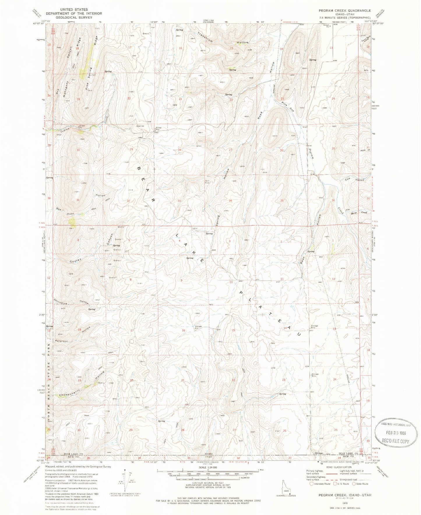
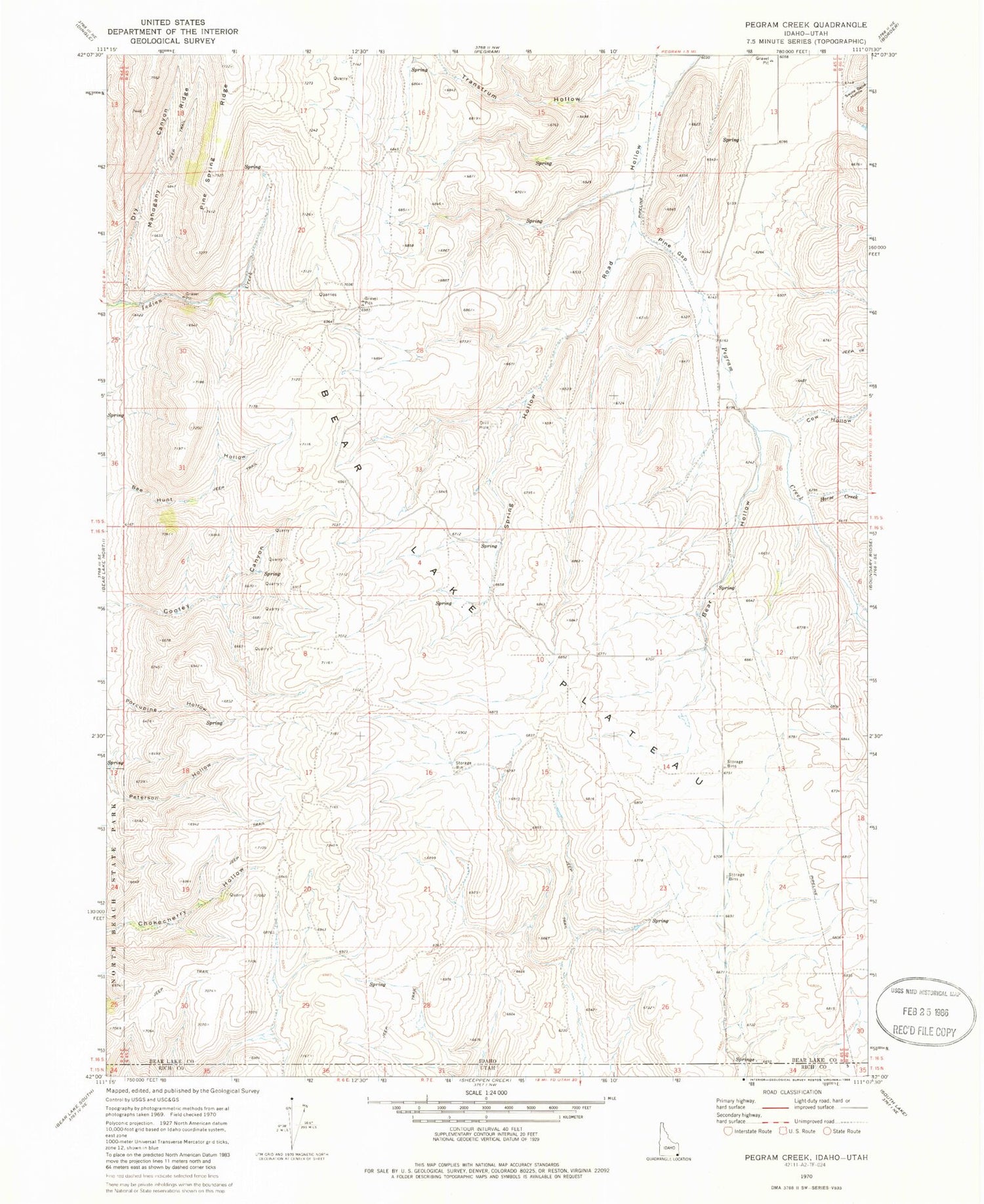
Historical USGS topographic quad map of Pegram Creek in the state of Idaho. Map scale may vary for some years, but is generally around 1:24,000. Print size is approximately 24" x 27"
This quadrangle is in the following counties: Bear Lake, Rich.
The map contains contour lines, roads, rivers, towns, and lakes. Printed on high-quality waterproof paper with UV fade-resistant inks, and shipped rolled.
Contains the following named places: Bear Hollow, Bear Lake Plateau, Cow Hollow, Dry Canyon, Horse Creek, Mahogany Ridge, Pine Gap, Spring Hollow, Sweetwater Creek, Swine Bend Hollow, Transtrum Hollow