MyTopo
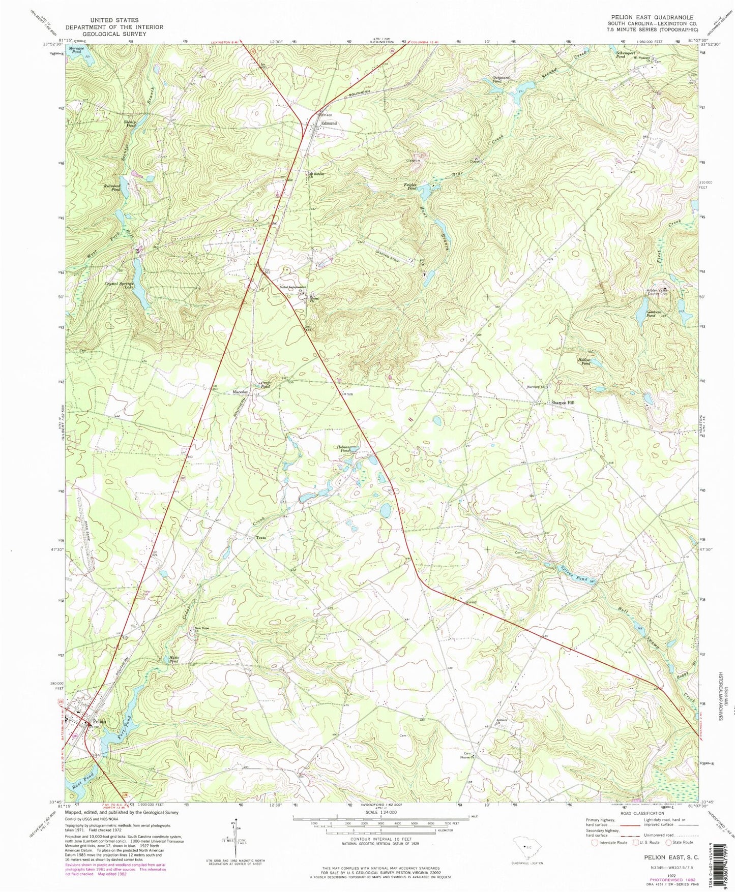
Classic USGS Pelion East South Carolina 7.5'x7.5' Topo Map
Couldn't load pickup availability
Historical USGS topographic quad map of Pelion East in the state of South Carolina. Map scale may vary for some years, but is generally around 1:24,000. Print size is approximately 24" x 27"
This quadrangle is in the following counties: Lexington.
The map contains contour lines, roads, rivers, towns, and lakes. Printed on high-quality waterproof paper with UV fade-resistant inks, and shipped rolled.
Contains the following named places: Antioch Cemetery, Antioch Church, Bachman Cemetery, Bear Creek, Bethel Cemetery, Bethel Church, Bethel Independent Church, Boggy Branch, Craft Pond, Crossroad School, Crystal Springs Lake, Darden Airport, East Fork Scouter Branch, Edmund, Edmund Census Designated Place, Edmund School, Falcon Airport, Feigles Pond, Fort Pond, Goodwin Pond, Guignard Pond, Guignard Pond Dam D-0974, Harmony Church, Hidden Valley Country Club, Hobson Pond, Hollow Pond, Hunt Branch, Hutto Pond, Larkin Glen Cemetery, Lexington County Airport at Pelion, Lexington County Fire Service Sharpes Hill Station 28, Lexington County Fire Service Station 6, Lexington County Fire Station 13, Lynch Branch, Macedon, Moragne Pond, Mount Hebron Lutheran Church, Mount Pleasant Church, New Hope Church, Pelion, Pelion Division, Rast Pond, Redmond Pond, Reichter - Richter Cemetery, Sand Hill School, Schumpert Pond, Sharon Church, Sharpes Hill, Sharpes Hill School, Shealy Pond, South Carolina Noname 32007 D-0972 Dam, South Carolina Noname 32018 D-0976 Dam, South Carolina Noname 32019 D-0977 Dam, South Carolina Noname 32025 D-0978 Dam, South Carolina Noname 32026 D-0975 Dam, South Carolina Noname 32033 D-0971 Dam, South Carolina Noname 32035 D-0955 Dam, Spires Pond, Testo, West Fork Scouter Branch