MyTopo
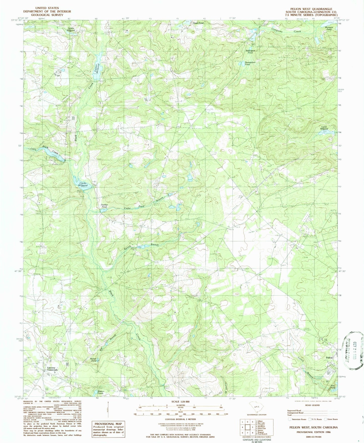
Classic USGS Pelion West South Carolina 7.5'x7.5' Topo Map
Couldn't load pickup availability
Historical USGS topographic quad map of Pelion West in the state of South Carolina. Map scale may vary for some years, but is generally around 1:24,000. Print size is approximately 24" x 27"
This quadrangle is in the following counties: Lexington.
The map contains contour lines, roads, rivers, towns, and lakes. Printed on high-quality waterproof paper with UV fade-resistant inks, and shipped rolled.
Contains the following named places: Areharts Pond Dam D-1716, Bachman Ponds, Ballington Pond, Ballingtons Pond Dam D-1704, Beaverdam Pond, Big Branch, Black Creek Cemetery, Boiling Springs Cemetery, Boiling Springs Church, Boiling Springs School, Cedar Pond Branch, Clarks Mill, Clarks Millpond, Congaree Area Girl Scout Camp, Crout Pond, Dunbar Pond, Eagles Nest-Fairview Airpark, Fairview Crossroads, Fairview Crossroads Census Designated Place, Fairview School, Florence Church, Harmons Pond, Huffman Burnt Millpond, Kyser Pond, Lexington County Fire Service Station 4, Lexington County Fire Service Station 14, Little Black Creek, Lucas Millpond, McIver Pond, Oak Grove Cemetery, Oak Grove Church, Pauline Church, Paxton Millpond, Pelion Elementary School, Pelion High School, Pond Branch, Saint James School, Saint Johns Cemetery, Saint Johns Lutheran Church, Scofield Cemetery, Smith Branch, Smith School, Smiths Millpond, South Carolina Noname 32012 D-0948 Dam, South Carolina Noname 32013 D-0949 Dam, South Carolina Noname 32034 D-0973 Dam, South Carolina Noname 32054 D-0947 Dam, South Carolina Noname 32055 D-1000 Dam, South Carolina Noname 32103 D-1707 Dam, Spring Branch, Town of Pelion, ZIP Code: 29123