MyTopo
Classic USGS Pemadumcook Lake Maine 7.5'x7.5' Topo Map
Couldn't load pickup availability
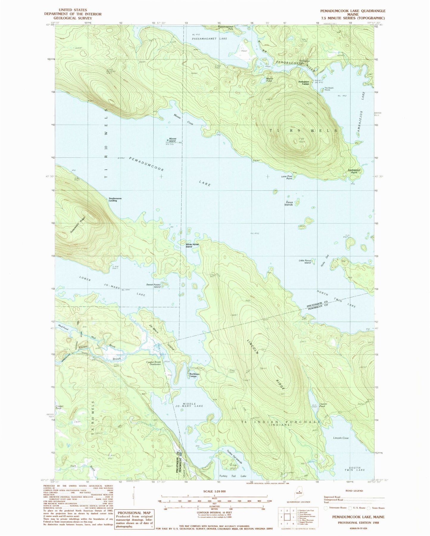
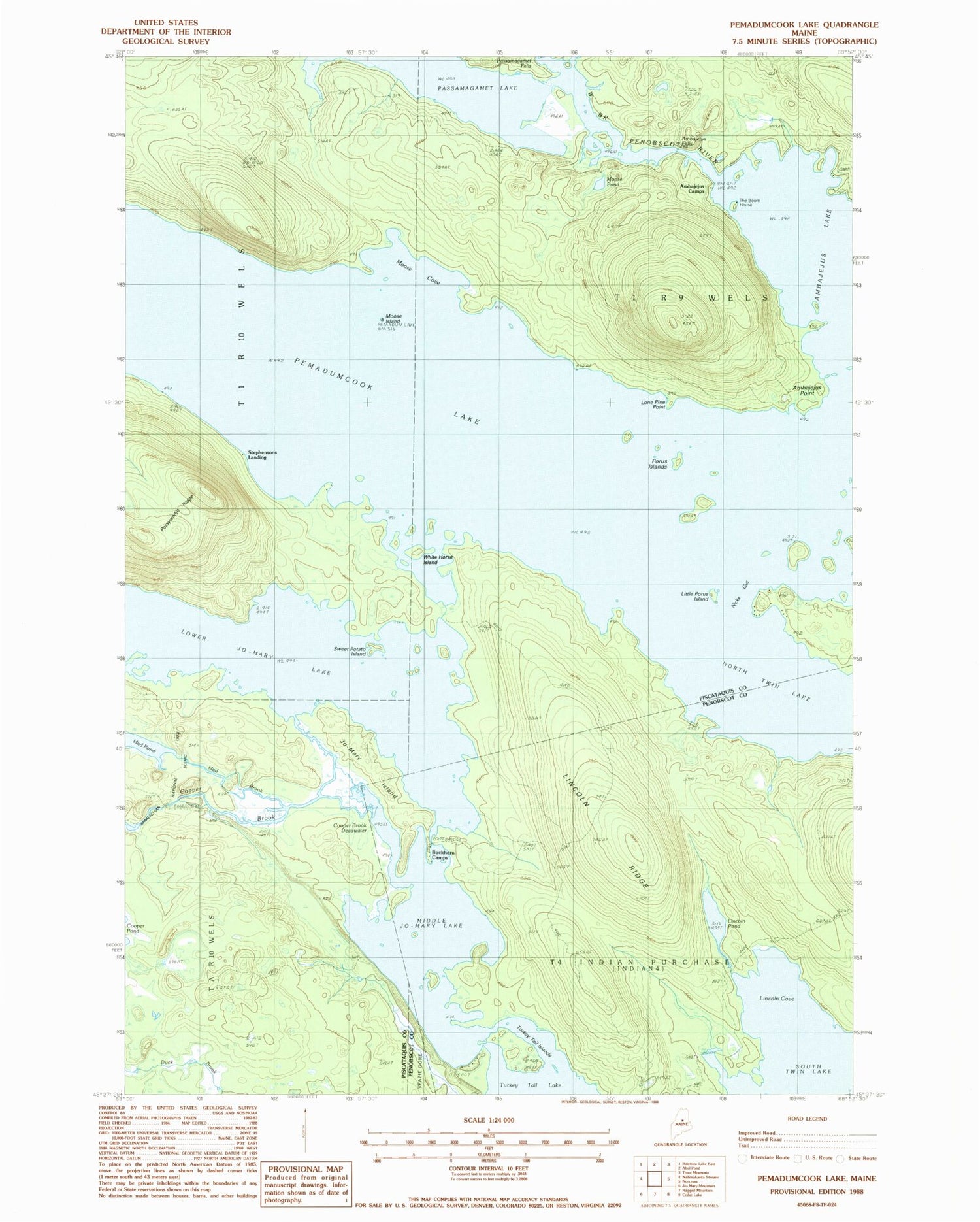
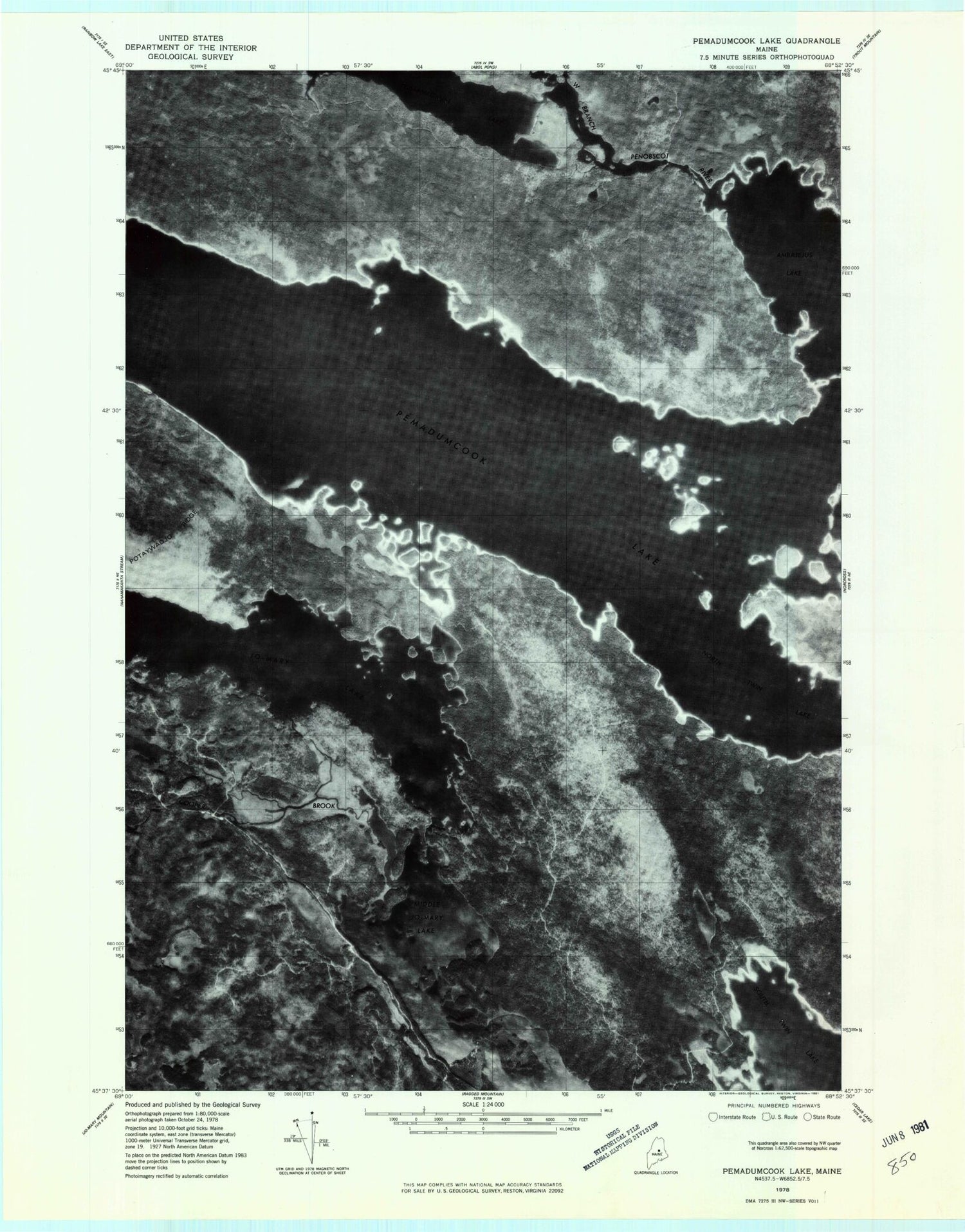
Historical USGS topographic quad map of Pemadumcook Lake in the state of Maine. Typical map scale is 1:24,000, but may vary for certain years, if available. Print size: 24" x 27"
This quadrangle is in the following counties: Penobscot, Piscataquis.
The map contains contour lines, roads, rivers, towns, and lakes. Printed on high-quality waterproof paper with UV fade-resistant inks, and shipped rolled.
Contains the following named places: Ambajejus Camps, Ambajejus Falls, Ambajejus Point, Buckhorn Camps, Cooper Brook, Cooper Brook Deadwater, Jo-mary Island, Jo-Mary Lake, Lincoln Cove, Lincoln Pond, Lincoln Ridge, Little Porus Island, Lone Pine Point, Lower Jo-Mary Stream, Middle Jo-Mary Lake, Moose Cove, Moose Island, Moose Pond, Mud Brook, Nicks Gut, Passamagamet Falls, Passamagamet Lake, Pemadumcook Lake, Porus Islands, Sweet Potato Island, Telephone Trail, The Boom House, Turkey Tail Islands, Turkey Tail Lake, White Horse Island, Stephensons Landing, Buckhorn Camps Seaplane Base, Twin Lakes, T4 Indian Purchase Township, T1 R9 WELS