MyTopo
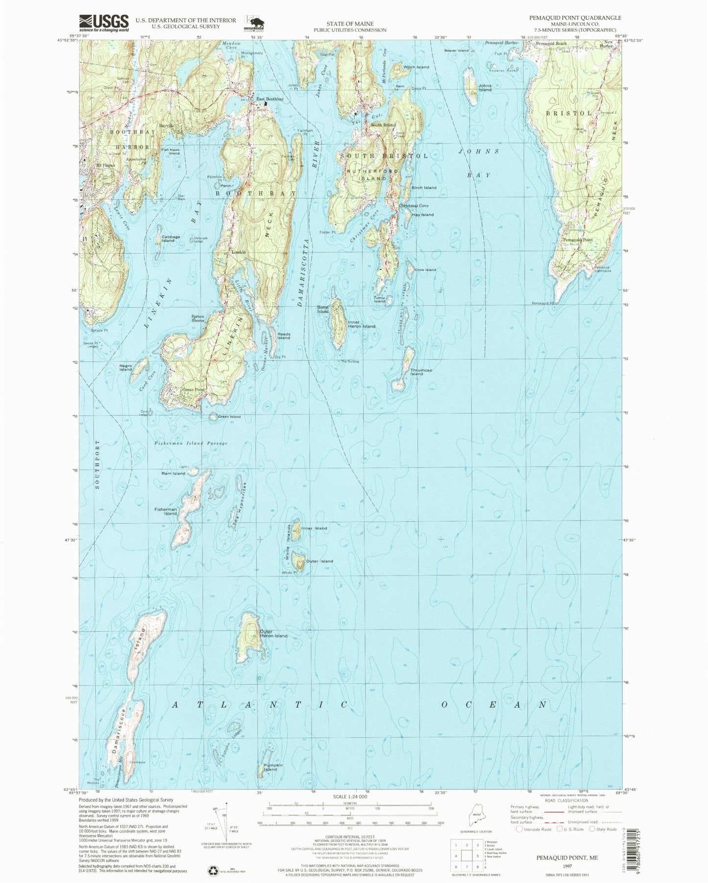
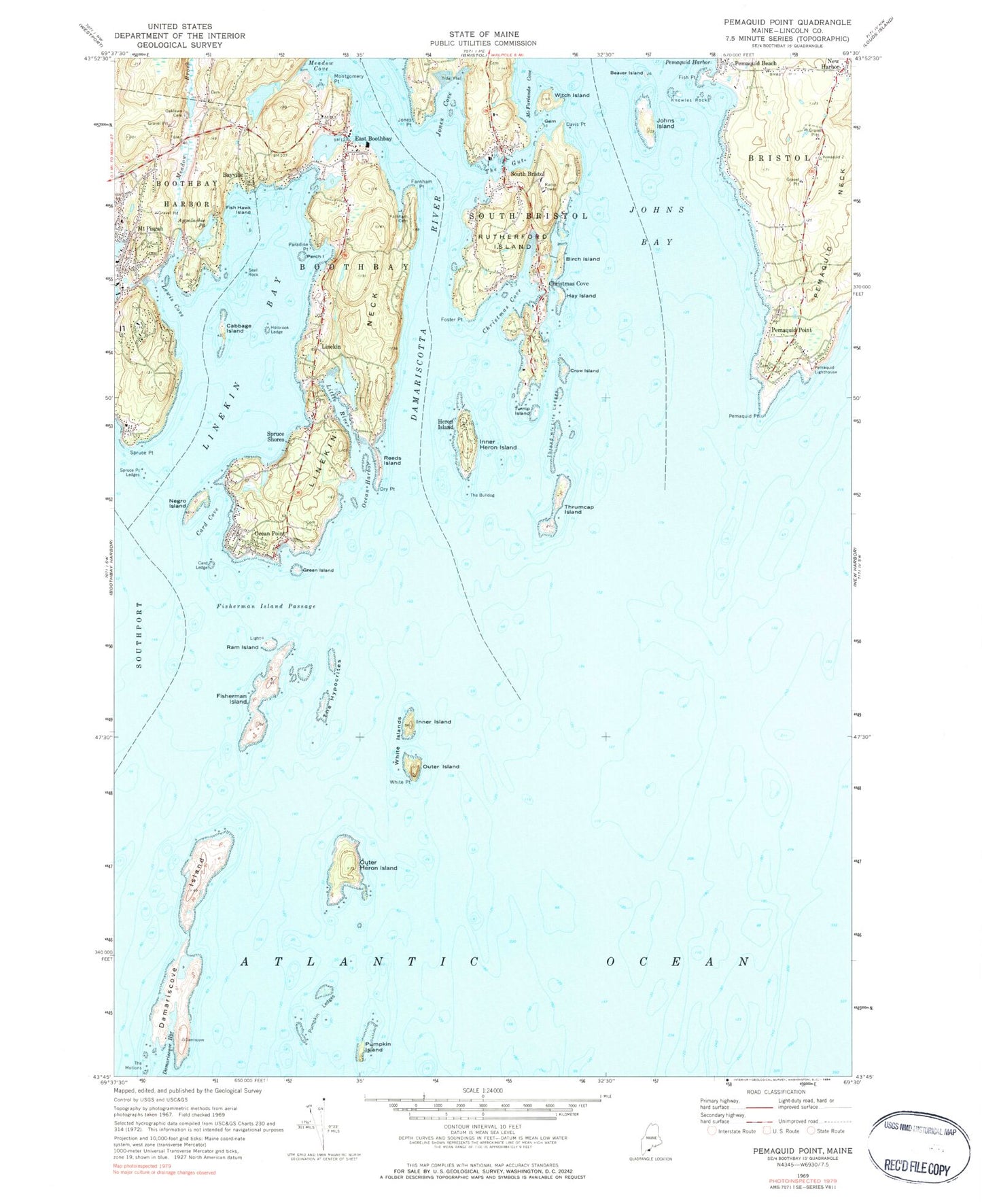
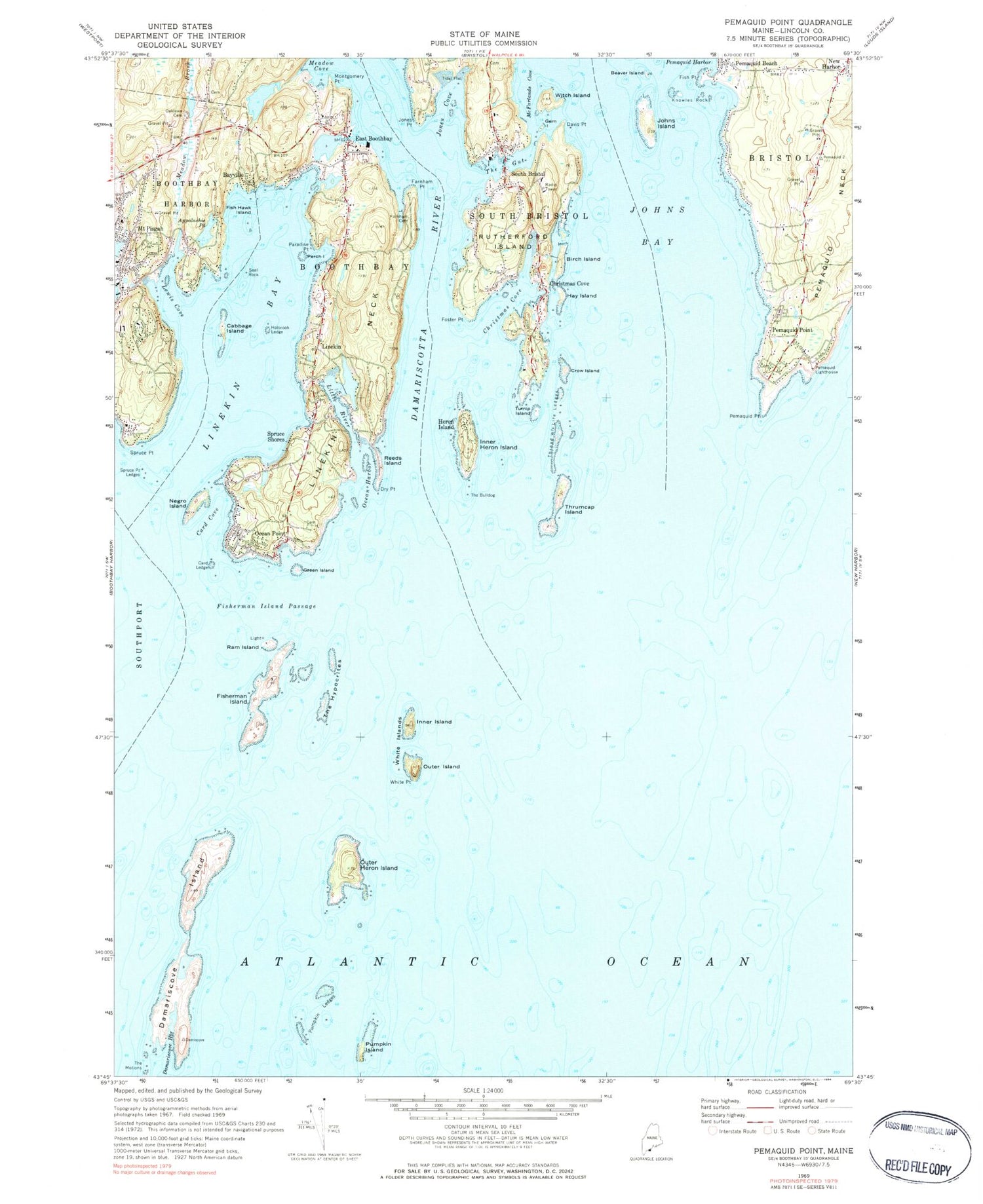
Classic USGS Pemaquid Point Maine 7.5'x7.5' Topo Map
Couldn't load pickup availability
Historical USGS topographic quad map of Pemaquid Point in the state of Maine. Typical map scale is 1:24,000, but may vary for certain years, if available. Print size: 24" x 27"
This quadrangle is in the following counties: Lincoln.
The map contains contour lines, roads, rivers, towns, and lakes. Printed on high-quality waterproof paper with UV fade-resistant inks, and shipped rolled.
Contains the following named places: Appalachie Pond, Bayville, Beaver Island, Birch Island, Cabbage Island, Card Cove, Card Ledge, Christmas Cove, Christmas Cove, Crow Island, Damariscotta River, Damariscove Harbor, Damariscove Island, Dry Point, East Boothbay, Farnham Cemetery, Farnham Point, Fish Hawk Island, Fish Point, Fisherman Island, Fisherman Island Passage, Foster Point, Gem Island, Green Island, Hay Island, Heron Island, Inner Heron Island, Inner Island, Johns Bay, Johns Island, Johns River, Jones Cove, Jones Point, Knowles Rocks, Lewis Cove, Linekin, Linekin Bay, Linekin Neck, Little River, Lookout Hill, Meadow Brook, Meadow Cove, Montgomery Point, Mount Pisgah, Negro Island, Oaklawn Cemetery, Ocean Harbor, Ocean Point, Outer Heron Island, Outer Island, Paradise Point, Pemaquid Beach, Pemaquid Lighthouse, Pemaquid Point, Pemaquid Point, Perch Island, Pumpkin Island, Pumpkin Ledges, Ram Island, Reeds Island, Rutherford Island, Seal Rock, South Bristol, Spruce Point, Spruce Point Ledges, Spruce Shores, The Bulldog, The Gut, The Hypocrites, The Motions, Thrumcap Island, Turnip Island, White Islands, White Point, Witch Island, Dictator Ledge, Corvette Ledge, Clifford Point, Decker Rock, Wylie Rock, Thread of Life Ledges, Long Cove, Davis Point, Holbrook Ledge, McFarlands Cove, Corvette Ledge, Dictator Ledge, Gangway Ledge, Heron Island South Ledge, Inner Heron Island Ledge, Outer Heron Island Ledge, Pemaquid Ledge, Pollock Rock, Pumpkin Island Northeast Ledge, Thrumcap Ledge, Tibbits Ledge, White Island Ledge, Town of Boothbay, Appalachie Pond Dam, Barrett Park, Bayville Post Office, Congregational Church of Boothbay Harbor, Damariscove Lifesaving Station, East Boothbay Post Office, East Boothbay Shipyards, East Boothbay United Methodist Church, Fishermans Memorial Park, Fishermans Museum and Art Gallery, Grand Banks Schooner Museum, Inner White Island Preserve, Levison Preserve, Lighthouse Cove, Little River Dam Preserve, Ocean Point Chapel, Our Lady Queen of Peace Roman Catholic Church, Pemaquid Beach, Pemaquid Lighthouse Park, Main Cemetery, Ram Island Light Station, South Bristol Elementary School, Spruceworld, Union Church of South Bristol, Wall Point, Woods End, Boothbay Harbor Census Designated Place, South Bristol Volunteer Fire Department, Boothbay Volunteer Fire Station East Boothbay, Bristol Fire Department New Harbor, Shipley Point, Rutherford Library, South Bristol Post Office