
MyTopo
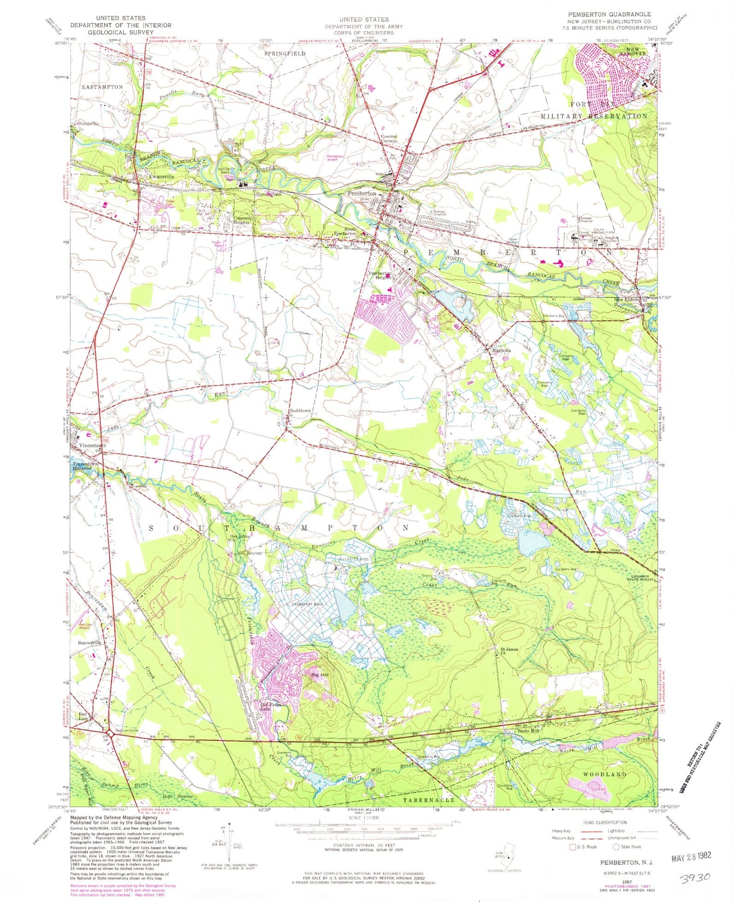
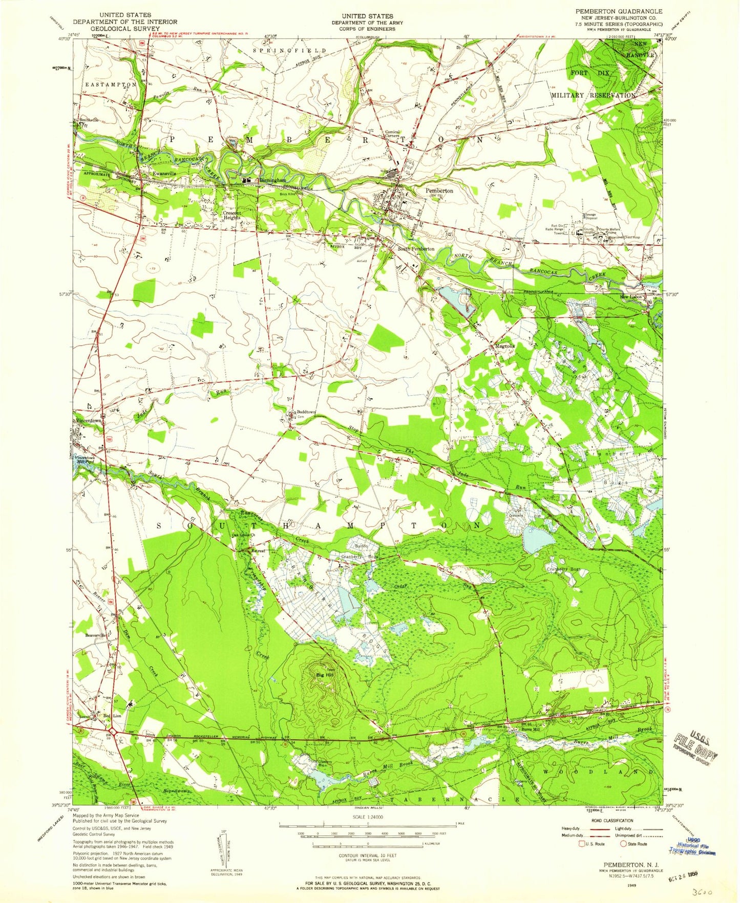
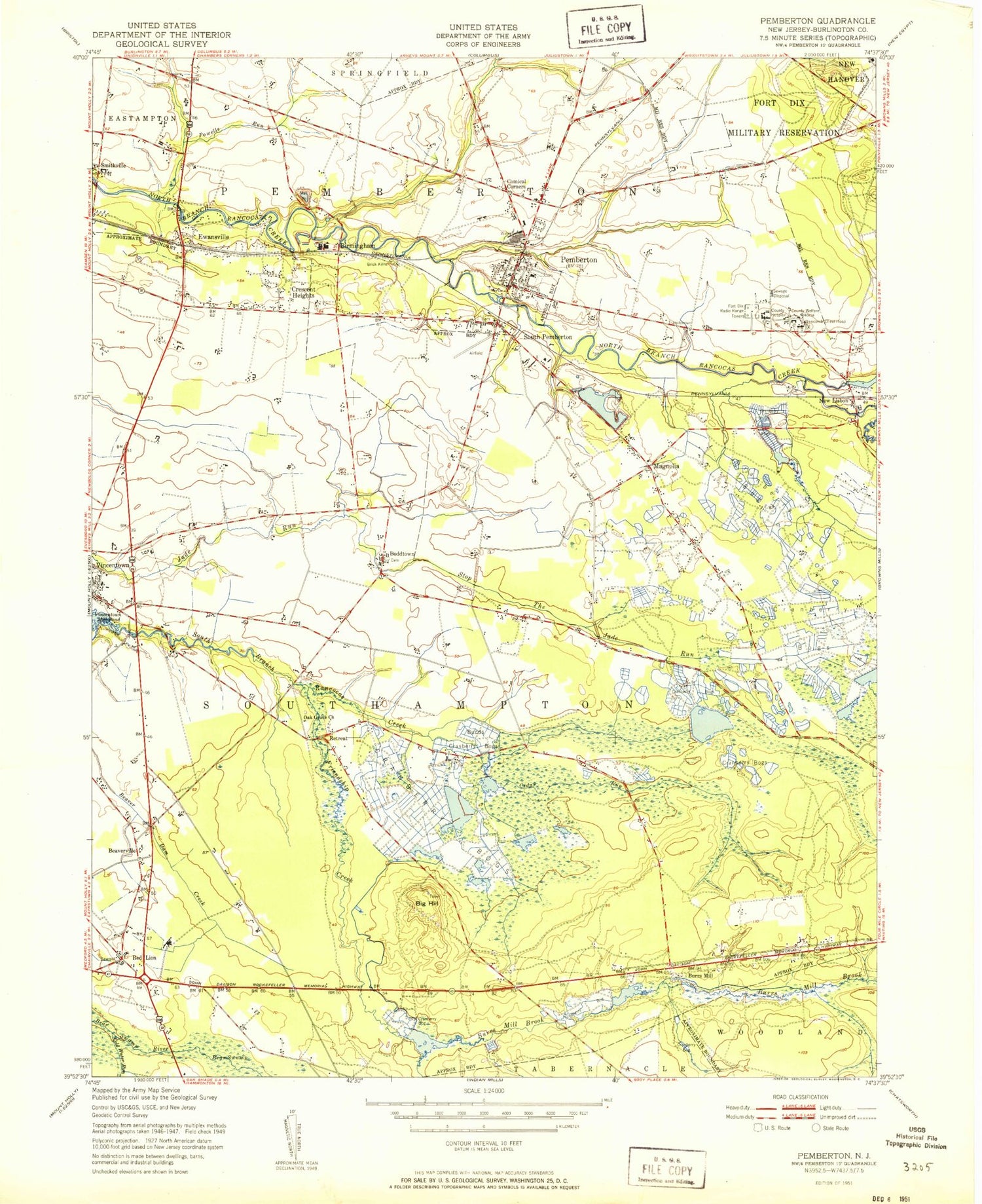
Classic USGS Pemberton New Jersey 7.5'x7.5' Topo Map
Couldn't load pickup availability
Historical USGS topographic quad map of Pemberton in the state of New Jersey. Map scale may vary for some years, but is generally around 1:24,000. Print size is approximately 24" x 27"
This quadrangle is in the following counties: Burlington.
The map contains contour lines, roads, rivers, towns, and lakes. Printed on high-quality waterproof paper with UV fade-resistant inks, and shipped rolled.
Contains the following named places: Beaverdam Creek, Beaverville, Big Hill, Birmingham, Birmingham Post Office, Borough of Pemberton, Budd Run, Buddtown, Burlington County, Burlington County Alternative High School, Burlington County College, Burlington County Juvenile Detention Center, Burrs Mill, Burrs Mill Brook, Buttonwood Hospital of Burlington County, Cedar Run, Cold Water Run, Comical Corners, Crescent Heights, Eastampton Township Fire Company Station 341, Ewansville, Fort Dix Elementary School, Friendship Creek, Friendship Creek Branch, Good Will Fire Company, Gravelly Run Dam, Gravelly Run Pond, Greenwood Branch, Hampton Lakes, Hampton Lakes Emergency Squad, Hampton Lakes Fire Company, Helen A Fort Middle School, Howard L Emmons Elementary School, Huntington Drive Dam, Lake Three, Leisuretowne, Leisuretowne Census Designated Place, Lisbon Dam, Magnolia, Magnolia Road Volunteer Fire Company, Marcus W Newcomb Middle School, Marl Pit, New Jersey State Police Troop C Red Lion Station, New Lisbon, New Lisbon Mill Dam, New Lisbon Post Office, Oak Grove Church, Old Forge Lake, Pemberton, Pemberton Airport, Pemberton Borough Elementary School, Pemberton Borough Police Department, Pemberton First Aid and Rescue Squad, Pemberton Heights, Pemberton Heights Census Designated Place, Pemberton Post Office, Pemberton Township High School, Pemberton Township Police Department, Powells Run, Red Lion, Red Lion Airport, Red Lion Circle, Retreat, Saint James Church, Samuel T Busansky Elementary School, Scrapetown, Scratch Ridge, Smithville, South Pemberton, Southampton Township School Number 1, Southampton Township School Number 2, Southampton Township School Number 3, Township of Southampton, Vincentown, Vincentown Millpond, Vincentown Post Office, WWJZ-AM (Mount Holly), ZIP Codes: 08011, 08064, 08068