MyTopo
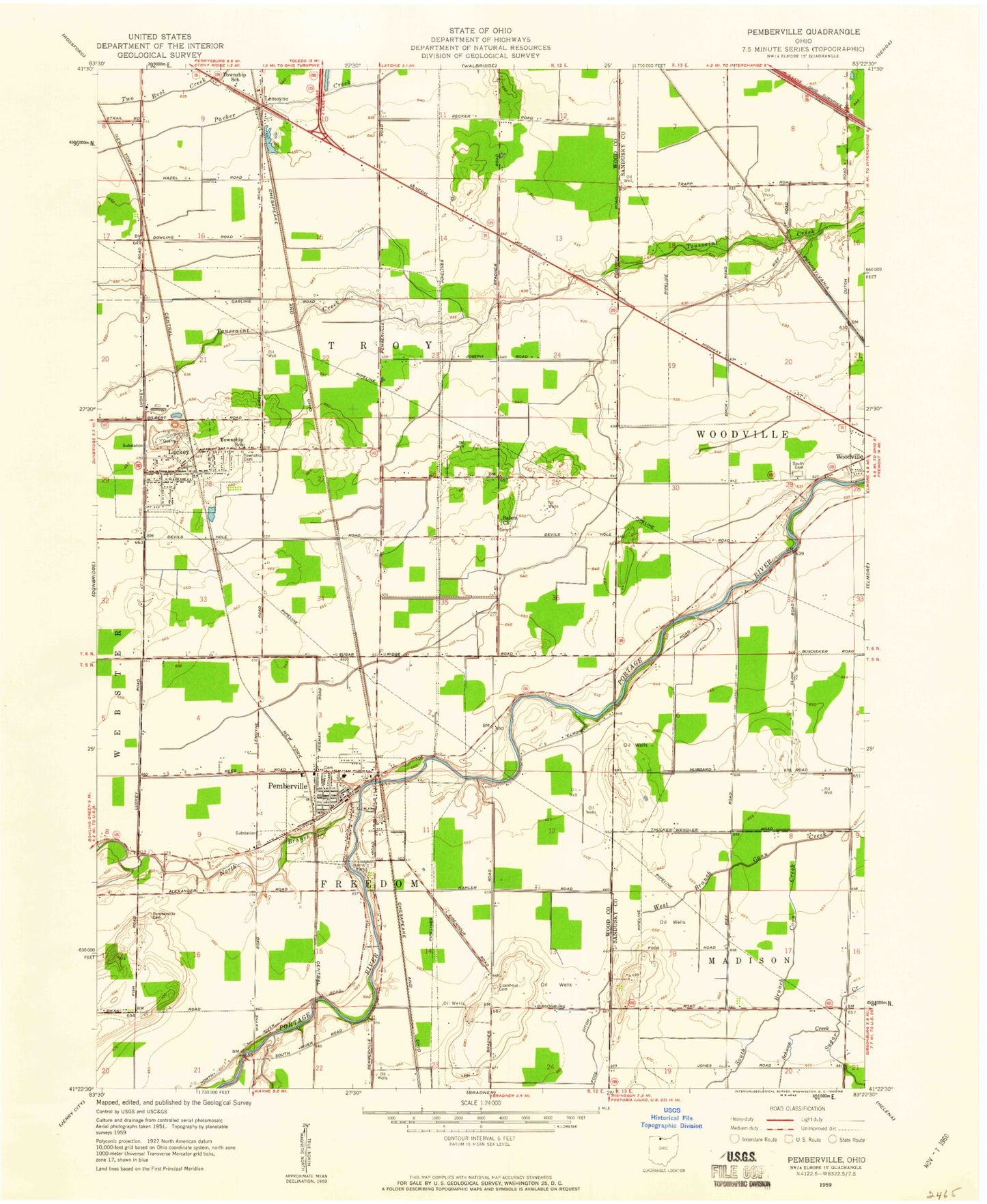
Classic USGS Pemberville Ohio 7.5'x7.5' Topo Map
Couldn't load pickup availability
Historical USGS topographic quad map of Pemberville in the state of Ohio. Map scale may vary for some years, but is generally around 1:24,000. Print size is approximately 24" x 27"
This quadrangle is in the following counties: Sandusky, Wood.
The map contains contour lines, roads, rivers, towns, and lakes. Printed on high-quality waterproof paper with UV fade-resistant inks, and shipped rolled.
Contains the following named places: Calers Ridge, Eastwood High School, Eastwood Middle School, Eisenhour Cemetery, Foos Ditch, Freedom Township Hall, Hiview Airport, Laffertys Trailer Court, Lemoyne, Lemoyne Elementary School, Lemoyne Post Office, Luckey, Luckey Elementary School, Luckey Police Department, Luckey Post Office, Luckey Quarry, Martin Ditch, North Branch Portage River, Pemberville, Pemberville - Freedom Fire Department, Pemberville Cemetery, Pemberville Elementary School, Pemberville Police Department, Pemberville Post Office, Salem Cemetery, Salem Lutheran Church, Schwan Creek, South Branch Coon Creek, Tousaint, Township of Freedom, Township of Troy, Trimmers Ridge, Troy Township Cemetery, Troy Township Volunteer Fire Department and Emergency Medical Services, Village of Luckey, Village of Pemberville, Westwood Cemetery, William Henry Harrison Park, WRED-FM (Gibsonburg), Yankey Creek, Zion Church, ZIP Codes: 43443, 43450