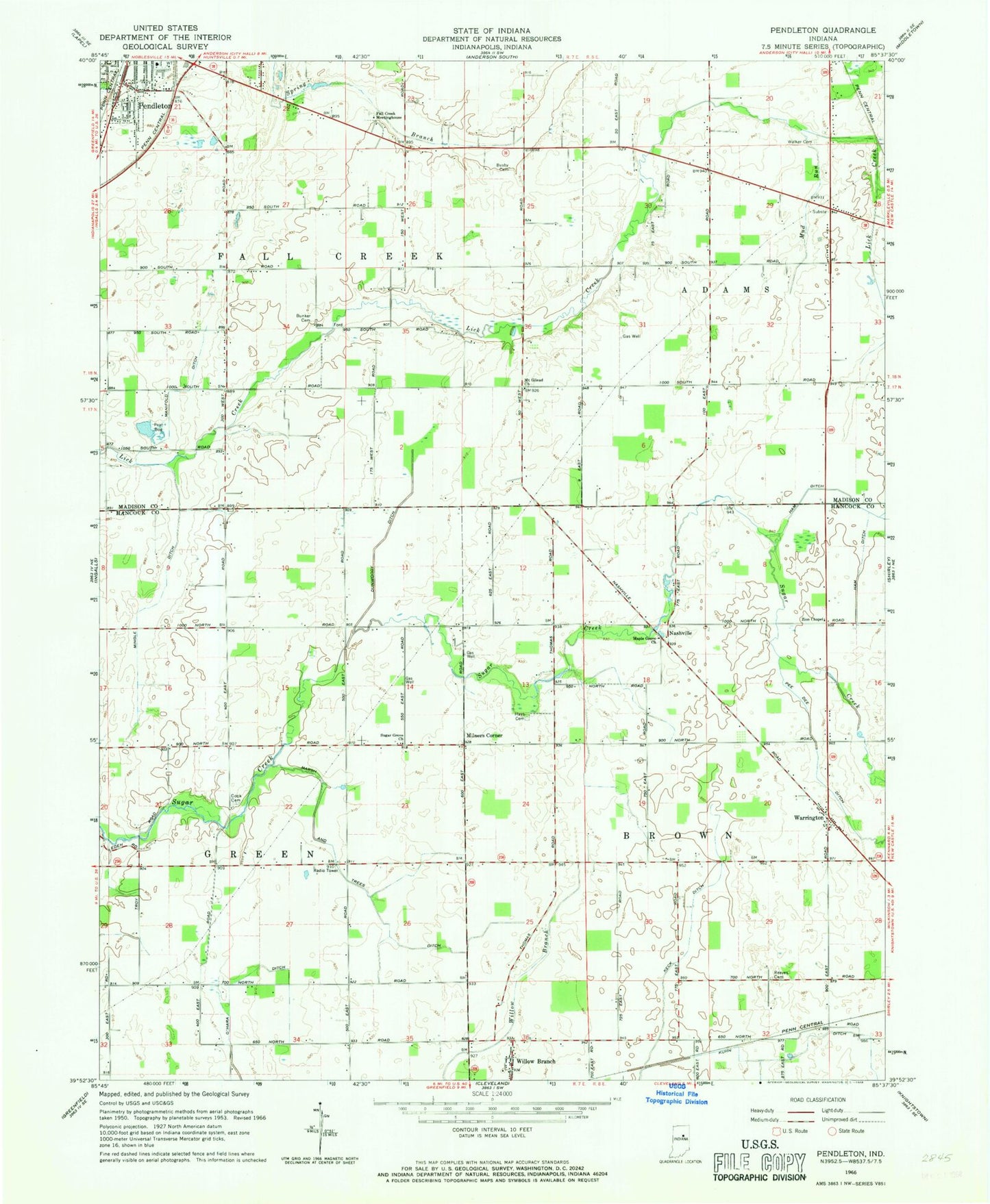
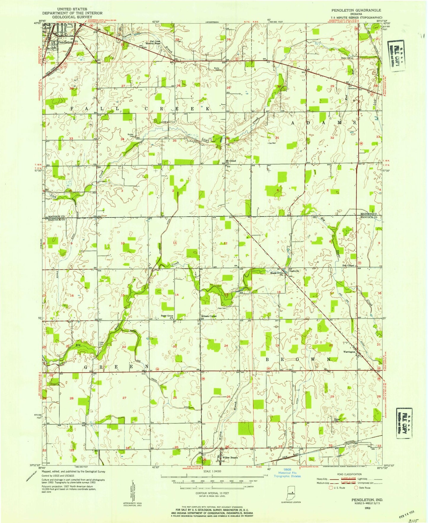
MyTopo
Classic USGS Pendleton Indiana 7.5'x7.5' Topo Map
Couldn't load pickup availability
Historical USGS topographic quad map of Pendleton in the state of Indiana. Map scale may vary for some years, but is generally around 1:24,000. Print size is approximately 24" x 27"
This quadrangle is in the following counties: Hancock, Madison.
The map contains contour lines, roads, rivers, towns, and lakes. Printed on high-quality waterproof paper with UV fade-resistant inks, and shipped rolled.
Contains the following named places: Adams Markleville Fire Protection Territory, Bunker Cemetery, Cook Cemetery, Dunwoody Ditch, Fall Creek Meetinghouse, Ham Ditch, Harless Airport, Hays Cemetery, Keck Ditch, Kuhn Ditch, Manifold Ditch, Maple Grove Church, March and Trees Ditch, Markleville Fire Department, Milners Corner, Mount Gilead Church, Mud Run, Nashville, O'Hara Ditch, Pendleton, Redskin Brook, Reeves Cemetery, Sauer-Harter Airport, Sugar Grove Church, Sunnyside Greenhouses, Township of Brown, Township of Fall Creek, Township of Green, Village Brook, Walker Cemetery, Warrington, WEEM-FM (Pendleton), Willow Branch, Zion Chapel, ZIP Codes: 46064, 46186