MyTopo
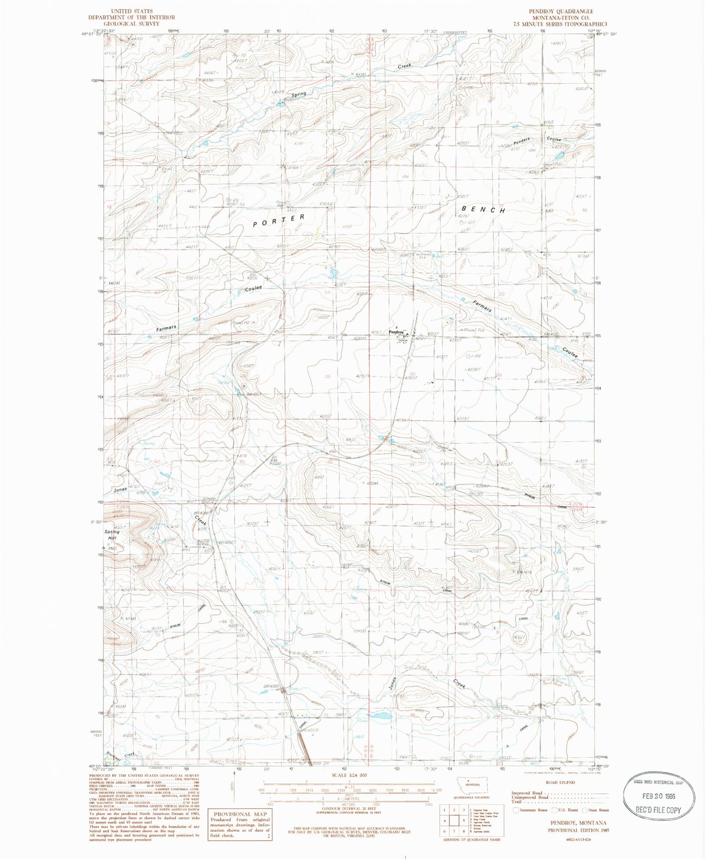
Classic USGS Pendroy Montana 7.5'x7.5' Topo Map
Couldn't load pickup availability
Historical USGS topographic quad map of Pendroy in the state of Montana. Map scale may vary for some years, but is generally around 1:24,000. Print size is approximately 24" x 27"
This quadrangle is in the following counties: Teton.
The map contains contour lines, roads, rivers, towns, and lakes. Printed on high-quality waterproof paper with UV fade-resistant inks, and shipped rolled.
Contains the following named places: 27N06W34DCBC01 Well, Bynum Canal, C Canal, Farmers Union Elevator, Highview School, Mike Horse Mine, Miller Coulee, Montana Elevator, Pendroy, Pendroy Census Designated Place, Pendroy Elementary School, Pendroy Post Office, Pendroy Volunteer Fire and Rescue, Rattlesnake Coulee, Rocky Mountain Elevator