MyTopo
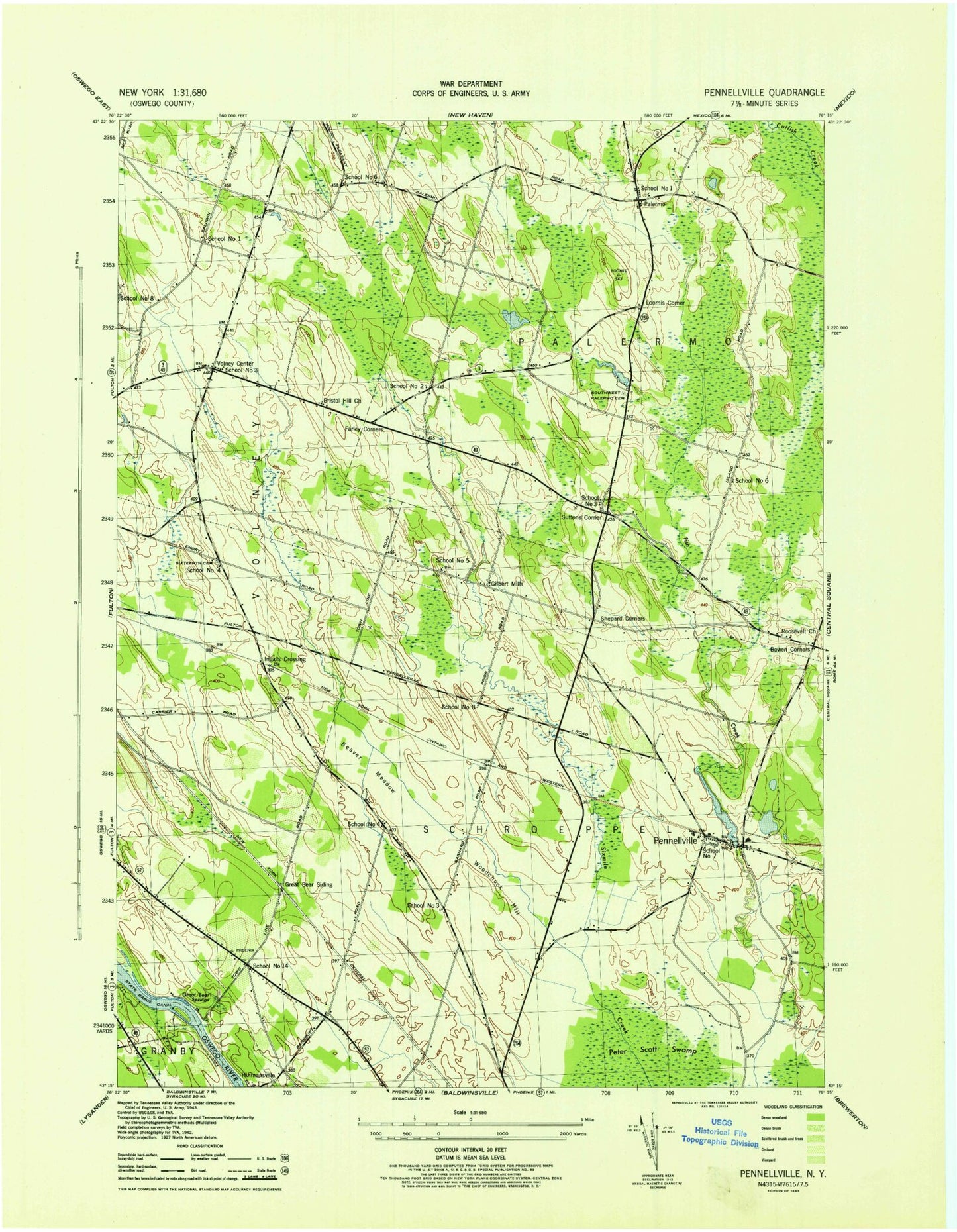
Classic USGS Pennellville New York 7.5'x7.5' Topo Map
Couldn't load pickup availability
Historical USGS topographic quad map of Pennellville in the state of New York. Map scale may vary for some years, but is generally around 1:24,000. Print size is approximately 24" x 27"
This quadrangle is in the following counties: Oswego.
The map contains contour lines, roads, rivers, towns, and lakes. Printed on high-quality waterproof paper with UV fade-resistant inks, and shipped rolled.
Contains the following named places: Austin Tree Farm, Beaver Meadow, Beaver Meadows Golf Club, Bell Creek, Bowen Corners, Bristol Hill, Bristol Hill Church, Camp Talooli, Carousel Farm, Catalbiano Farms, Clark Lane Mobile Home Park, Conifer Mobile Home Park, Emerald Crest Golf Course, Farley Corners, Gilbert Mills, Gilbert Mills Cemetery, Goodfellows Pond, Great Bear Siding, Great Bear Springs, Green Acres Mobile Court, Hidden Lake, Ingalls Crossing, Lake Temalo, Loomis Corner, Maryinuk Farms, Oswego County Bristol Hill Landfill, Palermo, Palermo Cemetery, Palermo United Methodist Church, Palermo Volunteer Fire Department, Pennellville, Pennellville Cemetery, Pennellville Post Office, Pennellville United Methodist Church, Pennellville Volunteer Fire Department, Roosevelt Cemetery, Roosevelt Church, School Number 1, School Number 14, School Number 2, School Number 3, School Number 4, School Number 5, School Number 6, School Number 7, School Number 8, Shepard Corners, Stewarts Pond, Suttons Corner, Suttons Corner Gap Filler Annex, Tinkers Cemetery, Town of Palermo, Town of Schroeppel, Town of Volney, Volney, Volney Center Cemetery, Volney Rural Cemetery, Volney Volunteer Fire Company Station 1, Woodchuck Hill, ZIP Codes: 13132, 13135